NASA
Outline Maps
Don't miss this gold mine of blank maps for your next geography lesson! Regions include traditional continents such as Asia, Europe, and Africa, as well as other major world areas such as the Pacific Rim and the Middle East.
Curated OER
Blank Europe Outline Map
In this blank outline map worksheet, students explore the political boundaries of the continent of Europe and those of the countries located there. This map may be used in a variety of classroom activities.
Curated OER
Blank Europe Outline Map 2
For this blank outline map worksheet, students explore the political boundaries of the continent of Europe and those of the countries located there. This map may be used in a variety of classroom activities.
Curated OER
Europe Outline Map
In this outline map worksheet, students examine the political boundaries of the continent of Europe. The map may be used in variety of activities that individual teachers create to accompany it.
Curated OER
Europe Outline Map
In this blank outline map worksheet, students explore the political boundaries of the continent of Europe and those of the countries located there.
Curated OER
Europe Outline Map (Labled)
In this blank outline map worksheet, students study the political boundaries of the labeled European nations.
Curated OER
Europe Map
In this blank outline map worksheet, students explore the political boundaries of the continent of Europe. This map may be used in a variety of classroom activities.
Curated OER
Europe Labeled Map
For this Europe political map worksheet, students examine the national boundaries. The map also highlights each of the nation's capitals with a star. The countries and capital cities in this map are labeled.
Curated OER
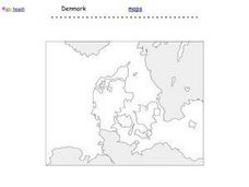
Denmark Outline Map
In this blank outline map worksheet, students explore the political boundaries of Denmark located in Europe. This map may be used in a variety of classroom activities.
Curated OER
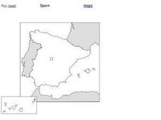
Spain Outline Map
In this blank outline map worksheet, students explore the political boundaries of Spain located in Europe. This map may be used in a variety of classroom activities.
Curated OER
Europe: Political Map
In this Europe political map worksheet, students examine each country's boundaries. The map also highlights each of the nation's capitals with a star.
Curated OER
European Map
In this blank outline map worksheet, students explore the political boundaries of the continent of Europe and those of the countries located there.
Curated OER
Europe Map Quiz
In this Europe map quiz worksheet, students examine an outline map of the continent and label the names of each of the countries.
Curated OER
European Country Map
In this Europe political map worksheet, students examine the national boundaries. The country names are labeled on the map.
Beverly Hills High School
Mapping Napoleon's Empire at Its Height (1812)
The complicated political history of Europe becomes apparent as young historians create a map of the borders of France when Napoleon's Empire was a its height in 1812.
Core Knowledge Foundation
Year 2: Northern Europe
How is life in Northern Europe different from other areas of the world? Historians journey through the various regions of Northern Europe discovering what type of climate, animals, and lifestyles exist in that section of the world. They...
Curated OER
Identifying, Mapping, and Personifying Countries Involved in WWII
Get artsy with this WWII group activity, starting with a whole-class assignment. Create a map of Europe, Northern Africa, and the Pacific using geometric shapes cut from construction paper and placed on the floor. Consider splitting the...
Curated OER
Romania
In this blank outline map learning exercise, students explore the political boundaries Romania located in Europe. This map may be used in a variety of classroom activities.
Curated OER
Countries Involved in World War II
Students create their own floor map of Europe, Northern Africa, and the Pacific. They locate, identify, and speak for one of the countries involved. In addition, they classify the country they represent as an Axis Power or as an Allied...
Curated OER
World Map Labels
In this geography skills worksheet, students identify the countries and bodies of water labelled on the maps of the world, Africa, Asia, Canada, Europe, the Caribbean, the Middle East, North America, Australia, and South America.
Curated OER
Silk Roads Big Map
Students create an oversized map from Europe to East Asia. They include information such as Silk Roads, geographical features, major cities and cultural information on their map.
Curated OER
Mapping Population Changes In The United States
Students create a choropleth map to illustrate the population growth rate of the United States. They explore how to construct a choropleth map, and discuss the impact of population changes for the future.
Curated OER
European Integration: Who and Why?
This French IV-V instructional activity addresses European integration into the European Union. French language learners research, discuss, and present in the target language. Online research, discussion, and presentations will take...
Curated OER
Where Is Rome?
Third graders discover Ancient Rome through maps and worksheets. In this world history lesson plan, 3rd graders locate Rome on a world map and identify the scope of the Roman Empire. Students label an entire map of Italy...


