Curated OER
Great Lakes Homepage for Kids
Here are some outstanding lessons on the geology and history of the Great Lakes. These lessons are divided into Grade 4 -6, and Grade 7 - 8 activities. The activities all use the background information, maps, graphs, data, and Great...
Centers for Ocean Sciences
Ocean and Great Lakes Literacy: Principle 1
Is your current lesson plan for salt and freshwater literacy leaving you high and dry? If so, dive into part one of a seven-part series that explores the physical features of Earth's salt and freshwater sources. Junior hydrologists...
Curated OER
What Do Maps Show?
This teaching packet is for grades five through eight, and it is organized around geographic themes: location, place, relationships, movement, and regions. There are four full lessons that are complete with posters, weblinks, and...
Curated OER
Iced In
Introduce junior oceanographers to ice conditions in The Great Lakes. The ice map links are no longer available, so you will not be able to have your class perform the mentioned data activity. You can, however, access the Canadian Ice...
Curated OER
United States Map - Lesson 11
Students explore lakes of the United States. In this geography instructional activity, students identify noteworthy lakes on a map of the United States.
Curated OER
Great Lakes Snow Analysis Collaborative Network
Young scholars interpret data on snow cover and analyze trend patterns. In this snow lesson students compare data and locate their school's GPS coordinates.
Curated OER
Colonial North America
Showcase the religion, conflicts, daily life, and politics of Colonial North America. A very well-done presentation highlights all the major colonial groups, social norms, demographics, and political struggles of the time. Perfect for an...
Curated OER
The Lake Effect
Fourth graders conduct an experiment demonstrating the effects of water and air temperature on precipitation. They create graphs demonstrating their findings using Claris Works for Kids.
Curated OER
North American Biomes
In this Science instructional activity, learners color a biome map of North America. Students color the map by solving the clues listed on a separate sheet of paper.
Science 4 Inquiry
An Investigative Look at Florida's Sinkholes
In May of 1981, the Winter Park Sinkhole in Florida first appeared and is now referred to as Lake Rose. Scholars learn about the causes of sinkholes through an inquiry project. Then, they analyze recent data and draw conclusions to...
Curated OER
Mystery State #19
In this mystery state worksheet, learners answer five clues to identify the state in question. They then locate that state on a map.
Curated OER
How the Great Salt Lake Relates To Us
Third graders name at least three resources that come for the Great Salt Lake. They describe at least one product that is made from each resource. They name and locate on a map at least five different geographic regions where Great...
Curated OER
Maps Can Help Us
First graders explore the geography of Montana by analyzing geographic maps of the area. In this Native American reservation lesson, 1st graders discuss the similarities and differences between reservations in the state of Montana....
Syracuse University
Erie Canal
While canals are not the way to travel today, in the first half of the nineteenth century, they were sometimes the best way to move goods and people. Scholars examine primary sources, including maps and pictures, to investigate the role...
Curated OER
Bell Live! The Great Lakes: A Superior Adventure
Young scholars participate in a virtual field trip to Lake Superior. In groups, they perform experiments in which test the level of toxins and bacteria in the water. They also watch video segments life in the lake and discuss their...
Calvin Crest Outdoor School
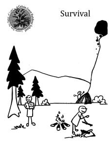
Survival
Equip young campers with important survival knowledge with a set of engaging lessons. Teammates work together to complete three outdoor activities, which include building a shelter, starting a campfire, and finding directions in the...
American Physiological Society
Sticky Adaptations A Lesson on Natural Selection
Now you see it, now you don't! The stick bug exhibits the ability to disappear into a wooded environment. Why does this adaptation manifest in some species, but not in others? Life science young scholars explore animal adaptations in...
Curated OER
Twelfth Night: Thrusting Greatness Upon the Television 1
Students create skits based on pairs of words. In this Twelfth Night lesson, students create a cluster map in which they brainstorm a dialogue/scene based on their word pair. Students perform and record their scenes and discuss...
Curated OER
Navigation
Students explain that globes are the best way to show positions of places, but flat maps are portable and can show great detail. They make a mercator projection of the route Lewis and Clark took on their journey.
Curated OER
Reading a Map
Third graders become familiar with the vocabulary and skills related to mapping. In this guided reading lesson, 3rd graders find proper nouns on from the map. Students read Goldilocks. Students make a map...
Curated OER
Students Slide to School on Air-Powered Sled
Students locate the Great Lakes on a US map, then read a news article about a sled being used as a wintertime school bus in Wisconsin. In this current events lesson, the teacher introduces the article with a map and vocabulary activity,...
Curated OER
Summertime Travel
Third graders write about a summer event they participated in. In this paragraph writing lesson plan, the teacher models how to write about a place they have visited. Students then write their own paragraphs. Students will point...
Curated OER
An Early American Culture
Young scholars identify the locations of the Hopewell culture. In this map skills lesson, students use a globe to mark several locations of the Hopewell culture.
Curated OER
Mystery State #5
For this mystery state worksheet, students answer five clues to identify the state in question. They then locate that state on a map.


