Curated OER
Mapping Worksheet #1
Get out the compass and a pencil its time to use a coordinate grid to practice mapping skills. Young cartographers use the prompts and provided grid to plot locations, draw parallel lines, and determine distances between points.
Curated OER
Map Coordinates: Monkey Map
Here's an engaging, meaningful, and clever lesson plan on map skills for elementary schoolers. Pupils combine story writing with mapping skills to create an original piece of work. They utilize a worksheet embedded in the plan to guide...
Curated OER
Topographic Mapping Skills
In this geography worksheet, students read an excerpt about topographic maps and why they are useful for various jobs. They also respond to eleven questions that follow related to the excerpt and locating specific map points on the map...
Curated OER
The Global Grid System-World Map Activity
Students demonstrate how to use the global grid system. In this map skills lesson, students use a world map to locate various locations. Students identify locations based on the global grid system. Students complete a worksheet as an...
Compton Unified School District
How Can We Locate Places?
How can we locate places? Maps, of course! Expose second graders to the tools available in maps and discuss how these tools can help people find locations. Students also look at communities, including what makes a community and the...
Scholastic
Volleyball Road Trip
Review coordinate mapping with your young geographers by matching cities on a volleyball team's road trip itinerary to their appropriate coordinate locations.
Curated OER
Where Am I? Map Activity
In this map activity worksheet, students determine which countries are shown on a set of 16 maps, then read facts about each country designed to help with a report on that country.
Curated OER
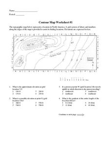
Contour Map Worksheet #1
Being able to read a topographic map is a standard in middle school earth science units and imperative for outdoor enthusiasts. As you introduce learners to this skill, you can assign this as an assessment or reinforcement. Pupils view a...
PBS
Working with Coordinate Planes: Activities and Supplemental Materials
Seven activities make up a collection of supplemental materials to reinforce graphing on a coordinate plane. Worksheet objectives include plotting coordinates within single and four quadrants, measuring straight and...
Curated OER
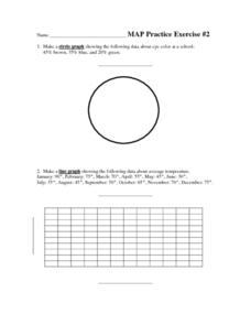
MAP Practice
In this geometry activity, students create circle, line and bar graphs using different comparisons of events. There are 24 questions with an answer key.
Curated OER
Put Me in My Place: Using Alphanumeric Grids to Locate Places
Students practice locating points on a large wall grid and create and label a neighborhood map. In this geography lesson, students spell and discuss places as the teacher places them on the map. They discuss the concept of an...
Curated OER
Exploring Earth Through Maps and Technology
In this maps worksheet, students read 3 pages of detailed information about maps, latitude, longitude, topography, satellites and global positioning. Students then answer 10 questions. There is also a research project assignment available.
Curated OER
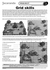
Grid Skills
In this geography activity, students use grid references on a map to locate places in the pictures given. They also identify another advantage of using a grid map, which they have an overhead view of the content to prevent any features...
Curated OER
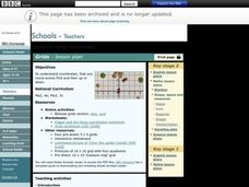
Grids
Take your study of coordinates online! Groups of students complete an online graphing introduction, plotting the points of virtual objects. A worksheet is included for extra practice.
Teach Engineering
What's Wrong with the Coordinates at the North Pole?
Here is an activity that merges technology with life skills as individuals use Google Earth to explore the differences between coordinate systems and map projections. The self-guided worksheet is the fourth segment in a nine-part unit....
University of Southern California
What Is The Ocean?
Go on a tour of the ocean through the lens of a scientist. Learners read maps of the ocean floor, study tide behavior, examine wave motion, and analyze components of soil. Each lesson incorporates a hands-on component.
Curated OER
Put the Mountains on the Map
Young scholars discuss what they know about the regions where snow leopards live. They observe the worksheets to see if they can identify any of the mountain ranges and then use atlases to check and complete the country identification...
Curated OER
Map Work: Using the Index and Grid References
In this maps worksheet, learners use the Oxford First Atlas to answer 20 questions about cities in Great Britain. Students will need to use the index and grid references to locate cities or countries.
Curated OER
WORLD GEOGRAPHY
Students identify and analyze map symbols and map grids by completing various worksheets and creating their own map using these skills. Students identify and analyze what latitude and longitude are on a map to play a game of Bingo....
Curated OER
Giving Students a Little Latitude
Young scholars use a world outline map to locate places using coordinates of latitude and longitude. They answer questions about places based on their knowledge of the map and on their research and make up more questions of this sort...
Curated OER
Degrees and Minutes
In this latitude and longitude worksheet, students place 9 cities on a map using the latitude and longitude of each. Once cities are placed in the correct location, students complete 2 short answer follow-up questions.
Curated OER
LRO and the Apollo-11 Landing Site
In this Apollo-11 landing site worksheet, students read about the NASA Lunar Reconnaissance Orbiter (LRO) that will collect images at a higher resolution than ever before. Students study a grid showing the lunar landing site from Apollo...
Curated OER
Metrics And Measurements
Students engage in a study of measuring distances between geographical locations on a map. They are able to define and use the map scale in conjunction with the metric system. For this lesson they make their own maps and measure the...
Curated OER
More Than One Grain of Rice
Young scholars explore mathematics, geography and agriculture by studying world rice production. In this production of rice lesson, students read One Grain of Rice and use a worksheet grid to calculate how much rice was received. Young...


