Curated OER
What Do Maps Show?
This teaching packet is for grades five through eight, and it is organized around geographic themes: location, place, relationships, movement, and regions. There are four full lessons that are complete with posters, weblinks, and...
Curated OER
Learning About the Map's Legend
Students draw a map of a room in their house and place a legend on it. They explain the legend orally.
Curated OER
Christopher Columbus: The Man, the Myth, the Legend
Learn more about maps by examining Christopher Columbus's voyage to the New World. Kindergartners will learn about basic map skills and how to identify the compass rose, oceans, and land masses. They will also discover the purpose of...
Curated OER
Maps and Legends by Micheal Chabon
Students read an essay to improve language skills and understanding of American culture for ESL teachers. For this American culture lesson, students read the essay 'Maps and Legends' by Michael Chabon and complete various activities to...
Curated OER
Where Am I: How to Read a Map
Third graders develop an understanding of maps. They explore what a map is, who uses maps, and how to use maps. Students investigate the compas rose. They create a compose rose which illustrates the cardinal directions. Students practice...
Curated OER
Topo Map Mania!
Students read and use topographical maps. They also use a compass to find bearing to an object on a map and in the classroom. Ask your students how they might travel to somewhere they have never been to befo
Curated OER
Mapping the Census
High schoolers learn why the census makes a difference. In this U.S. Census lesson plan, students learn the key elements of cartography, examine the difference between data and their representation, and create a map using census data.
Education World
Map Skills Worksheet 5
In this map skills practice worksheet, students practice reading a legend as they respond to 12 short answer questions regarding a legend and a map.
Curated OER
Drake's West Indian Voyage 1588-1589
Students investigate several maps detailing Sir Francis Drake's voyages. In this geography lesson, students practice reading maps and locating the precise locations of where Sir Francis Drake visited. Students create an...
Curated OER
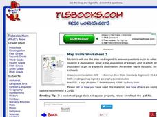
Map Skills
For this history worksheet, students utilize a map and legend to answer eleven comprehension questions. Students check their answers when done.
Institute for Geophysics
Understanding Maps of Earth
Here is your go-to student resource on primary geography concepts, including facts about the surface of the earth and its hemispheres, latitude and longitude, globes, types of maps, and identifying continents and oceans.
Curated OER
Caves
Explore caves with your class! Your scholars will participate in scientific observation, research, inference and deduction, reading, vocabulary, and writing activities about caves with this lesson plan. This resource contains five...
Curated OER
Transportation and Mapping
Students view murals that depict various modes of transportation. They discuss the importance of maps to navigation and create a map. They compare and contrast transportation of the past with modes of transportation used today.
Curated OER
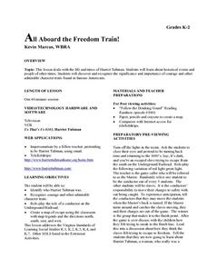
All Aboard the Freedom Train!
Young historians identify Harriet Tubman, her character traits, and role as a conductor on the Underground Railroad. They create an escape map using map legends and the Cardinal directions. This plan utilizes one of my favorite video...
Curated OER
The Legend of Sleepy Hollow
Young scholars discuss and define folklore, locate town of Sleepy Hollow, NY, on map, calculate distance from Sleepy Hollow to their school, if applicable, review vocabulary list from The Legend of Sleepy Hollow, read story aloud, and...
Curated OER
Topographic Mapping Skills
For this geography worksheet, students read an excerpt about topographic maps and why they are useful for various jobs. They also respond to eleven questions that follow related to the excerpt and locating specific map points on the map...
Curated OER
Map It!
Fourth graders demonstrate map making skills by using the computer to create maps of the geographic features, regions, and economy for their state.
Curated OER
Map Exploration
Are you looking for a terrific instructional activity on map activities for your second graders? Then, this resource is for you! The activities range from decoding, to fill-in-the-blank, to read-and-search. There is a website activity...
Curated OER
As the Kids Come and Go: Mapping a Classroom
Map the classroom with your kids to help them understand how maps work and how to read them. The lesson starts off with a story about animals living and moving around the globe, and then kids create maps of their classroom to show how...
Curated OER
A Walk Around the School: Mapping Places Near and Far
After reading Pat Hutchins’ Rosie’s Walk, have your young cartographers create a map of Rosie’s walk. Then lead them on a walk around the school. When you return class members sequence the walk by making a list of how the class got from...
Curated OER
Map It With Pixie
Fourth graders use the computer program 'Pixie' to create a topographic, detailed map for the state they live in. In this mapping skills lesson, 4th graders use Pixie to make a map of their state that includes topographic features, state...
Curated OER
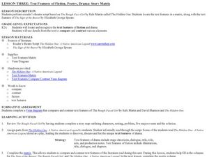
Text Features of Fiction, Poetry, Drama: Story Matrix
How do novels differ from plays? Explore with your class the text features of fiction and drama by reading The Hidden One: Native American Legend and then performing a reader’s theater script based on the story. Class members create a...
Curated OER
Waldseemuller's Map: World 1507
Students investigate the 1507 word map. In this world geography lesson, students examine the details of each section of the map and then draw conclusions about how the people of 1507 understood the world. Students are evalated on...
Curated OER
Where in the World War? Mapping the Geography of D-Day
Students examine how to read maps for historical information. They listen to a lecture on the history of D-Day, analyze a historical map of the invasion of Normandy, and answer discussion questions.


