K-State Research and Extensions
Water
How are maps like fish? They both have scales. The chapter includes six different activities at three different levels. Scholars complete activities using natural resources, learn how to read a map, see how to make a compass rosette,...
CK-12 Foundation
Direction on the Earth: Using a Compass
Navigate the world of orienteering in an informative interactive. Earth science scholars learn practical direction skills, such as proper polar coordinates and pairing compasses with maps. The interactive map allows them to practice...
CK-12 Foundation
Right Triangles, Bearings, and Other Applications: Sailing Race
Help your class get their bearings when it comes to right triangles. Pupils determine distances traveled or components given the bearing of a sailboat using an interactive. The scholars develop a sense of finding the bearings of a given...
Compton Unified School District
How Can We Locate Places?
How can we locate places? Maps, of course! Expose second graders to the tools available in maps and discuss how these tools can help people find locations. Students also look at communities, including what makes a community and the...
K12 Reader
Where On Earth Are You?
What do we use to determine the exact locations on the earth? Your kids can learn all about compass roses and latitude and longitude. Test understanding with the five reading comprehension questions included on the page.
Parkwood Hill Intermediate
Map Skills Project
Young pupils develop their mapping skills and knowledge by designing their own islands, using geographic terms and physical features they have learned as features of their work.
Super Teacher Worksheets
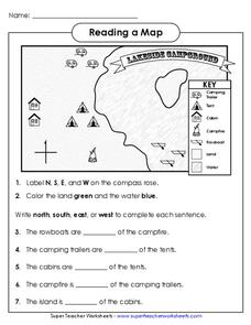
Reading a Map
Young geographers improve their map skills by practicing locating the cardinal directions on a map, identifying symbols on a map key, and describing where objects on the map are located relative to other locations.
Curated OER
Jordan's Neighborhood: Using a Compass Rose
A neighborhood map is a great way to practice compass rose and key skills! Use these 2 worksheets to introduce these concepts through reading and comprehension activities. First, students look at 3 compasses, circling their favorite and...
Curated OER
Compass Rose
Keep it simple and visual when practicing directions using this compass rose labeling activity. Learners fill in the compass themselves, using cardinal and intermediate direction abbreviations. Consider using their compass on a map to...
Curated OER
Telling Direction - Compass Rose
Keep it simple when practicing directions using this compass rose labeling worksheet. Learners read a brief text describing the cardinal and intermediate directions, then fill in the compass themselves. They can get immediate feedback...
Curated OER
Lesson on GPS
Young scholars investigate global positioning systems. In this technology and mapping lesson, students view a PowerPoint presentation in which they identify the features of a GPS, state its uses, and follow steps to find a waypoint.
Curated OER
Mapping My World
First graders make two maps. In this developing and reading maps lesson, 1st graders read Mapping Penny's World, discuss the parts of a map, create a map of their classroom, and create a list of directions of how to get to various...
Curated OER
Mapping the News
Students explore cartography. In this map skills and map making lesson plan, Students work in groups to create wall size world maps including legends, compass roses, latitude and longitude, and physical features. Students...
Curated OER
Google Earth
Students explore cardinal directions and the compass rose using Google Earth. In this cardinal directions and compass rose lesson, students use Google Earth to visit Disney World. Students choose which direction to go to get there....
Curated OER
People Change the Landscape
Young scholars examine ways in which humans have brought change to the natural environment. In this ecology and literacy lesson, students listen to the book Island Boy by Barbara Cooney. Young scholars observe and define map-reading...
Curated OER
Astrolabe Lab
In this astrolabe worksheet, students use a compass rose and an astrolabe to measure altitude and azimuth of five objects in the room and 5 objects outside the room. They answer questions about these two types of measurements.
Curated OER
Compass Rose
Second graders practice identifying the four cardinal directions. After locating a compass rose on a map, 2nd graders explain each point that corresponds to a direction. Using a toy ship as a manipulative on a map, students observe its...
Curated OER
Map It Out
Third graders create obstacle course maps. They lay out their course on the playground, using symbols for trees, fences, etc, Students, in groups, exchange maps and then follow the courses.
Curated OER
Reviewing Azimuth
Combine angles and the compass rose in this labelling worksheet. Geographers begin by labeling the cardinal directions on a compass template, along with the degrees corresponding to each. They then add the azimuthal directions, labeling...
Curated OER
Compass Rose Activity
Which direction is which? Use this compass rose labeling worksheet to practice with basic directions as learners fill in the compass themselves. They use cardinal and intermediate direction abbreviations. Consider using their compass on...
Curated OER
Compass Rose
Keep it simple and visual when practicing directions using this compass rose labeling worksheet. Learners fill in the compass themselves, using cardinal and intermediate direction abbreviations. North is done for them. Consider using...
Curated OER
Compass Rose
There isn't much learners do on this compass rose worksheet- an image includes degrees of direction and abbreviations of both cardinal and intermediate directions. There is a blank for students to fill out the compass #, however it is...
Curated OER
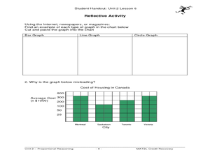
The Circle Graph
In this circle graph worksheet, students complete problems involving many circle graphs including a compass rose, degrees, and more. Students complete 7 activities.
Curated OER
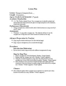
Using a Compass Rose
Second graders practice navigating around their neighborhood by utilizing a compass. In this geography lesson, 2nd graders view a compass rose, discover the purpose of it, and utilize it to navigate through a printed map of their...


