Curated OER
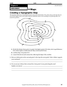
Creating a Topographic Map
In this topographic map worksheet, learners add contour lines to a topographic map using instructions provided. Once topographic map is finished, students complete 2 follow-up short answer questions.
Curated OER
Topographic Mapping Skills
In this geography worksheet, learners read an excerpt about topographic maps and why they are useful for various jobs. They also respond to eleven questions that follow related to the excerpt and locating specific map points on the map...
Curated OER
MAPS AND TOPOGRAPHY
Students analyze the details of a topographic map and create one of their own by utilyzing a map of elevations.
Curated OER
Contour Map Worksheet #4
There are only four questions here. There is a contour map of Cottonwood, Colorado and the creek that crosses it. Earth scientists tell in what direction the creek flows, identify the highest elevation on the map, draw a topographic...
Curated OER
Common Themes
Tenth graders test usefulness of a model Earth by comparing its predictions to observations in the real world. In this landforms lesson students construct an island from a contour map using model clay then analyze the landscape...
Curated OER
Salad Tray 3D Topographic Model
Students explore the characteristics of topographical maps. They examine the relationship of contour lines and vertical elevation. Students create a three-dimensional model of a landscape represented by a topographic contour map.
Curated OER
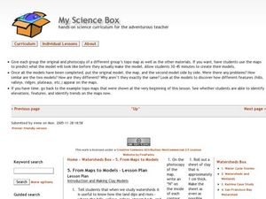
From Maps to Models
Fourth graders study topography maps and learn the importance of their contour lines. In this map lesson students create their own topography map.
Curated OER
"Potato Mountain": Reading/Understanding Topographic Maps
Students investigate how to read topographic maps. In this map reading instructional activity students complete a topographic map activity.
Curated OER
Introduction to Topographic Maps
Tenth graders create a topographic map and see how it represents different elevations. In this topographic maps lesson students read and interpret topographic maps.
Curated OER
Gilligan's Island
Students investigate topographical maps and match actual landforms to them. In this topographical maps lesson students create "Gilligan's Island" to scale then answer questions about it such as what the highest elevations is and...
Curated OER
Lesson Design Archaeology- USGS Maps
Students research USGS maps and identify the major features. In this map skills lesson, students identify low and high elevations on a USGS map and practice finding latitude and longitude.
Curated OER
Contour Map
In this contour map worksheet, students create 3 different contour maps by highlighting all the data points with the same value and connecting the dots.
Curated OER
Complex Analysis: Applications of Cauchy-Goursat Theorem
In this Cauchy-Goursat Theorem, students sketch and classify domains. They evaluate integrals and explore the analytic function. This two-page learning exercise contains approximately ten problems.
Curated OER
Math 312 Spring 2004: Complex Integration
In this complex integration worksheet, students use contour integration to find the area of odd shapes in a plane. This two-page worksheet contains four multi-step problems.
Curated OER
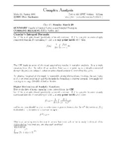
Complex Analysis: Cauchy's Integral Formula
In this integral formula activity, students evaluate integrals. This activity contains examples and explanations of Cauchy's Integral Formula, as well as higher derivatives of analytical functions. There are nine problems on this...
Curated OER
Complex Analysis: Introduction to Contours
In this contour worksheet, students compute complex valued functions of a real variable. They give examples of a parametric representation and draw a sketch of the points. This two-page worksheet contains explanations and examples, as...
Curated OER
Topographic Map Unit Plan
Students examine topographic maps and discover how to decipher contour intervals, use contour lines and apply information to complete a topographic map lab. Working in groups, they identify the scale of the map, latitude and longitude,...
Curated OER
WPA Art and Visual Elements of Art
Students recognize the following formal elements om art: visual and tactile texture; shape or contour; value. They create a 2-D or 3-D work of art that embodies this element strongly.
Curated OER
Doodle Animals
Fifth graders explore the abstract form of drawing of Paul Klee. They create a drawing of an animal using contour line in the same style.
Curated OER
What do Maps Show?
Seventh graders practice reading maps. In this geography lesson, 7th graders compare a topographical map to a picture of the actual place.
Curated OER
Building a Topographic Map from Benchmarks
In this map worksheet, students draw a topographic map using benchmark points. They draw contour lines showing 20 foot intervals.
Curated OER
Melody II
In this music worksheet, students identify melody as a string of notes that has a rhythm. They identify which notes given are melody and/or harmony. Students also map the contour of "Sweet Georgia Brown."
Curated OER
Rain Rain Go Away!
First graders are introduced to and practice the concept of melody when connected to music. They distinguish and demonstrate melodic contour as well as sing a song with accurate melody. Each student discriminates between the pitches and...
Curated OER
Computer Enhanced Contour Line Drawing
Students practice drawing contour lines using a computer program. Using the lines, they use them in a photo scanned onto the same computer with a photo-editing option. They change the colors and textures of the photo and turn it in to...


