Carolina K-12
Introduction to the European Union
What is the purpose of the European Union, and what institutions and countries comprise it? Check out this resource in which class members participate in a student-led WebQuest activity designed to offer an overview of the European...
Core Knowledge Foundation
The United Kingdom
Scotland, Northern Ireland, Wales, and England are four countries united by more than a monarchy. Academics explore the geography of the nations that make up the United Kingdom. The resource is broken into six lessons focusing on the...
Seterra
Northern Europe: Countries - Map Quiz Game
Remembering geography is a tiring and tedious task to many scholars. Change it up by assigning the map quiz game. Elementary and middle schoolers alike test their knowledge and compete with the clock to match as many countries as...
New York State Education Department
Global History and Geography Examination: August 2015
Need a comprehensive test about global history and geography? Look no further! Test young historians' understanding of how to use primary sources to formulate answers with an assessment that uses multiple-choice questions that require a...
New York State Education Department
Global History and Geography Examination: June 2016
Assess scholars' knowledge of the changing borders in Germany during World War II with a test that includes both multiple choice and essay questions.
New York State Education Department
Global History and Geography Examination: August 2016
Challenge class members with an architectural resource that asks them to use a variety of skills to answer multiple choice questions as well as several essay prompts about the streets and house fronts of ancient Athens. One question asks...
New York State Education Department
Global History and Geography Examination: January 2017
Global history and geography class members demonstrate their knowledge of and ability to analyze primary sources such as graphics, maps, political cartoons, and texts from important documents with an assessment that includes multiple...
New York State Education Department
Global History and Geography Examination: June 2017
Learners respond to multiple choice, short answer, and essay questions to demonstrate their understanding of global history and geography.
New York State Education Department
Global History and Geography Examination: August 2017
Looking for a final examination for global history and geography? Here's a resource that includes multiple choice, essay, and short answer questions.
New York State Education Department
Global History and Geography Examination: January 2018
Finding a test that assess knowledge of global history and geography can be challenging, but here's a resource that solves the problem. Updated January 2018, the exam asks class members to analyze charts, primary sources, and graphic...
Space Awareness
Where on Earth Am I?
Almost every phone has GPS installed, but a large number of teens don't know how the technology works. An initial activity illustrates how GPS determines a location on Earth. Scholars then apply trilateration procedures to a...
Curated OER
Ancient Greece Map Worksheet
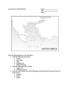
Since the beginning of time, geography has shaped the development of human civilization, and ancient Greece is no exception. This activity supports young historians with exploring this relationship as they first identify key land masses,...
Curated OER
Geography A to Z: All Around Europe #3
The Leaning Tower of Pisa, The Colosseum, and the country where the Kremlin is located are a few of the clues learners will use to determine the names of five world locations. The first letter of each mystery location is provided, but...
Curated OER
European Elevation Sort
Given a prepared database of European countries, sixth graders sort the countries in ascending order by elevation and identify the five countries with the highest elevations. This cross-curricular lesson combines elements of computer...
Ms. Catsos
Ancient Rome Map Worksheet
It wasn't just the great leaders of ancient Rome that shaped their civilization—the geography of the region played a major role as well. After first identifying major land masses, bodies of water, and city states on a map of Europe,...
Curated OER
Locations Of Countries In Europe
In this European geography worksheet, students describe where 12 countries in Europe are located by using directional phrases. Students also practice describing the nationalities of people from each country and how to pronounce each...
Curated OER
Living In the UK
In this geography worksheet, students complete activities on 16 worksheets pertaining to the geography and culture of the countries of the United Kingdom. This is intended for ESL students.
Curated OER
Europe Map Quiz
In this online interactive geography quiz learning exercise, students respond to 45 identification questions about the countries located in Europe. Students have 5 minutes to complete the quiz.
Curated OER
Europe Map Quiz (Easy)
In this online interactive geography quiz worksheet, students respond to 35 identification questions regarding the countries of Europe.
Curated OER
Europe Outline Map (Labled)
For this blank outline map worksheet, students study the political boundaries of the labeled European nations.
Curated OER
European Country Map
In this Europe political map worksheet, students examine the national boundaries. The country names are labeled on the map.
Curated OER
Europe at Exploration 1500
For this world empires and trade in 1500 worksheet, students examine a world empire map, world trade map, and Europe map. All maps display information from 1500.
Curated OER
Europe 1914
In this Europe 1914 map worksheet, students note the 9 regions of the Europe labeled on the map and their relevance to World War II.
Curated OER
Europe: Political Map
In this Europe political map activity, learners examine each country's boundaries. The map also highlights each of the nation's capitals with a star.


