K20 LEARN
Water We Going To Do? Floodplains And Watershed Management
How has human activity affected Earth's watersheds? An action-packed lesson plan, part of the K20 Center, examines water's ability to go with the flow regardless of what is in its path. Scholars build model watersheds, examine time-lapse...
College Board
2009 AP® Environmental Science Free-Response Questions
How do genetically modified crops affect agricultural practices? This is one of four environmental questions scholars respond to in an AP® test prep resource. Other topics include methane digesters, water runoff, and nitrogen-based...
Mr. E. Science
Erosion and Deposition
Get an in-depth look into erosion and deposition with a 23-slide presentation that details how gravity, water, waves, wind, and glaciers cause changes to the Earth's surface. Each slide consists of detailed images equipped with labels,...
Curated OER
Geography: Water, Water Everywhere
Students discuss flooding and its causes. They view a Powerpoint presentation about floods and prevention methods. After creating a model with clay and pans, they investigate river behavior in various terrains with different amounts of...
Curated OER
Floodplain Modeling
Students simulate the impact of fluctuating river volumes on structures and landforms. They experiment with table top-sized riverbed models and water. Students consider how human design can help mitigate the effects of a flood.
Curated OER
Deposition
In this earth science activity, students study the diagram on the sheet and describe the river valley. Then they list the main type of work done by the river at a specific stage. Students also explain the formation of the floodplain.
Curated OER
Spongy Wetlands
Students sort things that absorb and things that do not absorb, They predict, orally or in writing, what happens to houses with or without wetlands. Students build a wetland area in a meat tray to show how wetlands absorb water, and they...
Curated OER
Life Giving Rivers
Students examine the world's rivers in this six lessons unit which mingles science with social studies. The dynamic forces that create erosion in nature are also seen as habitats and ecosystems that are affected by environmental and man...
Curated OER
Floodplains in the Field
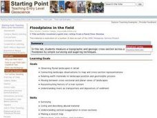
Students measure a topographic and geologic cross-section across a floodplain using simple surveying and auguring techniques in a field lab. Students also reconstruct the history of a river system.
Other
Marshall University: 1937 Flood: Huntington, West Virginia
Photo collection of 1937 flood in Huntington, West Virginia.
University Corporation for Atmospheric Research
Ucar: Considering Flood Risk
Students analyze and interpret data on a map of floodplains to assess risk of flooding and inform decision making that will mitigate the effects of flooding.
NASA
Floods: Using Satellites to Keep Our Heads Above Water
This article describes how scientists use satellite images to try and spot extreme floods. These satellites keep information stored, such as data on hundred-year floods, and try to identify likely flood plains based on that data.
CK-12 Foundation
Ck 12: Fourth Grade: Earth Science: Erosion and Deposition by Flowing Water
[Free Registration/Login may be required to access all resource tools.] Discusses how flowing water causes erosion; describes how runoff, streams, and rivers change Earth's surface; and identifies features caused by groundwater erosion.


