Scholastic
Study Jams! Landforms
First-class photographs dazzle your class as they are acquainted with Earth's various landforms. To reinforce learning, they can take a multiple-choice quiz, sing along to a karaoke song, or review key vocabulary terms, all on this...
Curated OER
Watershed Works: Unit 1
By constructing a watershed model and identifying watershed features in it, they discover how water erosion changes the landscape. As with most watershed modeling activities, this one is costly in terms of time and materials. It is,...
Curated OER
Blank Jeopardy
Games are a great way to motivate learners to internalize information.. Using this PowerPoint which is in a Jeopardy format, young scholars can review map skills and facts about the Civil War, famous places, and our government. This is a...
Space Awareness
Meet Our Home: Earth
Earth is a complex structure. Learners explore their home, the earth, using a fun hands-on activity. They create tactile models of the earth using ordinary household materials that represent some common features: land, polar caps,...
Polar Trec
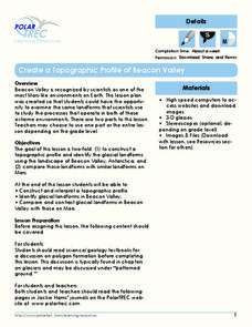
Create a Topographic Profile of Beacon Valley
Landforms in Beacon Valley, Antarctica, where there is no snow, bear a striking resemblance to landforms found on Mars. Scholars identify landforms found in Beacon Valley through analysis of topographic maps in the activity. They then...
Houghton Mifflin Harcourt
Off to Adventure!: English Language Development Lessons (Theme 1)
Give language skills a boost with a series of ESL lessons in an Off to Adventure! themed unit. Using a speak, listen, move, and look routine, scholars enhance proficiency through grand conversation and skills practice. Discussion topics...
K12 Reader
What Glaciers Leave Behind
Glaciers may seem distant and stationary, but they are huge deposits of moving ice that have made changes to the earth's surface. Your pupils can learn about the different types of impressions left by glaciers by reading the short...
Oregon State
World Map of Plate Boundaries
Young geologists piece together the puzzle of plate tectonics in an earth science lesson. Given a physical map of the world, they search for land formations that indicate the location of different types of plate boundaries.
Owl Teacher
Imaginary Nation: Constructing a Map
Your young geographers will combine what they have learned about the five themes of geography and their inner creativity to design a physical map for an imaginary nation.
Curated OER
Marine Energy
In small groups, energy engineers research and make a topographic map of a marine natural resource. They report to the rest of the class pros and cons of extracting their assigned resource. The two activities may take up to four class...
Curated OER
Landforms of Illinois
Fifth and sixth graders are introduced to the primary landforms of Illinois and discover how they were created. Landform cards are made for each pupil. They use the twenty-questions format until they have identified each one. Then,...
Curated OER
Coastal Erosion Diagrams
A set of super-descriptive and colorful slides demonstates the effects of ocean waves on coastal cliffs. You will need to do the verbal explanation, as little text is found on some of the slides, but the graphics really illuminate how...
Curated OER
Landforms Mobile
Students work together in groups to research the various types of landforms found on the Earth and locate them on a map. As a class, they discuss how the landforms affect the way people live in those areas. To end the lesson, they use...
Curated OER
From Coast to Coast
Students identify and describe characteristics of natural landforms such as mountains, islands, rivers, and inlets, research information about landforms that would be encountered on imaginary trip from one place to another, and design...
Curated OER
Regents High School Examination: Physical Setting Earth Science 2009
Junior geologists address 50 multiple choice questions and 35 short answer questions about the earth system. Plenty of visuals are included for interpretation: diagrams, graphs, maps, photographs, laboratory setups, weather symbols, and...
Curated OER
Regents High School Examination: Physical Setting Earth Science 2010
Every topic under the sun is covered in this New York State Regents High School Examination. With the focus of earth science, participants answer 85 quesitons about the solar system, geologic time, rocks and minerals, landforms, and...
Curated OER
Topographic Maps
Your choice of hands-on topographic mapping tasks is provided in this resource. From actual map-making to viewing and interpreting stereographic photos, the activities are sure to succeed. To make the most of this lesson, you will need...
Curated OER
Slip Slidin' Away
Students investigate mechanical weathering as a form of erosion. In this erosion lesson, students, define weathering and erosion before determining how the Earth's surface is in a constant state of change. They watch a video, access...
Curated OER
Exploring Regions of Our World
Examine how climate and landforms affect plants and animals that live in particular areas. Discover that these same factors affect peoples' homes, jobs, and recreational activities. Pupils research ecosystems and biomes, and then write...
Curated OER
What are Landforms?
These yellow slides and concise facts in a clear font will keep your students' attention while they see the main landform headings explained along with a photo.
Curated OER
Earth Science Jeopardy
This jeopardy game has 5 categories and 5 point levels, and is designed with a section of hodge podge, geography, and earth science review questions. The questions are clear and the point selections are designed to darken once used.
NorthEast Ohio Geoscience Education Outreach
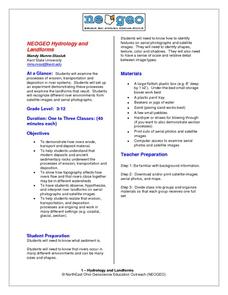
Hydrology and Landforms
Three days of erosion exploration await your elementary geologists. Learners begin by examining rivers via Google Earth, then they model water flow in sand, and finally, they identify resulting landforms. This lesson is written...
Curated OER
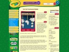
Cut-Out Continents Mobile
Students research major natural features on all seven continents. They compare and contrast continents, their sizes, shapes, and major landforms. Students create a unique display of the continents to show major landforms.
Curated OER
Landforms and Bodies of Water
A simple worksheet helps your learners with geographic terms. This could be used as a template for future worksheets which have learners identify some geographic terms, then complete an essay about one of the terms.


