Curated OER
Tall as a Mountain, Flat as a Plain
Students examine a variety of landforms that are found on the Earth and compare and contrast the distinguishing qualities of these forms. A topographical model of the landforms is made.
Curated OER
A Feature Presentation - Geographic Landforms
Students investigate, identify and compare the various geographic terms that can be used to describe the landforms occurring in the Hawaiian islands.
Curated OER
Title: Rivers as Borders
Students are introduced to the concept of borders. They read maps and identify rivers that separate different countries and states. They examine how or why a landform such as a river border might be the reason for different cultures.
Curated OER
Springfield Digital Storytelling Project: Landform Riddle
Creative projects and collaborative learning are hallmarks of 21st Century learning skills. Using an iphone, 6th graders create an iMovie which shows a student composed riddle. The riddle needs to be about one of the landforms they have...
Curated OER
The Happy Game: Physical Features
Students love to test their knowledge, use this game to see what your students know about landforms and other basic geographic terminology.
Curated OER
Changing Landforms
Students investigate different types of landforms. In this landforms lesson, students explore landforms by participating in a WebQuest. Students research the reasons behind landforms changing and create a picture using KidPix.
Curated OER
Haiku Wrap Up
Students create a haiku about the land formations they've studied. In this haiku lesson, students identify the metaphor and meaning of a given haiku, brainstorm comparisons for a landform photo as a class and choose one to use in a...
Curated OER
Surveying the Land
Students explore the different kinds of maps and the purpose of each. In this Geography lesson, students work in small groups to create a map which includes the use of a map key.
Curated OER
Mapping Landforms of South Carolina
Third graders analyze South Carolina maps. In this geography lesson, 3rd graders locate the five land regions in the state are and discuss how the regions are different. Students identify the major bodies of water and analyze how they...
Curated OER
I Can Find that Where? - A Study of Landforms
First graders make landform maps of the United States. In this landform lessons, 1st graders participate in a discussion of local landforms and make a landform map of the United States. They follow the teacher's directions to add plains,...
Curated OER
Fourth Grade Social Studies
In this social studies worksheet, 4th graders complete multiple choice questions about the climate, landforms, regions, government, and more. Students complete 25 multiple choice questions.
Curated OER
How to Use Technology to Teach Landforms
Students create a landform table on the computer. In this geography lesson, students use Microsoft Word to design a 3 column table. They list different landforms, examples, and attach a picture of each.
Curated OER
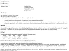
Land Formations
Second graders explore land formations. In this science lesson plan, 2nd graders develop an understanding of how land is naturally developed, investigate several land formations as well as earth science and chemical terminology, and ...
Curated OER
Landforms
In this landforms activity, students answer 2 questions about the major land forms and types of mountains. They match 10 landforms and types of mountains with their definitions.
Curated OER
Google Earth Landforms
In this lesson, Google Earth Landforms, students research a landform that has been studied in class. Students explore Google Earth and record everything they find about their landform. Students have the opportunity to extend their...
Curated OER
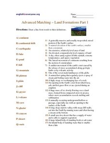
Advanced Matching--Land Formations Part 1
Using this activity, learners could review information they have covered about land forms, such as hills, mountains and plateaus. This 17 question activity could be used with upper elementary or ESL students to test or review information...
Curated OER
Water Works Wonders
Students examine where water is found in the world, how we use it, and the various forms it takes. They observe the refraction of light through a prism, record the day and night sky over a week's time, and create a topographic model of...
Curated OER
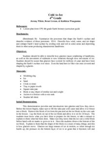
Cold As Ice
Fourth graders investigate how glaciers cause the weathering of landforms. They observe a brick that has been placed on a frozen slab of ice, and discuss the results, comparing them to the movements of a glacier. In small groups, they...
Curated OER
Geological Features: How Weathering & Erosion Help Create Landforms
Students explore how the Earth's surface changes resulting in geological features and landforms. They perform a read-a-loud on Thomas
Locker's Mountain Dance, complete a KWL chart, and create a
landform using plaster of paris.
Curated OER
Who Are the Aliens in Our Inland Seas?
Students work in teams to research specific landforms in Great Lakes Watershed, compile information into data table, and write legend explaining landform for children's book. Students then research area surrounding landform, compile...
Curated OER
Sub-Sahara Africa
Students listen to a lecture on the geography of sub-Sahara Africa. They then make a poster that illustrates the various landforms and climates that can be found in Africa. Students listen to a lecture on the diversity of African...
Curated OER
Lesson 2 Its a Small World (Day 2)
Students are able to explain how the water cycle recycles the earth's water supply. They are able to make use of the knowledge of land forms learned in social studies. Students are able to form a hypothesis on how/why the water cycle...
Curated OER
Georgia's Regions
Students understand that Georgia has 5 main land regions. They are able to identify the geographic regions of Georgia and describe the regions by completing a research project about a given region with 100% mastery.
Curated OER
Rocks and Minerals
Students are able to describe earth processes (e.g., rusting, weathering, erosion) that have affected selected physical features in students, neighborhoods. They are able to identify various earth structures (e.g., mountains, faults,...


