Curated OER
Absolute Location
Fifth graders examine the geographic concept of absolute location. Using a variety of resources, they create a life-size classroom grid and locate the coordinates of a point, identify latitude and longitude of different locations, and...
Curated OER
Stellar Navigation
Middle schoolers are introduced to the concept of stellar navigation. Inside a portable digital planetarium they identify various stars that were used as a navigational tool. They go through several activities in which they attempt to...
Curated OER
Where in the World? The Basics of Latitude and Longitude
Students are introduced to the concepts of latitude and longitude. In groups, they identify the Earth's magnetic field and the disadvantages of using compasses for navigation. They identify the major lines of latitude and longitude on a...
Curated OER
Map of Town
Third graders draw a map of the town given different sites to locate on the map by the teacher. They explain that latitude and longitude are used to locate places on maps and globes, identify the distinctive physical and cultural...
Curated OER
Summer Trip
Fourth graders search for information and directions to specific cities from their homes, figure cost of trip when given miles per gallon, distance, and cost per gallon of gas, develop outline budget for summer trip, and draw and label...
Curated OER
An Archaeological Adventure in Athens
Students review map skills and practice finding locations on a map. In groups, they create maps with mystery locations identified by hidden stick-on magnets. Other groups attempt to find the mystery locations and then check their work...
Curated OER
Wales: An Interdisciplinary Unit
Young scholars practice basic map and geographic skills as they compare Oregon to Wales. Students color map of Wales and Oregon using color codes to distinguish between land, water, and bordering nations or states, listen to stories and...
Curated OER
Way to Go! Create a Road Map Game
Students create a travel game of one of the United States. They research a state of their choice and create a travel game using a common road map. They interpret map symbols as they calculate map mileage for their games. They create...
Curated OER
Directions, Directions
Third graders review cardinal directions, moving around the room so that they are standing in the part of the room that is nearest the north, south, east and west. They are asked what would you do if they are lost? Pupils work as a...
Curated OER
Introduction to Field Mapping with a Compass and Pace
Students practice using compass and calibrate their own pace, take field measurements of pre-set course with compass and pace, convert measurements into map, using angles and vectors, and make composite class map by adjusting different...
Curated OER
The Coldest Place at the Bottom of the World
Students examine Ernest Shackleton's journey through the Antarctic and trace Shackleton's Actual Route on a map using longitude and latitude coordinates. Students compare his intended route with his actual and determine how far off...
Curated OER
GPS Sports Field Activity
Students practice using GPS receivers and explore how knowing the coordinates of two locations allows them to determine the distance between those two points. They use the theory that they already had knowledge of and apply it to a...
Curated OER
California Geography
Fourth graders explore geography of four distinct regions of California: mountains, coast, central valley, and desert. They locate California on map, identify state's boundaries and borders, and explore agriculture, a major economic...
Curated OER
Learning About Location: Charting the Path of the George W. Elder
Students acquire a working knowledge of the geographical concepts: absolute location, relative location, longitude and latitude. They analyze primary sources that shows the physical and human characteristics of the places along the 1899...
Curated OER
Maps and Globes
First graders complete a unit on map skills and the globe. They label maps, create a styrofoam ball globe, create a map of their community, sing a continent song, and complete a map and globe assessment worksheet.
Curated OER
Cardinal and Ordinal Directions
Students use a compass to locate cardinal and ordinal directions. In small groups, they describe and create a journey for their classmates using their compass. Groups create a scale map for their classmates to follow and relate this...
Curated OER
TE Activity: Northward Ho!
Students design a simple compass. They examine how the Earth's magnetic field has both horizontal and vertical components. They determine how a compass works and work with cardinal directions.
Curated OER
Schoolyard Geology
Discover that maps show information about an area and that they have common features like scales and legends. View an aerial map of your school and find features on the map such as the playground, roads, and trees. Trace the outline of...
Curated OER
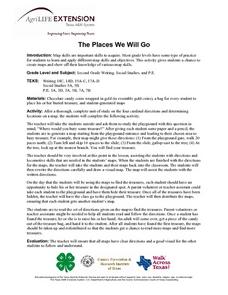
The Places We Will Go
Second graders demonstrate basic map skills. They each bury a bag of chocolate coins, create a map with directions to find their "treasure," and follow another student's directions to locate a bag of coins.
Curated OER
Topo Map Mania!
Students read and use topographical maps. They also use a compass to find bearing to an object on a map and in the classroom. Ask your students how they might travel to somewhere they have never been to befo
Curated OER
Valentine City
Students construct a small city on a table in the classroom. Each student is given a lot to develop. They give directions from one location to another, and write letters with correct addresses to their classmates.
Curated OER
Make a Classroom Map
Students map the items in their classroom to explain the importance of coordinate systems.
Curated OER
Create A Park Map
Students design ultimate park experience for Florida families as they demonstrate their knowledge of map legend skills.
Curated OER
Transportation and Mapping
Students view murals that depict various modes of transportation. They discuss the importance of maps to navigation and create a map. They compare and contrast transportation of the past with modes of transportation used today.


