Curated OER
Writing Vectors
In this vectors worksheet, students draw 15 vectors using a given key with direction and measurement. Students are given a specific distance and direction for each vector to draw.
Curated OER
Problem-Solving Decisions: Reasonable Answers
In this problem solving worksheet, students answer 6 questions pertaining to a story problem about a tabletop scale model of the Nile River.
Curated OER
Earth's Features
In this geography worksheet, students label a map of the world with the Arctic Circle, Tropic of Capricorn, Tropic of Cancer, Equator, North Pole, South Pole, and the Antarctic Circle.
Curated OER
School-Home Link: Maps
In this atlas and parent communication form worksheet, students use an atlas to find several things: the capitol city of Japan, the number of countries in Africa, where to buy a newspaper, the names of Presidents of the United States,...
Curated OER
Geographical Skills-- Map Scale
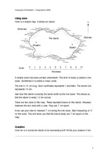
In this maps worksheet, students study a simple map and the scale in kilometres. Students read the directions and answer one question. Students then look at a sketch map of a town and answer 2 questions. Students also read how to show...
Curated OER
Labeling a Map of the British Isles and Elapsed Time
In this map work and elapsed time instructional activity, students label England, Scotland, Wales, and Ireland on a map. They calculate the elapsed time of a delivery that is described in a word problem that is broken down into four parts.
Curated OER
Map Analysis Worksheet
In this map analysis activity, learners decipher what type of map they are using based on a complete list of criteria. Students then answer multiple questions based on their discoveries.
Curated OER
Defining a Cultural Region Worksheet
In this cultural regions activity, students click on the webpage names listed to find information about the different cultures and cultural regions in Louisiana that may be used for research purposes.
Curated OER
Exploring Earth Through Maps and Technology
In this maps worksheet, learners read 3 pages of detailed information about maps, latitude, longitude, topography, satellites and global positioning. Students then answer 10 questions. There is also a research project assignment available.
Curated OER
Map Facts Worksheet
In this geography, ecology, and folklife worksheet, students search Louisiana maps of their choosing to discover the factual information required to complete the graphic organizer.
Curated OER
Viewing Earth and Sky
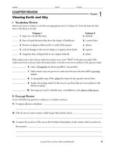
For this earth and sky worksheet, students review terms associated with map reading. Students also review topographic maps and how contour lines represent elevation. This worksheet has 5 matching, 5 true or false, 5 fill in the blank,...
Curated OER
Give Me Some Latitude
In this latitude worksheet, students use an atlas or other reference to respond to 4 multiple choice questions about the equator and the poles.
Curated OER
Backpack-tivity: An @ Home Learning Activity We're Off!
In this schedule reading worksheet, students map a trip from their home to a national park, ask a family member to show them a bus, train, and plane schedule for the destination, learn how to read a schedule, discuss with a family member...
Curated OER
Treasure Map
In this writing worksheet, pupils find a treasure by following the correct path on the map. Students write directions telling exactly how to get there. A list of sequential words is provided to help pupils write directions.
Curated OER
Middle Ages Traveler
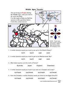
In this map worksheet, students are given three maps of France to use to answer multiple choice questions. Students complete an activity from the perspective of a Middle Ages traveler.
Curated OER
Asia Crossword
In this geography worksheet, students complete a crossword puzzle on the continent of Asia. They answer 21 questions related to the type of government systems found, capital cities, deepest lake, and lowest population density.
Curated OER
BOLTSS Map
In this geography worksheet, students identify the six features always used on maps. They identify each of these features by the acronym BOLTSS. Students examine the Melbourne Cricket Ground shown and respond to the 4 questions that follow.
Curated OER
The Longitude and Latitude of the Night Sky: Declination & Right Ascension
In this longitude and latitude activity, learners identify and write in the correct hours, minutes, and seconds for right ascension. Then they identify and write the correct + or - degree in the space for declination or latitude. There...
Curated OER
Project Map: Scale Worksheet
In this map reading learning exercise, students determine the distance from a plotted treasure on a topographic map. They must adjust for magnetic declination.
Curated OER
Latitude, Longitude, Seasons
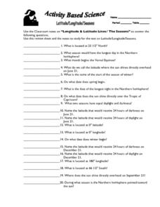
In this latitude and longitude worksheet, students use their classroom notes on both longitude and latitude lines as well as seasons to complete 20 fill in the blank questions.
Curated OER
African Safari Adventure
Learners conduct Internet research on the different safaris available. They locate and label safari sites on the continent of Africa. They create a PowerPoint presentation for the class to persuade the class why they should vote for...
Curated OER
U.S. History: What Happened Here?
Learners apply the global positioning system to create maps of local historical sites. By collaborating with local historical groups, they research events and relate them to broader, national history. In addition to writing essays...
Curated OER
Message in a Bottle
Sixth graders write a short story about being stranded on a deserted island. After a brief geography review of locations at various latitudes and longitudes, 6th graders draft their story about being stranded. They use sensory and...
Curated OER
Compass Rose Directions
Second graders use cardinal and intermediate directions to locate places on maps and places in the classroom, school, and community. They draw a setting map of "Little Red Riding Hood." Students give five steps of cardinal or...


