Curated OER
Latitude
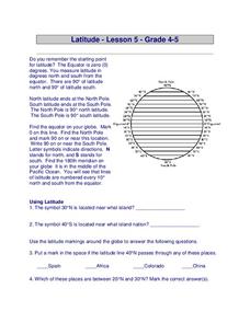
In this latitude worksheet, students answer questions about latitude that include absolute locations of countries and coordinates. Students complete 12 questions.
Curated OER
Directions on a United States Map
Young scholars generate directions for an imaginary trip. For this map lesson, students review the four main directions and how to use a map legend. Young scholars locate destinations based on directions given by classmates.
Curated OER
Map Work: Using the Index and Grid References
In this maps activity, students use the Oxford First Atlas to answer 20 questions about cities in Great Britain. Students will need to use the index and grid references to locate cities or countries.
Curated OER
Make a Map
In this mapping activity worksheet, students finish the map by following the 5 directions and using the map key. Students the map key, scale, and an inch ruler for help.
Curated OER
Viewpoints
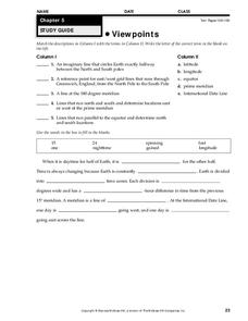
In this map worksheet, students review latitude, longitude, equator, and prime meridian. This worksheet has 5 matching and 8 fill in the blank questions.
Curated OER
Precipitation Map
In this precipitation map worksheet, students study the key and the map for the various precipitations that occur across the United States. Students then answer questions about the precipitation.
Curated OER
Finding Your Way Around Wookey Hole Caves and Papermill
In this social studies worksheet, students examine a detailed map of a place called Wookey Hole Caves and Papermill. Students answer 8 questions about the map. It is not clear if the place on the map is real.
Curated OER
Reading Skills - Giving Directions
In this reading skills learning exercise, students identify places on a map. After reading a description of where each of the fifteen places is located, students match each building to the names of the places.
Curated OER
Outline Map of Japan
In this geography worksheet, students examine a black line outline map of Japan. There is a compass rose on the page. There are no labeled cities.
Curated OER
Test Your Reading Skills - Understanding Maps 2
In this map reading worksheet, students will use their answers from p.62 (another worksheet) and the map of Melton Park on p. 61 (another worksheet) to fill in the missing words on the worksheet.
Curated OER
Sunrise and Sunset
Students utilize a Mesonet daily solar radiation to determine the times of sunrise and sunset and the length of the day. They describe how sunrise and sunset change with latitude and longitude and how the length of the day changes with...
Curated OER
From Home To School
Students locate and use internet maps to trace a route from their home to school. They calculate the distance of the route using the map legend then determine the distance they travel to school and back in a regular school week and over...
Curated OER
Pennsylvania Walkers Club
Students participate in an school-wide walking club. Students choose a destination in Pennsylvania they would like to visit. After plotting the best way to get their using a map, the walk each day and record their distance in miles on...
Curated OER
White Bear Lake Fitness Challenge
Students participate in fitness challenge. After choosing a destination they would like to visit, students record their mileage to their destination after riding on bikes and walking on treadmills. Students receive an incentive...
Curated OER
Latitude and Longitude
Fifth graders study latitude and longitude. They estimate the latitude and longitude of their hometown and find the latitude and longitude of other cities using a map. They use a website to find out the cities' actual latitude and...
Curated OER
Geometry: Mountain Rescue Mission
Fifth graders improve their skills using map coordinates by playing a mountain rescue game. In pairs, they roll dice to determine their moves up a mountain. The team that reaches the rescue site in the shortest distance on the grid...
Curated OER
See the State
Fourth graders are given a map of Indiana and have to plan a road trip including at least two major points of interest with 100% accuracy. The students estimate the distance between their two chosen locations with 100% accuracy.
Curated OER
Adventures With Maps And Globes
First graders examine the differences between a map and a globe. They discuss and identify the symbols on maps and globes, then in small groups complete a worksheet. Students then complete a Venn Diagram comparing maps and globes.
Curated OER
Latitude & Longitude Bingo
Pupils practice map reading skills through a reinforcement game of bingo. They select any 24 of 30 listed cities to write on blank bingo cards. Then using atlases, locate a city based on the latitude and longitudinal coordinates called...
Curated OER
Locating Patterns of Volcano Distribution
Students examine patterns of volcanic distribution worldwide, use tables to plot and label location of each volcano on map, lightly shade areas where volcanoes are found, and complete open-ended worksheet based on their findings.
Curated OER
At Your Fingertips
First graders observe a variety of different foods including kiwi, banbnas, coffee, chocolate and discuss where they come from. They discuss the terms import and export then identify the locations where the items came from and their...
Curated OER
Vocabulary Review and Map Skills
Students, when given the name of a community, identify a food, a craft, a custom, language and music, unique to that community 100% of the time. They find similarities and differences between this community and their own in four...
Curated OER
Tracking Satellites Using Latitude and Longitude
Young scholars investigate how to track satellites using latitude and longitude. They investigate what man learns from all the satellites currently being studied today. Students analyze the four basic types of satellite orbits.
Curated OER
Social Studies: African Folklore and Geography
Students discover the connection between geography and folklore in several African nations. In groups, they record information from maps of their assigned countries. Students observe the pictures in books and match the geographic...


