Arcademics
Penguin Hop
It's a race to learn the state capitals. Using a multi-player video game, participants hop from iceberg to iceberg as penguins in response to questions about state capitals. The real-time practice lets both teacher and learner assess...
Alabama Department of Archives and History
Birmingham: The Magic City
Why is Birmingham known as the magic city? A comprehensive lesson plan provides hands-on activities, group discussion, and writing exercises to teach young historians about the importance of the city of Birmingham. Scholars learn the...
Happy Housewife
State Notebooking Pages
When learning about US geography, it can hard to remember facts about 50 different states. Help your young scholars organize all of this information with a collection of easy-to-use note-taking guides.
Curated OER
Texas Map
In this Texas worksheet, students explore the state of Texas. Students look at a blank map of Texas and add the state capital, major cities, and any other major attractions of the state of Texas on the blank map.
Scholastic
Perfect Postcards: Illinois
Connect the geography and history of Illinois using an art-centered lesson on the railroads. The railroad connected once-distant places, particularly in the Midwest. Using research, class members create postcards of fictional cross-state...
Curated OER
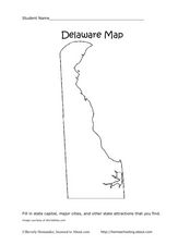
Delaware Map
In this state maps worksheet, students identify the state of Delaware, and fill in the state capital, major cities, and other attractions in the state.
Curated OER
Connecticut Map
In this state maps worksheet, students identify the state of Connecticut, and fill in the state capital, major cities, and other major attractions.
Curated OER
Colorado Map
In this state maps worksheet, students identify the state of Colorado, and fill in the state capital, major cities, and other attractions for the state.
Curated OER
Tennessee Map
In this Tennessee outline map, learners examine the political boundaries of the state. Students mark the state capital, major cities, and other state attractions.
Curated OER
Vermont Map
In this state maps learning exercise, students identify the map of Vermont. Students fill in the state capital, the major cities, and other state attractions.
Curated OER
New Mexico Map
In this state maps worksheet, students identify the state of New Mexico. Students fill in the state capital, major cities, and other state attractions.
Curated OER
Montana Map
For this state maps worksheet, students identify the state map of Montana. Students fill in the capital city, the major cities, and other state attractions.
Curated OER
Maine Map
In this state maps worksheet, students identify the map of Maine. Students fill in the capital city, major cities, and other state attractions.
Curated OER
Michigan Map
In this state maps activity, students identify the map of Michigan. Students then fill in the capital city, major cities, and other state attractions.
Curated OER
North Carolina Map
For this state maps worksheet, learners identify the state map of North Carolina. Students fill in the state capital, the major cities, and other state attractions.
Curated OER
Play Doh Map of Your State
Students create a state map using Playdoh. In this hands-on state geography lesson, students work in groups to form a three-dimensional map of their state using Playdoh made at home following a (given) recipe. Students use four colors...
Curated OER
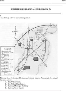
Fourth Grade Social Studies
In this social studies worksheet, 4th graders answer multiple choice questions on state maps, city maps, road maps, political maps, and more. Students complete 25 multiple choice questions.
Curated OER
Name the States Worksheet 5
In this name the states worksheet, students examine 6 state map outlines and identify each of them by writing the state names and postal abbreviations.
Curated OER
Name the States Worksheet 2
In this name the states worksheet, students examine 6 state map outlines and identify each of them by writing the state names and postal abbreviations.
Curated OER
Name the States Worksheet 1
For this name the states worksheet, students examine 6 state map outlines and identify each of them by writing the state names and postal abbreviations.
Curated OER
Indiana State Map
In this state maps worksheet, students identify the state of Indiana and fill in the state capital, major cities, and other attractions in the state.
Curated OER
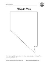
Nevada Map
In this state maps worksheet, students identify the state of Nevada. Students then fill in the state capital, major cities, and other state attractions for the state.
Curated OER
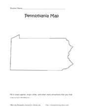
Pennsylvania Map
For this state maps worksheet, students identify the map of Pennsylvania. Students fill in the state capital, the major cities, and other state attractions.
Curated OER
Map It With Pixie
Fourth graders use the computer program 'Pixie' to create a topographic, detailed map for the state they live in. In this mapping skills lesson, 4th graders use Pixie to make a map of their state that includes topographic features, state...


