Space Awareness
Navigating with the Kamal
Historians have proven that as early as 1497 skilled navigators were using a kamal to sail across oceans. Scholars learn about navigation tools and astronomy before building their own kamals. They then learn how to use it to determine...
Curated OER
Orienteering
Everything you wanted to know about orienteering, and more! Take your class on an adventure with this creative activity. You will need to gather some supplies and materials and maps for your specific location, but the unit sounds like it...
NASA
From Smoke Signals to Cell Phones: Tracing How Technologies Evolve
Explore the science of space exploration. Pupils consider technological advances in propulsion, communication, power, navigation, and imaging. They select one of these areas and create a timeline of historical progress that contributed...
Teach Engineering
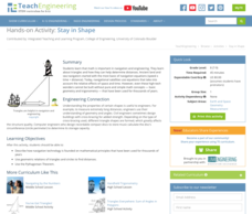
Stay in Shape
Using their knowledge of right triangles, pupils find out how far a ship is from a light house. Class members determine how far around the world a ship would be sailing at a constant speed.
Space Awareness
The Sun Compass of the Vikings
Evidence shows the Vikings likely navigated by using a simple sundial to find their course. Videos, a short story, and discussion help bring this time period to life as they study European history with a hands-on experiment. Scholars...
Space Awareness
Where on Earth Am I?
Almost every phone has GPS installed, but a large number of teens don't know how the technology works. An initial activity illustrates how GPS determines a location on Earth. Scholars then apply trilateration procedures to a...
Space Awareness
Navigation in the Ancient Mediterranean and Beyond
Ancient texts, like Homer's Odyssey, mentions navigating ships by observing constellations. Pupils learn about the link between history and astronomy as they relate to navigation in the Bronze Age. Scholars complete two hands-on...
Space Awareness
Britannia Rule the Waves
Could you determine longitude based on measuring time? Early explorers used a longitude clock to do just that. Scholars learn about early exploration and the importance of the invention of the clock. Then pupils build their own longitude...
Space Awareness
How To Travel On Earth Without Getting Lost
Have you ever wanted to travel the world? Take a virtual trip with a geography lesson that uses longitude and latitude, the position of the sun, an astronomy app, and a classroom globe.
NOAA
Technology II
Ping, ping, ping. The last installment of a 23-part NOAA Enrichment in Marine sciences and Oceanography (NEMO) program explores technology use in marine studies, such as sonar. Activity involves simulating sonar techniques to identify a...
Discovery Education
Physical Oceanography and Meteorology, Navy Search and Rescue Operation
It's an ocean rescue mission! Groups must find a pilot downed off the coast of the Chesapeake Bay. Rescuers must determine the distance needed to travel as well as the heading to get to the pilot's last known position. Taking into...
PHET
Mapping the Ambient Magnetic Field
No GPS allowed! High school scientists continue to explore magnetic fields with a hands-on activity. After mapping the ambient magnetic field in the classroom and completing data analysis, they write about the similarities and...
PBS
Arthur Compass Rose
Keep your class headed in the right direction with this printable compass rose. Large and easy to read with a smiling picture of Arthur in the middle, this resource would make a fun addition to the desk of any primary grade student.
Owl Teacher
Imaginary Nation: Constructing a Map
Your young geographers will combine what they have learned about the five themes of geography and their inner creativity to design a physical map for an imaginary nation.
Curated OER
Mapping Worksheet #1
Get out the compass and a pencil its time to use a coordinate grid to practice mapping skills. Young cartographers use the prompts and provided grid to plot locations, draw parallel lines, and determine distances between points.
Curated OER
True North, Magnetic North
Students explain why compass angles need to be corrected for regional magnetic variation. They observe the difference between magnetic and true north. Each student measures the angle of variation for a town in a different state.
Curated OER
Magnetism
This set of seven activities attracts physical science stars to concepts concerning magnetism. Pupils play with a lodestone, magnets, needles, and iron filings to understand magnetic forces, fields, and applications. If you are new to...
Curated OER
Introduction to Magnets
Ask your class what they know about magnets, then take some time and explain basic magnetic properties. This presentation covers polarity, magnets in compasses, and magnetic force. It provides a quick hands-on exploration where kids...
Curated OER
Construct, Bisect, Duplicate: Geometry Practice with Compass and Straight Edge
Geometers employ a straight edge and compass to duplicate and bisect segments and angles, construct perpendiculars, parallel lines, figures, and circles with points of concurrency. Ample practice with 65 questions across 8 worksheets. No...
Curated OER
Making a Six-pointed Star
In this polygon worksheet, students identify and create a six-pointed star by completing 6 steps. First, they use a compass to trace a circle with a given radius. Then, students draw a point on circumference of the circle and place the...
Curated OER
Basic Mapping Skills
Establish and study the parts of a map with your class and, then they will work in small groups to create their own detailed map, including a legend. There are specific instructions to follow on what needs to be included.
Curated OER
Mapping It Out: Social Studies Online
A great way to introduce 2nd graders to map skills would be to use this presentation. The visuals are inviting and the layout is easy to understand. This would be a terrific way to cover the basics on how to read a map. There is also a...
Curated OER
Compass Points 2
If you're looking for a worksheet that enhances the skills of your pupils when using a compass, this one could be for you. Pupils are faced with 12 compass word problems in which they must give a variety of answers regarding degrees,...
Curated OER
Compass Reading
Here's a basic lesson on reading a compass. Learn the names of the parts of a compass. Learn how to read a bearing in degrees. Then go outside and follow a course of cones set up on the grass or in a clear area. Starting at one cone,...


