NASA
Erosion and Landslides
A professional-quality PowerPoint, which includes links to footage of actual landslides in action, opens this moving lesson. Viewers learn what conditions lead to erosion and land giving way. They simulate landslides with a variety of...
Curated OER
Ecosystems and Remote Sensing
Learners obtain remote sensing data to compare and contrast global biomass data with global temperature data.
Curated OER
An Introduction to GPS
GPS is a technological tool that has become available for use by the general public. Navigate the components and science involved in this remote sensing system. Here is a comprehensive collection of slides that would be valuable to share...
Curated OER
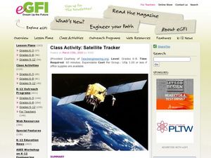
Class Activity: Satellite Tracker
Demonstrate how the Skywatch website works, locating your city via The International Space Station. Have cooperative groups use string and a protractor to identify an azimuth. When each groups' height has been marked, you will have a...
NASA
Build a Satellite
Shake, rattle, and explore space with satellites. Engineers learn how satellites work before designing, building, and testing their own models. Groups engage in quality assurance reviews with colleagues to improve their designs, and the...
NASA
Mapping the Watery Hills and Dales
How does GPS know where everything is located? Pupils read about satellites that are mapping the ocean and the question on how satellites know where they are. Readers discover the workings of the Global Positioning System and create...
NASA
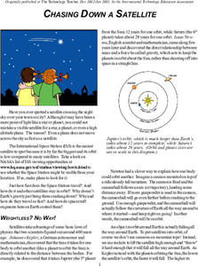
Chasing Down a Satellite
Calculate the speed of the International Space Station. By reading the article, pupils learn about the concept of orbits. Scholars work through a formula to determine how fast the International Space Station is traveling to stay in...
NASA
Speaking in Phases
Hear from deep space. Pupils learn how satellites transfer information back to Earth. They learn about three different ways to modulate radio waves and how a satellite sends information with only 0s and 1s. Using sound, class members...
NASA
The Saturn System Through the Eyes of Cassini
Get a close-up view of Saturn. Pupils read a NASA eBook filled with images of the Saturn system, including the rings and moons of Saturn along with images of the planet itself. Learners become familiar with the planet's system as they...
American Museum of Natural History
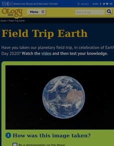
Field Trip Earth
Take a field trip around Earth by way of satellite images. Learners watch a video lesson that describes different images taken from orbiting satellites. They then test their visual skills in a 14-question online quiz.
International Technology Education Association
Team Up on the Weather
There's a little bit about every aspect of weather in this trivia game. The lesson resource provides 36 questions and answers pertaining to four different topics related to weather: effects, science, technology, and statistics. Groups...
Discovery Education
Satellite Telemetry
Satellites require rockets to launch, but it doesn't take a rocket scientist to understand them. Future engineers learn about how satellites send data to Earth and how to interpret satellite images. They see how radio waves play a role...
CK-12 Foundation
Satellites, Shuttles, and Space Stations: Satellites in Orbit
Blast off! How do satellites, space shuttles, and space stations escape Earth's gravity and achieve orbit? Young astronauts study rocket science (literally) with an interactive lesson. They discover the four main uses for satellites, how...
CK-12 Foundation
Clarke's Dream
How does satellite TV keep a steady stream when the earth and the satellite are constantly moving? Scholars use a simulator to adjust the radius of orbit of a satellite around the earth. They view graphs of acceleration and time period...
Space Awareness
Where on Earth Am I?
Almost every phone has GPS installed, but a large number of teens don't know how the technology works. An initial activity illustrates how GPS determines a location on Earth. Scholars then apply trilateration procedures to a...
Space Awareness
A View From Above
Analyzing and interpreting satellite data takes knowledge and patience. Through a detailed lab investigation, young scholars learn the process of analyzing this data. They use technology to create color images and maps from real...
NOAA
Satellite Communications
How do satellites communicate? What types of satellites orbit Earth? Discover and mimic the way satellites communicate between two points in a hands-on activity that has pupils using mirrors, flashlights, and marbles.
NOAA
Tracking a Drifter
Be shore to use this drifter resource. The third installment of a five-part series has learners using the NOAA's Adopt-a-Drifter website to track to movement of a drifter (buoy) in the ocean. Graphing the collected data on a map allows...
Teach Engineering
Weather Forecasting
According to the Farmers' Almanac, the weather will be nice today. Class members examine how weather forecasting plays a part in their lives with a resource that provides information on the history of forecasting, from using cloud...
NASA
Down to Earth
There are only 10 types of people in the world: those who understand binary and those who don't. The lesson includes four activities in which students learn binary, convert binary to images, understand CCD arrays, and interpret...
Virginia Department of Education
Planet Line-Ups
Should Pluto be considered a planet or a dwarf planet? Scholars research planets in our solar system to understand their similarities and differences. It also includes memory activities related to the order of the planets.
NASA
The Case of the Wacky Water Cycle
Join the tree house detectives in learning about the processes of the water cycle, water conservation, water treatment, and water as a limited resource.
Curated OER
Using Vegetation, Precipitation, and Surface Temperature to Study Climate Zones
Using NASA's Live Access Server, earth scientists compare the temperature, precipitation, and normalized difference vegetation index for four different locations. They use the data to identify the climate zone of each location using...
NASA
NASA Visualization Explorer
Read some of the most up-to-date information available from NASA's current Earth and space research! Along with showcased stories, you will find computer animations and satellite images that help you to view what humans cannot see with...


