Curated OER
Roaming Biomes
Students use the Internet to research the capabilities of earth-observation satellites. Using the information, they write a report on how remote-sensing technology is used to measure the impact of climate change. They identify the...
Curated OER
Cosmic Collisions and Risk Assessment
In groups, pupils create their own scientific impact experiments using ordinary materials, and observe and measure results with a variety of impacting bodies and velocities.
Curated OER
Tracking the Movement of Sunspots
Students examine how the development of new technology has increased our knowledge of how the sun works. Students study sunspots through the use of solar imaging from satellite instruments.
Curated OER
Keep in Touch: Communications and Satellites
Students investigate how satellites help people communicate with others far away and in remote areas. They discuss a scenario of someone travelling to an area with no mode of communication, observe a teacher demonstration, and create a...
Curated OER
Search for Ice and Snow
Students use satellite images to locate areas of ice and snow on the globe. They create a table showing the information they gathered. They present their information to the class.
Curated OER
Satellite Tracker
Learners use satellite tracking software to monitor different satellites. They predict and graph the motion of the space station. They create a 3-D display of its path and share it with the class.
Curated OER
Aruba Cloud Cover Measured by Satellite
Students analyze cloud cover over Aruba. They compose and submit written conclusions which include data, analysis, errors in data collection, and references.
Curated OER
The Relationship Between Science and Technology
Learners explore the problem that scientists face when attempting to manipulate a satellite's attitude control. They participate in a demonstration using a swivel chair and a bicyle wheel with handles and then discuss their observations.
Curated OER
Satellite Simulation
Students explore communication ovr long distances using satellites. The lesson uses a light beam to represent a radio signal being relayed from one place to another via a "mirror satellite."
Curated OER
WEATHER SATELLITE PREDICTION PROJECT
High schoolers compile weather satellite data from three satellites for one month, obtain weather reports and data from professionals, then create a document with predicted results.
Curated OER
Science Excursion: Cover Mapping Land
Students study remotely sensed images and topographic maps to classify land cover types in their watershed area. They take samples in the watershed area to interpret the images.
Curated OER
FILLING IN THE GAPS - Acquiring and Analyzing Satellite and Ground-Based Data
Students monitor rainfall, compute daily averages, and compare their methods of computation to those used by actual researchers using satellite observations.
Curated OER
From Pirates to Pilots to Spies
Sixth graders enjoy this introduction to the world of map projections, globes, aerial photographs, and satellite images. This lesson instructs students on the advantages and disadvantages of each earthly representation.
Curated OER
Science - Lesson 42 - Astronomy
Third graders demonstrate the position of the Earth, Moon, and Sun in a solar and lunar eclipse. They list uses for manmade satellites and write a description of how a satellite would be use.
Curated OER
The Use Of Satellites
Pupils use the Internet to do research. They organize information and make a presentation on a satellite to the class. They discuss the capability of the leading edge of technology for a given time.
Curated OER
Interpreting Satellite Images
Students identify differences between photography and satellite imagery space.
Curated OER
How Do Satellites Work?
Students model how satellites transmit data by using numbers not images.
Curated OER
The Adventure of Echo the Bat
Pupils compare different habitats based on satellite imagery. They identify land features in the satellite imagery.
Curated OER
Extreme Ultraviolet Explorer Satellite Dataflow Demonstration
Students participate in a hands-on demonstration of the communication between the EUVE satellite and a scientist on Earth.
Curated OER
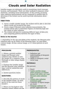
Clouds and Solar Radiation
Students examine how clouds affect incoming solar radiation. They compare and contrast satellite images and incoming solar radiation measurements as methods to provide information about clouds.
NASA
Nasa: Imagers: Teacher's Guide
NASA site provides a thematic unit on Remote Sensing targeted for students in grades 5-8. Within the unit, users will find lesson plans, reproducible worksheets, visuals, and links to useful resources.
NOAA
Noaa: Photo Library: National Severe Storms Laboratory
This National Severe Storms Laboratory Photo Album features amazing photographs of tornadoes, instruments, sky scenes, lightning, and hail.
Science Buddies
Science Buddies: Harbor Porpoise Movement
In this project you can use archived satellite tracking data to learn about activity patterns of harbor porpoises. How far do they travel? Can you find patterns in the routes individual animals take? Can you correlate their route with...
Science Buddies
Science Buddies: Catching Stardust
How do astronomers collect stardust? They design and build satellites that are launched into space to collect particles on specially designed panels. Satellites can be sent to orbit around an object of interest: a planet, moon, or comet....


