Curated OER
TE Lesson: Navigating at the Speed of Satellites
Middle schoolers study the basic concepts of the Global Positioning System and how it increases the accuracy of navigation. They examine trilateration and how the speed of light is used to calculate distances.
Curated OER
GPS Art
Learners design their own logo or picture and use a handheld GPS receiver to map it out. They write out a word or graphic on a field or playground, walk the path, and log GPS data. The results display their "art" on their GPS receiver...
Curated OER
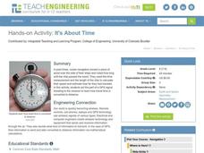
It's About Time
Young scholars investigate how Global Positioning Systems work and how and why GPS receivers make errors. They graph data points and apply estimation and prediction to real-life GPS situations, discuss time delay, and complete a worksheet.
Curated OER
Find It!
Learners analyze the basic concept of Global Positioning Systems using triangulation and measurement on a small scale in the classroom. They describe a satellite and how it helps in locating a person on Earth. They explain how...
Curated OER
Mapping My Community
Ninth graders are introduced to GPS technology. They complete fieldwork as they visit a specific area of their community to identify and map types of land use in the surveyed area. They use the collected data to create a digital map.
Library of Congress
Loc: Everyday Mysteries: What Is Gps?
Where are you and where are you going? Visit this site and learn the discovery and purpose of GPS, Global Position Systems.
CK-12 Foundation
Ck 12 Exploration Series: Simulations: Physics: Driverless Car
[Free Registration/Login Required] Learn about adding two vectors together by components in the context of a GPS-style city map. Adjust magnitude and angles in the two vectors to simulate the driverless car. Examples taking this concept...
Science Buddies
Science Buddies: Tracking Geomagnetic Storms in the Ionosphere
The Sun is the ultimate source of the energy that powers weather systems on Earth. Geomagnetic storms are sun-powered storms in the upper atmosphere, arising from energized particles that are periodically ejected by the Sun. Among other...
TryEngineering
Try Engineering: Find It With Gps!
Using a GPS handheld device and online resources, young scholars work in teams to explore the technology behind GPS, current GPS applications, and brainstorm new applications for future global use to solve society's issues.
University of Colorado
University of Colorado: Global Positioning System Overview
A good overview of the Global Positioning System. Describes what it is, how it works, and goes into detail about its different applications.
Other
Eduscapes: Hand Held Devices in the Classroom
What's the difference between Palms, Handsprings, and other hand held devices? This site presents the answer to this and many other questions about these technologies. If you want to know what they are and how you might use them, visit...
Other
Geoscience Australia: Map Reading Guide: How to Use Topographic Maps [Pdf]
A topographic map can be challenging to read. This guide explains how to decipher one and how to use a magnetic compass to orient yourself to the landscape. It also explains how to use GPS coordinates.
NOAA
Noaa: National Ocean Service Education: Global Positioning Tutorial
Illustrated tutorial explains the history and science of geodesy. Animations help students visualize how scientists measure and monitor the size and shape of the Earth and the location of points on its surface.
Other
Groundspeak Inc.: Geocaching the Official Global Gps Cache Hunt Site
Geocaching is a unique online treasure hunt game. Players 'hide' a cache anywhere on the globe and other players must follow the clues to locate the cache. Great for getting practice using GPS. There is plenty of guidance to playing, as...
TeachEngineering
Teach Engineering: Distorted Disturbances
Students pass around and distort messages written on index cards to learn how we use signals from GPS occultations to study the atmosphere. The cards represent information sent from GPS satellites being distorted as they pass through...
TeachEngineering
Teach Engineering: Where Are the Plastics Near Me? (Field Trip)
An adult-led field trip allows students to be organized into investigation teams that catalogue the incidence of plastic debris in different environments. These plastics are being investigated according to their type, age, location and...
TeachEngineering
Teach Engineering: Plot Your Course Navigation
In this unit, students learn the very basics of navigation, including the different kinds of navigation and their purpose. The concepts of relative and absolute location, latitude, longitude and cardinal directions are discussed, as well...
TeachEngineering
Teach Engineering: Mind Bending Gps Occultations
Students learn about the remote sensing radio occultation technique and how engineers use it with GPS satellites to monitor and study the Earth's atmospheric activity. Students may be familiar with some everyday uses of GPS, but not as...
TeachEngineering
Teach Engineering: What Is Gis?
Geographic information systems (GIS) are important technology that allows rapid study and use of spatial information. GIS have become increasingly prevalent in industry and the consumer/internet world in the last 20 years. Historically,...
TeachEngineering
Teach Engineering: Projections and Coordinates: Turning a 3 D Earth Into Flatlands
Projections and coordinates are key advancements in the geographic sciences that allow us to better understand the nature of the Earth and how to describe location. These innovations in describing the Earth are the basis for everything...
American Geosciences Institute
American Geosciences Institute: Earth Science Week: Earth Caching
In this lesson, students learn about EarthCaches and processes of the Earth. Using online resources, they find an EarthCache located near their school, visit it, and record the information required in its associated activity. They...
Massachusetts Institute of Technology
Mit: Open Course Ware: Courses: Modern Navigation
College-level planetary science course highlighting modern navigation. Course introduces the concepts and applications of navigation techniques using celestial bodies and satellite positioning systems (GPS). Course features include...
Massachusetts Institute of Technology
Mit: Open Course Ware: Exploring Black Holes: General Relativity and Astrophysics
College-level physics course focusing on black holes. Course topics include general relativity, astrophysics, and elements of cosmology . Course features include selected video lectures, lecture notes, assignments, and exams.
Massachusetts Institute of Technology
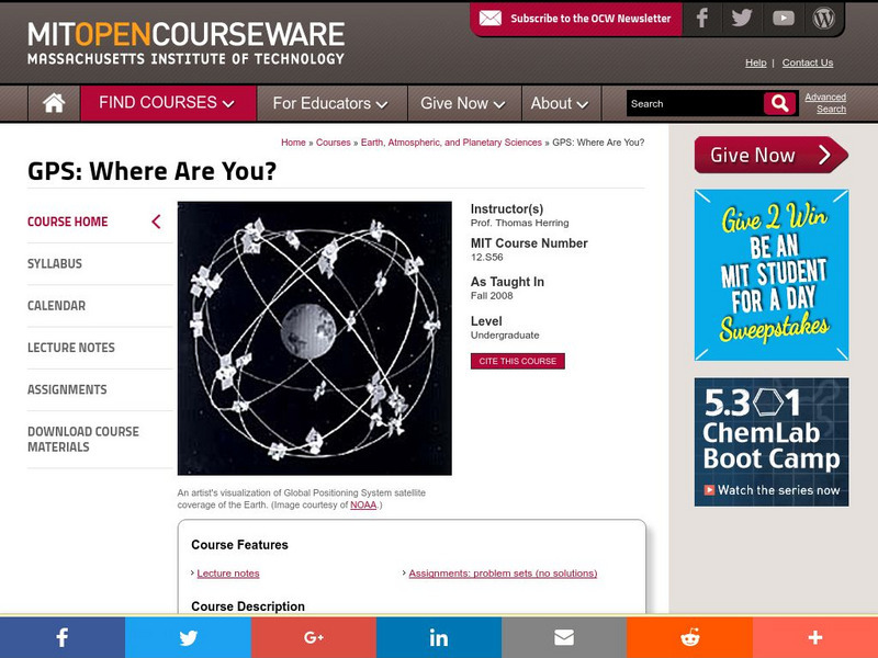
Mit: Open Course Ware: Gps: Where Are You?
A basic course from MIT on how a Global Positioning System(GPS)works, and the many new applications for using it. Includes lecture notes and assignments.


