Curated OER
Utah Worksheet
For this Utah worksheet, students examine a large color picture of the Utah state flag. After doing their own research, students fill in facts about the state: capital city, flower, tree, motto, date of statehood and what the state is...
Curated OER
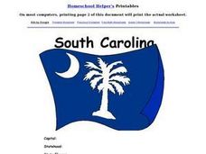
South Carolina Worksheet
In this South Carolina worksheet, students examine a large color picture of the South Carolina state flag. After doing their own research, students fill in facts about the state: capital city, flower, tree, motto, date of statehood and...
Curated OER
New Jersey Worksheet
In this New Jersey learning exercise, students examine a color picture of the state flag. After doing their own research students fill in 10 blanks with information about New Jersey including the capital city, motto, bird, flower, and...
Curated OER
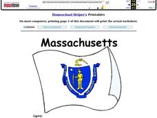
Massachusetts
For this Massachusetts worksheet, students respond to 7 different questions related to the state of Massachusetts. They identify and name the capital of Massachusetts and the state bird and flower. Then, students name the state motto and...
Curated OER
Missouri
In this Missouri state worksheet, students respond to 7 different questions related to the state of Missouri. First, they identify and name the capital of Missouri and when it became a state of the US. Then, students identify and name...
Curated OER
Pennsylvania State Map
In this geography of Pennsylvania worksheet, students color and label a map of the state. Students also study the location of Pennsylvania on a grey background map of the entire 50 states.
Curated OER
Tennessee State Map
In this Tennessee state geography worksheet, learners color and label major cities and physical features on the map. Students also study a second map of the U.S. that shows the location of the state of Tennessee.
Curated OER
Washington State Map
In this Washington map learning exercise, students color and label the major cities and important physical features on the map. Students also study a second map that shows the location of Washington in the United States.
Curated OER
Virginia State Map
In this geography of Virginia worksheet, students color the map and label major cities and physical features. Students also study a second map showing the location of the state of Virginia in the United States.
Curated OER
California State Map
In this geography of California worksheet, students color the map and label major cities and physical features. Students also study a second map showing the location of the state of California in the United States.
Curated OER
Georgia State Map
In this geography of Georgia worksheet, students color the map and label major cities and physical features. Students also study a second map showing the location of the state of Georgia in the United States.
Curated OER
Florida State Map
In this geography of Florida worksheet, students color the map and label major cities and physical features. Students also study a second map showing the location of the state of Florida in the United States.
Curated OER
Illinois State Map
For this Illinois geography worksheet, students color and label a map of Illinois. Students study the location of the capital and where Illinois is situated in the United States. There is a black line map of the state with a grey US map...
Curated OER
Kansas State Map
In this map of Kansas worksheet, learners color and label major cities and physical features of this state. Students also study the location of Kansas in relation to the other states in the U.S. by studying the background map.
Curated OER
Indiana State Map
In this Indiana state map worksheet, students color and label the important cities and physical features on this outline map. Students also learn of Indiana's location in the U.S. by studying the background map.
Curated OER
Idaho State Map
For this Idaho state map worksheet, students color and label important physical features and cities. Students also study the background map to learn the location of Idaho as related to the rest of the U.S.
Curated OER
Hawaii State Map
In this Hawaii state map learning exercise, students color and label important locations and physical features on the map of the 8 islands of Hawaii.
Curated OER
Iowa State Map
In this Iowa state map instructional activity, students color and label the important cities and physical features. Students also study the background map that shows the location of Iowa in the United States.
Curated OER
Geography Crossword Puzzle
In this history worksheet, students answer nine questions concerning a variety of states and compass directions including north, south, east and west. Students complete a crossword puzzle.
Curated OER
States And Capitals
In this states and capitals worksheet, students research, analyze and memorize the fifty United States states and their capitals. Students complete a word scramble puzzle containing the fifty states and capitals.
Curated OER
History 8 Ch.19b Word Search
For this US History worksheet, students locate and identify various vocabulary terms related to a particular period in US History. There are 15 words/phrases located in the puzzle.
Curated OER
American States And Their Nicknames
In this social studies activity, learners match the American states with their nicknames. There are no examples and no hints given on the page.
Curated OER
Statehood Of _____
In this social studies worksheet, students record information about the state they live in. Students include the capital, date of admittance to the Union, people responsible for statehood and the name of the first governor.
Curated OER
State Emblems and Symbols
In this State Emblems and Symbols worksheet, learners select a State to research. Students fill in a chart about the state which includes 10 different facts, such as state bird, flower, and song.


