Curated OER
Mapmaking: Colorado Quarter Reverse
Learners examine the Colorado quarter reverse and draw symbols of the state's land and water features on maps. Using copies of the Colorado reverse, they color the coin design. They list reasons for the state's motto of "Colorful Colorado"
Curated OER
Freedom and Dignity Project
Students use maps to "recreate" important battles of the Revolutionary war. Students research these battles, focusing on how topography played a role in the victory or defeat of the American army. A field trip may also be used as an...
Curated OER
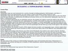
Building a Topographic Model
Students explore Mount Shasta and various locations on Mars to examine ways geographical data can be represented. They study topographic maps and translating data from 2-Dimensions to 3-Dimensions.
Curated OER
River Study
Students study physical features of a local stream. They study how to identify water features on topographic maps.
Curated OER
Running Water/Rivers-Life Cycle
Students explore the parts of a river system and use topographical maps to determine the stage of the river.
Curated OER
United States Geography and Topography
Fifth graders recognize the major regions of the US while reading a map. Students study the physical features of the US. Student research and report on states and their capitols.
Curated OER
Finding Longitude and Latitude on Pennsylvania Maps
Students draw the lines of longitude and latitude on a map. Students look at a topographical maps to see how topography relates to land use.
Curated OER
Science Excursion: Cover Mapping Land
Students study remotely sensed images and topographic maps to classify land cover types in their watershed area. They take samples in the watershed area to interpret the images.
Curated OER
The Silk Roads Big Map
Students generate oversized rendition of the Silk Roads from Europe to East Asia, apply elements such as political and topographic features, the Silk Roads, products of the regions, and the routes of key travelers.
Curated OER
African Safari
Sixth graders gain an appreciation for the different cultures that inhabit the Earth by focusing on the people of Africa
Country Studies US
Country Studies: Afghanistan: Mountains
An interesting discussion of the mountain ranges in Afghanistan. There is information about the meanings of the names, the various roads and passes through the mountains, and some mention of vegetation in the mountains. From Library of...
Science Buddies
Science Buddies: Career Profile: Geographer
Learn about the career of a geographer, a social scientist that uses knowledge of climate, culture, and topography to address a whole host of problems the world faces. Find out the educational requirements and what the job entails in...
Science Education Resource Center at Carleton College
Serc: Discover Our Earth
Study earthquakes, volcanoes, topography, plate tectonics, and sea level change using graphs, maps, and movies. Engage in earth science knowledge discovery, critically evaluate the data and results, and reach conclusions about the earth...
Science Education Resource Center at Carleton College
Serc: Investigate Topography Caused by Glacial Lake Agassiz & Glacial Riv Warren
In this field investigation students will travel to Bonanza Educational center located on Big Stone Lake. The students will hike up the prairie where they will sit and sketch the topography of the land. The students will then travel down...
Other
Photo.net: Costa Rica: The Land
A geographic and topographical exploration of Costa Rica which covers all of the regions of the country.
US Geological Survey
United States Geological Survey: Topographic Maps
"Note: The information on this page is being retained for technical and historical reference only. The site is not under active maintenance and may include expired information and outdated links." This site gives an overview of the...
Georgia Department of Education
Ga Virtual Learning: Weather and Climate
In this amazingly comprehensive interactive tutorial you will learn how factors such as ocean currents, topography, and air currents affect weather patterns. You will also learn the similarities and differences between weather and climate.
TeachEngineering
Teach Engineering: Can You Catch the Water?
Students construct a three-dimensional model of a water catchment basin using everyday objects to create hills, mountains, valleys and water sources. They experiment to see where rain travels and collects, and survey water pathways to...
Texas A&M University
Ocean World: Bringing the Ocean to the Classroom
Online resource for students and teachers to see information on icebergs, fisheries, coral reefs, waves, currents and more. Provides teachers with learning activities. Has its own ask-an-expert site (Ask Dr. Bob), and provides real-time...
US Geological Survey
U.s. Geological Survey
The U.S. Geological Survey reports on the latest news affecting the earth today, as well as providing a wealth of data, reports, and information.
Other
Ordnance Survey: Map Zone: Relief and Contour Lines
Discover how to read and show height on maps using relief and contour lines.
PBS
Pbs Learning Media: Visualizing Topography
Explore the topography of a hill, a valley, and a cliff in this interactive activity featuring visualizations of three-dimensional topography in two dimensions. Adapted from Stephen Reynolds' "Visualizing Topography."
Science Education Resource Center at Carleton College
Serc: The Science of Puddles
Students will look at their schoolyard and determine where a puddle will form after a heavy rain. They will map the school yard and draw chalk lines to demonstrate their predictions. After a rain children will check their predictions and...
Science Education Resource Center at Carleton College
Serc: Investigating How Terrain and Watersheds Are Connected
In this lab, students will investigate the topography of a watershed and determine how it may affect physical stream parameters focusing on how terrain and water systems are connected.


