Curated OER
US Geography: The Midwest
Students investigate the geography and agricultural products of the Midwestern United States. In this US geography lesson, students watch and discuss a video that depicts the Midwest of the US as the breadbasket of the country. They make...
Curated OER
Arkansas History Lesson Plan
Students discover the history of their state by working in a group. In this U.S. history activity, students investigate the state of Arkansas by reading their textbook and participating in art activities. Students discover the...
Curated OER
The Fifty States
Students become familiar with the states. They study capitols, mottos, nicknames, and other various details. They create group projects that be presented to the class.
Curated OER
50 States: New England States
Students discover where certain states are located and what the look like. They look for their information on a web site. Each student is assigned a state which they must research then present to the entire class.
Curated OER
Roundtable
Fifth graders apply the Five Themes of Geography as they relate to the U.S., the world, and specific places in United States history. They recognize and label geographical locations on a map of the United States.
Curated OER
The 50 States and its Holidays
Though the format of this ELL lesson plan is confusing (the standards listed are for plate tectonics, yet the objectives are for American geography and holidays), a teacher could glean some ideas from the main idea. Here, pupils complete...
Curated OER
Texas, Our Texas
Students explore U.S. geography by completing a coloring activity in class. For this Texas history lesson, students utilize the web to locate Texas on a map of the U.S. Students view a PowerPoint presentation which showcases the state...
Curated OER
Expanding the Mission: Historical Parks
Students explore U.S. geography by viewing a documentary in class. In this national parks lesson, students view video clips of individual national parks and locate them using Google Earth software. Students create a persuasive...
Curated OER
A Visit to Charm City
Learners explore U.S. geography by participating in a role-playing activity. In this Baltimore history lesson, students discuss the geography of Baltimore city and complete a worksheet which discusses the "charm" Baltimore is known for....
Curated OER
Agriculture Cares for the World
Students explore world geography by analyzing agriculture. In this dietary habits lesson, students discuss the role parents play in their children's diet and where the food comes from. Students write agricultural research paragraphs and...
Curated OER
Egg Hunt Lesson
Fourth graders explore religious holidays by participating in an egg hunt. In this Easter lesson, 4th graders review the different U.S. states and capitols before completing a geography egg hunt activity. Students read geographic clues...
Curated OER
Nevada, A to Z
Fourth graders explore U.S. Geography by reading a timeline. In this Nevada history lesson, 4th graders identify the geographic location of Nevada and discuss the history. Students read the book S is for Silver: A Nevada Alphabet and...
Curated OER
The United States and Canada Review Worksheet and Study Guide
In this geography skills activity, students respond to 34 short answer questions about the geographic features and climates found in the United States and Canada.
Curated OER
States in the USA Quiz
In this online interactive geography quiz worksheet, students respond to 50 identification questions about the states in the United States of America. Students have 4 minutes to complete the quiz.
Curated OER
Living Swamps, Bayous and Forests
Third graders explore interesting environments by exploring Louisiana. In this wetland lesson, 3rd graders utilize the web to research the State of Louisiana, the bayous in the area, and the Gulf of Mexico. Students write a journal entry...
Curated OER
Plotting Slave Population Density in Connecticut in the 1700's
Tenth graders explore slavery in the U.S. by researching the web. In this U.S. history lesson, 10th graders identify the geography of Connecticut and the overall involvement the state had in the slavery process. Students view data of the...
Curated OER
Know Your Area
Students investigate transit by analyzing their school surroundings. For this local geography lesson, students identify their school in relation to the rest of their state, country and globe. Students discuss their personal travel habits...
Curated OER
Identifying Border States of the U.S.
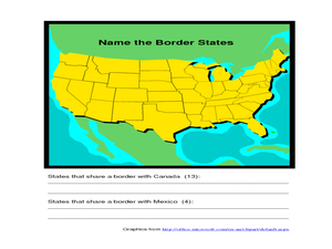
In this identifying border states of the U.S. worksheet, 3rd graders visually identify then write the names of the states that border Canada and Mexico; page 1 is a lesson, page 2 is the worksheet.
Curated OER
Las Vegas: We Are Just Like You
Students practice making multimedia documentary films by investigating cities of America. In this U.S. geography lesson plan, students examine Las Vegas and compare the state of Nevada to 15 other states and discuss their main...
Curated OER
Florida: U.S. Geography for Kids
In this Florida geography worksheet, students locate and label the important features of Florida and create icons for the economy and culture of Florida.
Curated OER
My Summer Vacation
Students study the United States geography using Google Earth. In this U.S. geography lesson, students create travel journals about five U.S. geographical locations. Students research the human and physical characteristics for each region.
Curated OER
U.S. Political Map
In this political map activity, students use the map of the United States and the 7 cities to measure the straight-line distance between the cities. Students add the total number of miles traveled and write their answers in the spaces.
Curated OER
Washington, D.C. Map
Here is an outline map of Washington, DC. Some of the points of interest in the city are labeled, as are Maryland, Virginia and Arlington. There are plenty of important monuments and locations not identified, making for a good project.
Curated OER
American States and Their Capitals
In this United States capitals worksheet, students match the 15 states on the left side of the sheet to their respective capitals on the right side of the sheet.


