Curated OER
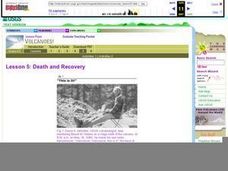
Death and Recovery
Mount St. Helens erupted on May 18, 1980, devastating plant and animal life for miles around. Two activities are included in this lesson plan. In one, learners evaluate tree rings to determine the age of a tree and the year of a volcano....
Curated OER
Volcanoes: Windows Into The Earth
Students investigate the concepts related to volcanoes and focus upon Mt. St. Helens. They define the difference between an active and dormant volcano. They conduct research using a variety of resources. The information is used in order...
Curated OER
Volcanoes!: The Mountain Blows its Top
Young scholars observe two demonstrations to conclude why bulge developed on the north flank of Mount St. Helens and conclude that when the "cap" was removed the pressure inside the volcano was suddenly released causing the violent...
Curated OER
Volcanoes!: Forecasting the Path of Mudflows
Young scholars construct a mockup of a volcano by crumbling up newspapers and piling them into the shape of a volcano. They place a tarp over the newspapers making sure the tarp is large enough to simulate a flat area at the volcano's...
Curated OER
Volcanoes and People
Students discover that volcanic eruptions are geologic events that take place within the upper part and on the surface of the Earth's lithosphere. They explain how volcanoes are related to the Earth's lithosphere. They focus on the May...
Curated OER
Volcanoes!: The Dangers of Snow and Ice
Students observe a demonstration of how melting snow and ice can contribute to mudflows. They then observea list of continents with the number of snow and ice covered mountains on each continent and discuss. They then label a group of...
Curated OER
Volcanoes!: Eyewitness Accounts
Students review previous lessons about volcanoes and name the phenomena they think the eyewitnesses of the Mount St. Helens witnessed. They play the roles of reporter, eyewitness and scientists who are serving on a committee...
Curated OER
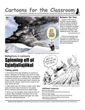
Cartoons for the Classroom: Spinning off of Eyjafjallajökull
The name itself may have your scholars' heads spinning: Eyjafjallajökull. Its recent volcanic eruption spurred many political cartoons on unrelated topics- using an analysis handout scholars examine the use of metaphor in 2 cartoons...
Curated OER
Lesson 4: Fire, Rock, and Water
You can demonstrate the destructive force of volcanic mudflows to your early earth scientists using this lesson plan. Messy, but memorable, the two demonstrations require some preparation. Use one or both! Included is a link to activity...
Curated OER
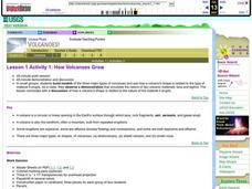
How Volcanoes Grow
Students create models of the three major types of volcanoes and determine how a volcano's shape is related to the type of material erupted. They then observe a demonstration that simulates the nature of two volcanic materials: lava and...
Curated OER
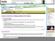
Lesson 2 Activity 2: Mapping Mount St. Helens
Students use topographic map skills to interpret impact of the May 18, 1980 eruption of Mount St. Helens on the volcano's topography, and draw profile views of Mount St. Helens before and after the May 18, 1980, eruption.
Curated OER
How Volcanoes Grow
Students build models of the three major types of volcanoes and see how a volcano's shape is related to the type of material it erupts. As a class, they observe a demonstration that simulates the nature of two volcanic materials: lava...
Curated OER
Gelatin Volcanoes
Students investigate magma flow using gelatin volcano models. In this earth science lesson, students sketch the magma bodies as observed from the top of their model. They explain why magma moves that way.
Curated OER
Volcanoes
What a wonderful resource! This presentation describes key vocabulary and information relating to volcanoes. The visuals are inviting and the descriptions useful. It provides everything a teacher needs to introduce or review this topic...
Curated OER
Forces of Nature: Ring of Fire
Third graders will research the Ring of Fire and be able to share their findings with their partner. They will also demonstrate volcanic eruptions using a baking soda and vinegar volcano model. Then they will discover how continental...
Curated OER
Earthquakes and Volcanoes
Nice pictures, maps and informative diagrams are incorporated into this PowerPoint about earthquake types and the types of waves carrying energy produced. There are a number of pages explaining scientific terminology and diagrams to...
Curated OER
Volcanoes-Viscosity Demonstration
Learners engage in a lesson which demonstrates that volcanism is the process whereby materials formed inside the Earth come out onto the surface. They participate in a simple, yet effective, activity which demonstrates how volcanoes...
Curated OER
Survival Experts
Students take on the role of survival experts as they research and produce brochures or guides to educate others about what to do in the event of a natural disaster.
Curated OER
What Happened?
Learners read legends about volcanoes. They develop their own legend and shares them with the class. They practice their writing skills as well.
Curated OER
Where Am I?
Young scholars identify volcano locations by latitude and longitude. They analyze a world map, and complete a "Volcano Event Locations Chart."
Curated OER
Geographic Landforms
Each slide is a simple notebook page with one landform in blue and its definition in red. There are 26 vocabulary terms in all, some you may want to use, and others easily hidden. It is recommended that you add photos or other graphic...
Curated OER
Volcano Lore and Legend
Students examine the effect of volcanoes on the environment. Using the internet, they research the role of the volcano in mythology. Individually, they use everyday materials to create their own model of a volcano and present it to the...
Curated OER
Magnetic Volcanoes
Students research on world maps active volcanoes, those that have erupted recently as well as the dormant ones. They assess the conditions on Earth and how volcanoes erupt and then create an erupting volcano with magnets and a cookie...
Curated OER
Let Me Tell You About...
Young scholars comprehend the differences between flat maps and relief or topographical maps. They recognize how forces such as earthquakes, volcanoes, water, and wind-as well as human actions--have altered the Earth's surface. Students...


