Curated OER
Teaching about Rain Storms, Land Use, and Lake Turbidity
Students investigate the impacts of major rainfall and subsequent runoff on turbidity in lakes. They, in groups, develop a presentation of their research and/or write a paper summarizing their investigation.
Curated OER
What is a Watershed, Anyway?
Students constrct a watershed and write about their observations. Students use maps to locate their area in relation to the watershed and inquire about what is applied to the ground above.
Curated OER
Rain Drops Keep Falin' On My Drainage Basin
Students compile information about rainfall, lake elevations and releases of water from Tuttle Creek reservoir into maps, graphs and charts.
Curated OER
Exploring Our Watershed System
Students examine how watershed systems are made up, and visit the Susquehanna watershed system and map out the system. They evaluate the order of watercourses in their area.
Curated OER
Drink It Up???
Students research and record facts about well, lake, and tap water. They increase their computer skills for research, creating a spreadsheet, and word processing.
Curated OER
Land Use and Nitrogen
Students consider the effects of development on water quality. They test nitrogen levels in waters before and after development, investigate wastewater treatment options and research best management practices to reduce nitrogen loads.
Curated OER
Junior Engineering Surface Water
Students experience the effects of pollution and erosion on a model of a watershed and explore ways to change the outcome.
Curated OER
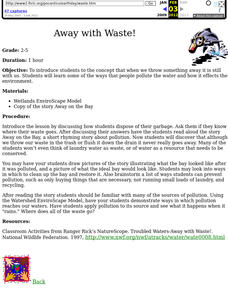
Away with Waste!
Students read and analyze the story Away on the Bay as a springboard to discuss water pollution. They may look into ways in which water can be cleaned and a watershed restored.
Curated OER
A Living Watershed
Students, through this series of lessons, use local resources, speakers, print and video materials, as well as standard text materials to study the ecosystem of the local watershed.
Curated OER
Waterbasins and Watersheds
Students define water basins and watersheds, then delineate the boundaries of their local water basin/shed using maps.
Science Education Resource Center at Carleton College
Serc: Exploring the Environment: Water Quality
A project based scenario where students research problems and come up with answers to a local water board's concerns over water quality in the watershed. Background information is accessible for the following topics: importance of water,...
Geographypods
Geographypods: Freshwater: Issues and Conflicts: Drainage Basins and Flooding
In this learning module, students learn how a watershed or drainage basin functions and the impact of human activities on them. Also covers groundwater, stream discharge, hydrographs, and the 2010 floods in Pakistan. Includes rich...
Other
Alberta Riparian Habitat Mgt Society: Riparian Areas: A User's Guide [Pdf]
The authors of this guide explain through pictures and clearly written text, what riparian areas are, why they are so important for an ecosystem's health, how to assess their health, and how to improve and preserve them.
US Geological Survey
Us Geological Survey: Watersheds
Learn all about watersheds in this text based article. What are they? Where are they found? What purpose do they serve?
US Geological Survey
Usgs: The Water Science School: Watersheds and Drainage Basins
Understand what watersheds are and the purpose of drainage basins. This is a resource designed to enrich classroom learning about the science of water.
Other
Montauk Historical Society: Montauk Point Lighthouse: Erosion Control
This website explains the problem that erosion has created for this particular lighthouse. There is a detailed explanation of what is causing the erosion and how to fix it.
National Geographic
National Geographic: Exploring Place in the Chesapeake Bay Watershed
In this activity, students use the National Geographic FieldScope to examine the Chesapeake Bay watershed and its tributaries, and learn how their location connects to it. They then develop a watershed profile for their location....
National Geographic
National Geographic: Mapping the World's Watersheds
In this lesson, students use a world map to locate and label major rivers and their watersheds. They then compare watershed shapes and look at typographical features that determine their shapes. A vocabulary list with definitions is...
National Geographic
National Geographic: Water Availability in the u.s.
In this lesson plan, students use National Geographic FieldScope to investigate patterns of water availability and precipitation in the United States.
Nature Conservancy
Nature Works Everywhere: How Natural Areas Filter Water
By studying nature's filters, students learn about the importance of water quality for human health and agriculture.[4 min, 6 sec] Includes lesson plan and student handouts.
Smithsonian Institution
Tween Tribune: Fish in Northwest Have New Hopes for Home
Read about efforts by scientists to develop new habitats for salmon and steelhead species of fish in the Pacific Northwest.
TeachEngineering
Teach Engineering: Can You Catch the Water?
Students construct a three-dimensional model of a water catchment basin using everyday objects to create hills, mountains, valleys and water sources. They experiment to see where rain travels and collects, and survey water pathways to...
TeachEngineering
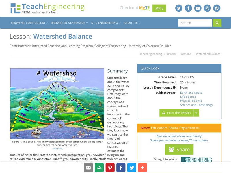
Teach Engineering: Watershed Balance
This lesson teaches the concept of a watershed and why it is important in the context of engineering hydrology. Learners learn about runoff and how we visualize runoff in the form of hydrographs.
US Environmental Protection Agency
Epa: Water Resources: Water Bodies
Learn about EPA's work to protect and manage water resources and what you can do to help.




![Alberta Riparian Habitat Mgt Society: Riparian Areas: A User's Guide [Pdf] Handout Alberta Riparian Habitat Mgt Society: Riparian Areas: A User's Guide [Pdf] Handout](https://d15y2dacu3jp90.cloudfront.net/images/attachment_defaults/resource/large/FPO-knovation.png)

