Curated OER
Mastering the Keyboard
Sixth graders view an animated program showing how the continents fit together millions of years ago. In groups, they compare and contrast the distribution of rocks and fossils based on how the continents fit together. After reading a...
Curated OER
Dancing Skeleton Puppets
Students experience, explore and study the Mexican holiday Day of the Dead. They assess the importance of having bones, identify the different bones that we have in our body and encounter how to make a skeleton and decorate it in...
Curated OER
Tear the Continents
Students tear paper into representative continent shapes and configure them with world oceans through relative location, direction and latitude and longitude starting points. They recognize the shape of the continents. Students recognize...
Curated OER
Continents on the Move
Students examine the tectonic plates of the Earth and how the landforms of Earth have changed position over time. In groups, they identify the evidence that the continents are still moving. To end the instructional activity, they...
Curated OER
Exploring the World's Geography
Learners discuss the seven continents of Earth and the diverse geography. After discussion, they create their own paper-mache globes which properly display all seven continents, the equator, and the prime meridian. They conduct research...
Curated OER
Me on the Map Lesson 2
Students analyze and interpret maps, globes and geographic information systems to define and identify cities, counties, states, countries and continents to create a booklet called me on the map. They also determine and calculate the...
Curated OER
Rain Forest Adventures
Students identify and describe where tropical rain forests are located and examine the geographical correlation between rainfall and rain forest. They brainstorm what they think they know about tropical rain forests - where they're...
Curated OER
World Continents
Students identify the continents of the world. In groups, students create a three-dimensional clay representation of their assigned continent. Using KidPix software, they draw and color their continent. Students research their continent...
Curated OER
Modeling Earthquake Data
Students evalute evolutionary theories and processe of Geology. They examine evidence that the movement of continents has had signicicant global impact, major geological events. Students evaluate the forces which shape the lithosphere...
Curated OER
A Geological Puzzle
Students compare and contrast the various types of rocks on each continent. In groups, the calculate the rock ages and types to determine if the continents, in their opinion, were joined at one time. They develop two imaginary...
Curated OER
Putting the World in Perspective
Young scholars work in small groups to: make a mental map of the world by tearing paper shapes of the seven continents and locating them on a flat surface in their relative positions, compare their finished mental map to a reference...
Curated OER
Maps and Globes
First graders complete a unit on map skills and the globe. They label maps, create a styrofoam ball globe, create a map of their community, sing a continent song, and complete a map and globe assessment worksheet.
Curated OER
Identifying and locating the continents and oceans of the world.
Third graders physically construct a balloon replica of the world globe by coloring, correctly labeling, and cutting out the seven continent shapes from the worksheet, gluing them onto their correct locations on an inflated blue balloon....
Curated OER
Africa, A Look Through the Eyes of A Child
Second graders read literature about Africa, examine physical characteristics of the continent, explore animals native to Africa, and discuss distance between Africa and locations in the United States.
Curated OER
Exploring China
Second graders explore the geography, holidays, important teachers, and inventions from China in the nine lessons of this unit. The results of their inquiries are expressed through a variety of products, writings, and presentations.
Curated OER
2nd Grade - Act. 22: The World Game
Second graders play World Game to become more familiar with continents, oceans, countries and states.
Curated OER
Around the World in 5 Days
Learners explore continents, draw map, discuss cultures, use research to learn geography, and investigate cultures.
Curated OER
Rolling Around the Continents
Students practice throwing skills by rolling a ball at a target, and practice the location of the seven continents, the equator, and the northern and southern hemispheres.
Curated OER
Treasures of Egypt
Learners match pictures of Egyptian culture with their descriptions. They assemble a poster of resources about Egypt.
Curated OER
Continents and Oceans Quiz
Here is a simple quiz you can give your geographers. In it, they must list the world's seven continents and five oceans. They color the landforms green and oceans blue.
Curated OER
Aboriginal Dreamtime Symbols
Students create their own dreamtime symbols in the style of modern Aboriginal culture. They are told that aboriginal art is very important in native Australian culture. Students locate Australia on a world map. They find pictures of...
Curated OER
The Continent Game
Young scholars order the continents in terms of area, population and other geographic terms.
Curated OER
Frogs Frogs Frogs
Students view a disk on the continental movement and analyze the given data on fossils, rock types and climate zones. In this geology lesson students draw a diagram of the earths layers, take a quiz complete a PowerPoint presentation.
Curated OER
Global Connections Geography Review
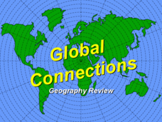
In this beginning world geography PowerPoint, students answer basic questions about continents and oceans, as well as land and water that surround or can be found in the United States. Correct responses earn a mark on the...


