Curated OER
Cartesian Baseball
Students are told what a coordinate system is and also that it provides a way of uniquely describing each point on a plane or in space. They are given a practice problem along with the equation. Students solve the following problem:...
Curated OER
Fossil Fuels and Its Effects On The World
Middle schoolers explore the effects of a declining fossil fuel system would have on the world. They read the line graph and other information to answer questions about fossil fuels. Students use mathematics to analyze graphical data...
Curated OER
SkyServer Scanvenger Hunt
Students discover the variety and beauty of objects in the sky and the ability of a research telescope to obtain quantitative information about these objects. They use the SkyServer Navigation Tool to identify objects and record...
Curated OER
Anamorphosis
Young scholars classify optical illusions according to their distinguishing characteristics. They create anamorphic art and use Mylar flexible mirrors to view and then they describe and analyze the optical illusion.
Curated OER
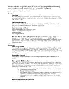
Geometry and Measurement
Learners view a right triangle displayed by the teacher. Students measure legs and the interior angles of the triangle. They look for a pattern or relationship between the legs and angles. Learners use pegboards and string to create more...
Curated OER
Creating Line Graphs
Students relate data to coordinate graphs and plot points on this graph. They use minimum wage data to construct the graph. Students decide appropriate time intervals for the graphs. They share graphs with their classmates.
Curated OER
"Vary" Bright Days
Students explore how the Earth's axial tilt and revolution around our sun lead to differences in day length through the year. In groups, they create and use a model of the earth on its axis to demonstrate the concepts.
Curated OER
Earth, Sun and Moon
Learners investigate that the sun is at the center of the solar system through role play. One student is the sun and one student is the Earth. The students then show how the Earth orbits around the sun. Learners view a flashlight and...
Curated OER
Lines, Rays, Line Segments, and Planes
Students are introduced to lines, rays, line segments and planes. They explore the differences between lines, rays, line segments and planes. Students pracice graphing lines, rays, line segments and planes.
Curated OER
Cartesian Coordinate System
Students explore the Cartesian coordinate plane and plot points on the graph. They interpret coordinates for a point from the graph and give the ratio of rise over run for slope.
Curated OER
Reading Graphs
Students plot functions on the Cartesian coordinate plane. They explore lines and parabolas. Students analyze graphs and answer questions about the information presented on the graph using an online program.
Curated OER
Physics: Vector Addition
Students drill and practice putting problems into vector form. They draw each problem before trying to solve them. Students draw arrows for any vector quantities to indicate magnitude and direction.
Curated OER
Grid it, Map it
Young scholars participate in designing a city layout using grids and coordinates. They work on a city space and create a grid on a life size layout on the gym floor.
Curated OER
"All Day Nightmare"
Students read an "All Day Nightmare" by R.L. Stine. They use the interactive book to choose the plot at the end of each chapter. They also complete an open-ended story.
Curated OER
Maps, Charts, and Graphs
Students define key geographic terms and track a hurricane on a map. They examine various types of maps and find locations on them,including rivers, cities and mountains.
Curated OER
Maps: Latitude and Longitude
Students visit interactive sites focusing on latitude and longitude. They participate in activities about the prime meridian, time zones, and equator. They view the coordinates of states and cities.
Curated OER
Plotting Grids Using Battleship
Young scholars coordinate grid points on X and Y axises to plot a physical location. The game of "Battleship is used to present first hand knowledge of this skill.
Curated OER
INTERPRETING MAGNETIC FIELD MAPS
Students interpret magnetic field maps, rotate the coordinates to obtain different views, change the coordinate representation, and produce alternate graphical representations.
Curated OER
MAP MAGNETIC FIELD OF A ROOM
Learners map the magnetic field of a room (classroom or room at home -- recommend kitchen) at two or more heights. They create a coordinate grid within the room and make a relatively accurate map of the room to super impose the...
Curated OER
Coordinate Graphing
Students practice basic coordinate graphing and plotting points on the coordinate axis. In this geometry instructional activity, students are introduced to ordered pairs, and the x and y axis.
Curated OER
Exploring Area/Perimeter Through Coordinate Geometry
Students explore area and perimeter through coordinate geometry using student literature, hands-on manipulatives, and the Internet.
Curated OER
Snowfall Statistics for Snowboarding
Young scholars use the Internet to collect the current daily snowfall amounts and also to find the price of a lift ticket for snowboarding at different ski resorts in the United States.
Curated OER
Algebra I: Graphing - Lesson Plan
Twelfth graders graph ordered pairs on a coordinate plane.


