PBS
Arthur Compass Rose
Keep your class headed in the right direction with this printable compass rose. Large and easy to read with a smiling picture of Arthur in the middle, this resource would make a fun addition to the desk of any primary grade...
Curated OER
Math with Maps and Globes
Students round out their math skills with these ‘round the world' ideas. In this math and geography lesson, students try out time zone sticks, a polar race, and tic-tac-globe to engage them in learning more about globes and the...
Curated OER
Through the Forest and Home Again: Maps Help Us Find Our Ways
Students read Little Red Riding Hood, focusing on her path home to Grandma's house. In this language arts and geography lesson, students perform a reader's theater, re-creating the walk home and possible routes that could have been...
Curated OER
Mapmaker, Make Me a Map!
Pupils are introduced to the state quarter program and examine the Colorado state quarter. They locate Colorado on a map and create a map with a key. They discuss the state motto and examine pictures of the state's geographical features.
Curated OER
Mapping Counties
Students practice reading a map. In this mapping instructional activity, students illustrate a map and compare and contrast the counties based on their population. Students also explore what a census is and read census data on a map. A...
Curated OER
United States Map - Lesson 4: States
Students use a United States Map to locate their state and use map symbols to determine the boundaries of a state. In this states lesson plan, students learn the definition of a state and identify their own on a map.
Curated OER
Learning to Read a Map
First graders identify the map and globe symbols: Cardinal Directions; Compass Rose; Mountains; Rivers; Lakes; Towns; Roads.
Curated OER
Kid Maps: Reading and Creating Maps with Human Characteristics
Students look at maps. In this map lesson, students listen to the book My Map Book by Sara Fanelli and they see the difference between human characteristics (buildings, etc.) and natural characteristics (rivers, etc.). They...
Curated OER
Map Projections
Young scholars view examples of various map projections using a website. Students record differences between the map projections. Young scholars discuss uses for the various map projections and the differences between the maps they...
Curated OER
Countries of the World
Students identify countries on a world map. In this map skills lesson, students define the word "country" and use post-it notes to locate several countries on a world map.
Curated OER
Geography of South America
Young explorers study South American geography. They study maps and create a physical map of the Andes themselves! They also research the geography, environment, and the culture of the Andes and present a report to the class.
Curated OER
United States Map- Continent, Country, State
Young scholars identify their continent, country, and state on a globe. In this geography lesson, students use a globe to identify the seven continents, the United States, and the state which they live in. Young scholars define key terms.
Curated OER
Bird's Eye View Map
Pupils explore seeing things from a bird's eye view. They listen to the book, "As the Crow Flies," view various objects from eye level views and standing on a chair, create a drawing of an object from both views, and read "Ben's Dream"...
Curated OER
The Water Nearby
Learners explore water located near where they live. In this map skills maritime lesson, students use Google Maps to find their school and the body of water closest to them. Learners research the body of water and answer questions about it.
Rainforest Alliance
Protecting the Critical Habitat of the Manatee and Loggerhead Turtle
Explore ocean habitats with a lesson that showcases the home of manatees and loggerhead turtles in Belize. Here, pupils compare and contrast the homes of ocean animals to those of humans, listen to an original short story about...
Curated OER
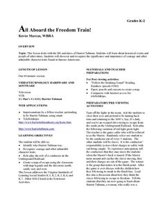
All Aboard the Freedom Train!
Young historians identify Harriet Tubman, her character traits, and role as a conductor on the Underground Railroad. They create an escape map using map legends and the Cardinal directions. This plan utilizes one of my favorite video...
Curated OER
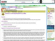
Learning Directions on a Map
Young scholars use north, south, east, and west to identify relative locations and provide directions.
Curated OER
Mapping Community Values
Students discuss the origin of various maps focusing on the values behind them. Students also explore how human needs and geography influence community settlement patterns. Students extend learning by creating and mapping their own ideal...
Curated OER
Bunyans Lesson Plan
Learners practice their map skills. In this early childhood lesson plan, students use a map of the United States and identify the location of several natural wonders included in the book The Bunyans by Audrey Wood.
Curated OER
Lesson Design Archaeology- World Map
Students practice locating positions on the world map. In this map skills instructional activity, students explore the world map and items such as the compass rose, Equator, mountains, cities, etc. The students practice locating...
Curated OER
Learning About the Map's Legend
Students draw a map of a room in their house and place a legend on it. They explain the legend orally.
Curated OER
United States Map- Land Elevation
Students explore a physical map. In this map skills lesson, students discuss examples of elevation and investigate the symbols used to identify elevation on a map. Students use the map to identify various land elevations.
Curated OER
Cardinal Directions
First graders study cardinal directions on maps. In this geography lesson, 1st graders determine and show where North, South, East, and West are on various maps.
Curated OER
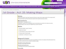
Making Maps
First graders create a map of their classroom that can be used to find a hidden treasure. They examine two- and three-dimensional objects and discover characteristics.
Other popular searches
- Mapping Skills First Grade
- Esl Lessons Mapping Skills
- Mapping Skills Activities
- Geography Mapping Skills
- Mapping Skills Test
- Early Mapping Skills
- Geographic Mapping Skills
- Mapping Skills and Halloween
- Mapping Skills of China
- Alberta and Mapping Skills
- Topographic Mapping Skills
- Social Studies Mapping Skills


