Curated OER
Learning Directions on a Map
Students use north, south, east, and west to identify relative locations and provide directions.
Curated OER
United States Map Lesson
Students explore basic map skills. For this United States geography lesson, students define "country" and "state," locate their state on a United States map, and identify and trace state boundaries defining their state and surrounding...
Curated OER
Song Mapping
Learners explore locations on the United States map. In this map skills activity, students recite the song This Land Is Your Land and locate various places listed in the song on the map.
Curated OER
Opening Doors to Social Studies with Children's Literature: The Desert Alphabet Book
Pupils explore the geography of the United States. In this social studies lesson, students identify the major deserts on a map of the United States.
Curated OER
My World
Young scholars study maps. In this social studies lesson, students draw a map of either their room at home or the route they take to school. Young scholars label items on their maps.
Curated OER
We're Gonna Have A Party
First graders explore map skills. They discuss the map vocabulary and use directions to find a location on a map. Students discuss and use the components of a map to answer a variety of questions. They use the map and directions to find...
Curated OER
Our World With MapsQ
Learners examine and compare different types of maps. In this map skill lesson, students look at neighborhood and national maps on the overhead projector while making comparisons of the symbols and locations. They use a T-chart to record...
Curated OER
Archaeology- State Map
Students study state maps. In this map skills lesson, students identify the states' location and how to use a legend. Students complete photocopies of the state map.
Curated OER
Simple Route Map
Students demonstrate how to locate features on a Landscape Picture Map. In this map skills lesson, students locate and circle places where they would go to mail a letter, return a library book, or play a baseball game.
Curated OER
Lesson Design Archaeology- USGS Maps
Learners research USGS maps and identify the major features. In this map skills lesson, students identify low and high elevations on a USGS map and practice finding latitude and longitude.
World Maps Online
Introduction to the World Map
Students identify the differences between maps and globes. In this map skills instructional activity, students are shown a globe and a map and recognize the differences. Students use post-it notes to locate several locations on the world...
Curated OER
A View from the Ground
Students look at a park from ground perspective. In this map skills lesson, students are introduced to a story about a girl at a park and make observations about the park based on a picture. This prepares students for the next lesson in...
Virginia Repertory Theatre
The Town Mouse and the Country Mouse
Accompany the story, Town Mouse Country Mouse by Jan Brett with an assortment of activities designed to reinforce concepts covering story structure, comprehension, grammar, and social studies. Here, scholars identify the difference...
PBS
Arthur Compass Rose
Keep your class headed in the right direction with this printable compass rose. Large and easy to read with a smiling picture of Arthur in the middle, this resource would make a fun addition to the desk of any primary grade student.
Curated OER
A Place of My Own: A Study of Maps
Young scholars investigate maps. They demonstrate their knowledge about maps and place landforms in the proper place as they create salt dough maps. They create a geography folder as well.
Curated OER
This is My Neighborhood
Students predict the things that they may see, smell, or hear in their neighborhood. They take part in a neighborhood walk, creating a rough map of their neighborhood as they go. Upon return to the classroom, students create a final map...
Curated OER
As the Kids Come and Go: Mapping a Classroom
Map the classroom with your kids to help them understand how maps work and how to read them. The lesson starts off with a story about animals living and moving around the globe, and then kids create maps of their classroom to show how...
Curated OER
Map Scale
Young scholars investigate the purpose of map scale and how it is used to measure the distance and the size of objects.
Curated OER
Simple Route Map
Learners identify the best route between various locations on a map. In this map skills lesson, students use a landscape picture map to find routes to and from certain places. Learners use map markers to highlight the routes.
Teaching Tolerance
Buddy Share
Here's a project that gives academics the chance to share their opinions on social justice with storytelling, creative writing, or art. Scholars choose what they want to create and are assigned buddies to support their efforts. To...
Teaching Tolerance
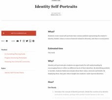
Identity Self-Portraits
What symbols represent you best? Individuals consider how they would draw peers using symbols about their identities with an interview and art activity. After conducting interviews and portraits, the art makes a great centerpiece for...
Teaching Tolerance
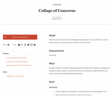
Collage of Concerns
A picture can speak louder than words. An interesting lesson introduces the themes of social justice and diversity to young learners by having them create artwork. Scholars create collages from a variety of sources to showcase what...
Curated OER
Introduction to the United States Map
Students identify a map of the United States. In this United States map lesson, students study a map of the United States and find various locations on the map. Students then locate and list the state that touches their state.
Curated OER
United States Map - Lesson 9
Students explore the concept of cardinal directions. In this geography lesson plan, students identify the compass rose on a large U. S. map and then discuss the cardinal directions.


