Radford University
Escape from the Zombie Apocalypse - Exploring Quadrilaterals through Google Maps and Google Earth
Prepare for the zombie apocalypse ... by studying quadrilaterals? Given a map of an imaginary town, scholars identify quadrilaterals created by streets. They then use Google Earth and Google Maps to find parallelograms, rectangles,...
Teach Engineering
Where Are the Plastics Near Me? (Mapping the Data)
The last activity in a nine-part series has teams create a Google Earth map using the data they collected during a field trip. Using the map, groups analyze the results and make adjustments to the map to reflect their analysis. A short...
Radford University
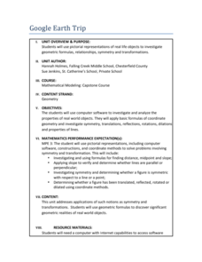
Google Earth Trip
Travel the world instantly—and learn about math along the way. Using pictures of famous places taken from Google Earth, scholars look for parallel and perpendicular lines based on slope and angle measurements. They also calculate...
PBS
Earth’s Ever-Changing Surface
The Grand Canyon formed between five and six million years ago, but is it still changing? Scholars explore 10 sites in the United States, including the Grand Canyon, to better understand the geoscience processes that formed these...
Curated OER
The Seven Continents Scavenger Hunt
Who doesn't enjoy an engaging scavenger hunt? Here, scholars listen to, and discuss, the informative text, Where is my Continent? by Robin Nelson. They then explore the seven continents and four major oceans using...
Alabama Department of Archives and History
From Alabama Farmer to Civil War Soldier
As part of a study of the Civil War, class members conduct a WebQuest to create a timeline of battles fought by the 10th Alabama Infantry Regimen. They then use Google Earth to pinpoint these battles of the Civil War on a map of Alabama.
Montana State University
Meet Mount Everest
Learning about one landform might seem boring to some, but using the resource provided practically guarantees scholar interest. The second in a sequential series of eight covering the topic of Mount Everest includes activities such as a...
Google
History of Math Lesson Plan
Learners honor mathematicians who have contributed important discoveries throughout history by researching and creating a report about a famous mathematician and their contributions to the history of mathematics. Pairs of learners...
Curated OER
Convergence with The Cay: Exploring Geographic Concepts Wrapped in a Story
Here's an awesome unit that uses The Cay as the anchor text. The 16-page packet is loaded with teaching ideas, activities, and suggested adjustments.
Google
Plate Tectonics Questions
Investigating plate tectonics, boundaries, and the earth's physical attributes is the focus of this short answer, tectonic plates worksheet.
Nature Works Everywhere
Sharks and Shorelines
Examine predator-prey marine relationships through an interactive lesson design. Learners begin by studying a specific shark species and then analyze real-time shark-tracking data. They also study threats to shark populations and...
Curated OER
Create Your Own Country Project
Young scholars demonstrate their knowledge of geography with this fun, collaborative social studies project. Working in small groups, students develop their very own countries, writing descriptions...
Other popular searches
- Google Earth Landforms
- Google Earth Scavenger Hunt
- Google Earth North Pole
- Google Earth Game
- Social Studies Google Earth
- Geography Google Earth
- Google Earth Lesson Plans
- Google Earth and Regions
- Google Earth Geology
- Google Earth Journalism
- Google Earth Glaciation
- Google Earth Ratings=3


