Curated OER
Comparing Cities and Their Common Functions
Ninth graders begin the lesson by watching a PowerPoint on the functions of cities. In groups, they use the internet to research various cultures throughout history and the cities that were formed at the time. They present their findings...
Curated OER
World Cities
Students examine the settlement patterns of world cities. In groups, they are given a region of the world and asked to create a city in the location. They are given a set of characteristics of the city and determine what would be found...
Curated OER
Identifying World Cities
Students describe the functions and characteristics of their local community. In groups, they develop a definition of a city and identify the characteristics that make up a city. Using the internet, they rank cities based on their...
California Academy of Science
Optimal and Sustainable: Renewable Energy Revamp
More than 100 cities around the world have shifted from fossil fuels to renewable energy sources. Scholars investigate a city wanting to make this switch, but needs help determining how to make the shift. Groups consider all options,...
US National Archives
WWII: Western Europe 1939-45 – Hamburg
Was bombing German cities an effective means to an end, or was it a war crime? Could it be both? Young historians ponder these questions with an activity that prompts them to use primary sources to summarize the debate surrounding RAF...
Time Warp Trio
The Seven Blunders of the World
Learners explore the cultures and civilizations of Mesopotamia. They take a look at the factors that shaped the region, and study the history of the Hanging Gardens of Babylon, and other ancient wonders of the world. The class is divided...
US National Archives
Eastern Europe 1939-45 — Stalingrad
Acts of civilian courage in Great Britain—and in one case, the island of Malta—often receive the George Cross, instituted by King George VI at the beginning of World War II. After the valiant defense of Stalingrad by its inhabitants,...
Curated OER
Applying the Pythagorean Theorem to find Distances Between Cities
Young scholars solve problems using the Pythagorean Theorem. In this geometry lesson, students identify the Pythagorean Triple and use it to solve real life problems.
Curated OER
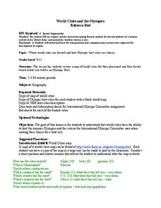
World Cities and the Olympics
High schoolers examine the various cities in which Olympics have been held. Using a map, they describe the reasons why those cities were chosen and choose their own city for the Olympics and state the reasons why. They examine...
Curated OER
Great Monuments of the World
Students explore the wonders of the world through inquiry. In this world monuments lesson, students investigate famous landmarks around the world as they conduct and apply research. Students create products that feature their findings...
Curated OER
Weather In The World
Students investigate the weather in different places in the world. In this algebra lesson, students use technology to gain an understanding of how to study integers. They add and subtract integers on a number line.
Curated OER
Location of Cities 201
Students work in pairs to locate the ancient cities on a world atlas using the longitude and latitude measurements. They examine the physical and human futures that explain their locations.
Cave Creek Unified School District
Crusades and Culture in the Middle Ages
The Crusades sounds like a glamorous time period in the Middle Ages full of glory—but was it? Scholars find and review the truth of the Crusades' influence on the world through the resource. The study guides, separated individually by...
New York City Department of Education
Egypt
This six-week unit encompasses all subjects with a focus study on world history and the development of ancient civilizations. As gifted and talented students dive into the interesting yet challenging topic of Egypt, they think critically...
Curated OER
Matrix Analysis of Networks
Explore the connection between a finite graph, a directed graph, and a matrix. Graph lines and identify the relationship of matrices in real-world scenarios. Then use this information to work with a partner to plan and design a town...
Curated OER
Growing up in Las Vegas; Memories of Childhood in the Neon City
High schoolers investigate the history of Las Vegas through conducting interviews. For this oral history lesson, students locate and speak with older residents of Las Vegas in order to gain a better understanding of the city. High...
Curated OER
HIV/AIDS in Our Spanish-Speaking Community and the World
Students study the HIV virus and how it has impacted the hispanic community. In this infectious disease lesson students discover how HIV/Aids is found all over the world, what misconceptions are out there and what kinds of treatments...
Curated OER
Where in the World? The Basics of Latitude and Longitude
Learners are introduced to the concepts of latitude and longitude. In groups, they identify the Earth's magnetic field and the disadvantages of using compasses for navigation. They identify the major lines of latitude and longitude on a...
Curated OER
City Bound
Fifth graders identify the reasons for people migrating to cities after the Civil War. Using population data, they discover why populations in cities rose while rural populations fell during 1860 to 1900. They discuss the impact a...
Curated OER
Sunrise, Sunset
What locations on Earth get the longest number of hours of daylight in the summer? Hint: It's not the equator! Use real-world sunrise and sunset data to develop trigonometric models that can be used to estimate the number of hours of...
NOAA
Climographs
In the second instructional activity of a five-part series, young climatologists use provided temperature and precipitation data to create climographs of three different cities. They then analyze these climographs to develop a general...
Radford University
Escape from the Zombie Apocalypse - Exploring Quadrilaterals through Google Maps and Google Earth
Prepare for the zombie apocalypse ... by studying quadrilaterals? Given a map of an imaginary town, scholars identify quadrilaterals created by streets. They then use Google Earth and Google Maps to find parallelograms, rectangles,...
Curated OER
Cutting Down Trees
Students research what kind of problems force a city or town to decide to remove trees. Students research what controversy has occurred in other cities or towns. Students interview those responsible for such decisions in your city or...
Curated OER
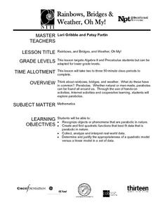
Rainbows, Bridges & Weather, Oh My!
Explore how real-world applications can be parabolic in nature and how to find quadratic functions that best fit data. A number of different examples of modeling parabolas are explored including a student scavenger hunt, the exploration...


