Curated OER
GIS and Agriculture
Students are introduced GIS systems and how they operate. Using a GIS system, they locate and map the various types of agricultural products grown in Oregon. They rank each county based on the amount of agricultural products produced and...
Curated OER
Mapping Lab and Lead Poisoning
Students are introduced to GIS and its uses. They make predictions before viewing the actual lead poisoning cases by location of Dade County. Pupils use actual Miami-Dade County spatial data to explore basic principals. Students
Curated OER
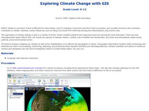
Exploring Climate Change with GIS
Students investigate climatological changes that are occurring to the Earth. In this climate change lesson, students access an assigned web site to view maps and lessons that show how climate change makes a difference to life on Earth.
Curated OER
Central America and the Caribbean
Use the library or Internet to find resources on a chosen topic. The class will comprehend the collected information, structure the information with texts and graphics for a presentation. Each presentation focuses on Hispanic culture and...
Curated OER
World Population
Students examine the world population data using MyWorld GIS software and compare and contrast the population characteristics of countries around the world. Students summarize their findings in a report.
Curated OER
Where in the United States Are We?
Students spend the lesson identifying the location of the fifty states and the capitals. Using a software program, they retrace te outline of each state numerous times. To end the lesson, they write a story about a state and city of...
Curated OER
The Hawaiian Islands
Fourth graders present information of people, places, and environments. They collect, organize, and analyze date to use with these representations.
Curated OER
Behold the Wonder of Creation
Fifth graders explore and become familiar with U.S. National Parks. They research several parks and compile the information they find into a spreadsheet. They plan and write a report/booklet about one of the U.S. National parks.
Curated OER
Science: Discovering Sharks
Students incorporate some basic information regarding ocean life and ecological conservation into their "earth watch" lives.
Curated OER
About the U.S.A.
Students research the United States and discover its different climate zones, geographical features, animal life, and various cultures. Students complete a research chart using books, encyclopedias and the internet and present their...
Curated OER
Welcome to New York State
Students choose one region of New York state, and create a travel brochure that includes information such as geographical features, tourist attractions, accesibility, economic features, and historical events that occured in that region.
Curated OER
Comparative Stream Quality
Students examine water quality on a nearby stream. They collect water samples and test for various factors, including any contamination from the treatment plant, and present their information in a Powerpoint presentation.
Curated OER
Career Connections
Students research the characteristics of specific occupations with personal career interests and aptitudes. In this career exploration lesson plan, students select three careers to explore and consider their own interests and aptitude....
Curated OER
Living in America (The Earliest Years)
Fifth graders work in groups to study a particular group of Native Americans. They use a study guide to guide their research and use the internet and text resources to gather information. Students post their research on a class web page.
Curated OER
Exploring the Various Regions of Boyle Heights: Continuity and Change
Student study the local landscape of Boyle Heights, California and draw a sketch of the area. Students use map making skills in this activity. Studient make a portfolio of information and photographs they accumulate over time on the area.
Curated OER
Geography And The Revolutionary War
Young scholars gain a deeper understanding of both geography and the Revolutionary War. They practice using on line research in examining historical events and using political, physical, and topographic maps.
Curated OER
Are Butterflies Free?
Students use remote sensing to study monarch butterfly migration and human interaction to save the Oyamel forest (Mexico) for butterfly and human habitation.
Curated OER
Living Swamps, Bayous and Forests
Third graders explore interesting environments by exploring Louisiana. In this wetland lesson, 3rd graders utilize the web to research the State of Louisiana, the bayous in the area, and the Gulf of Mexico. Students write a journal entry...
Curated OER
Sam Houston for President...Again
Fourth graders discover the political career of Sam Houston. In this Texas history lesson, 4th graders research primary resources and create a modern-day version of Sam Houston's political campaign of the 1840s.
Curated OER
Macbeth Madness
Learners participate in various social studies activities in correlation to William Shakespeare's Macbeth. In this Macbeth lesson, students study maps of Scotland, England, and Norway to identify locations mentioned in Macbeth. Learners...
Curated OER
The Fantastic Kindergarten Zoo
First graders create their own zoo to share with other classes and parents. Groups create displays for the animals. Have each group brainstorm how they create a display for their animal.
Curated OER
Introduction to Archaeology
Students view a PowerPoint presentation called, Archaeological Terms then discuss the job of an archaeologist and new vocabulary. They view the teacher made "artifact grid" and photograph the grid from different angles. They work in...
Curated OER
Our Barrio: Our Community/Adams & Normandie
Third graders examine various structures and people, including the region of Adams and Normandie, in Los Angeles. They conduct Internet research, and identify and locate features in the Adams/Normandie region during the past 60/70 years.


