Curated OER
Geography and Culture
Students explore African geography, study the overall continent of Africa and its individual countries, discuss demographics, and participate in research and class activities.
World Maps Online
Introduction to the World Map
Students identify the differences between maps and globes. In this map skills instructional activity, students are shown a globe and a map and recognize the differences. Students use post-it notes to locate several locations on the world...
Curated OER
Introduction to Africa
Students are introduced to Africa. The purpose of this lesson is to find out what students all ready know about the continent of Africa, and what students are interested in learning more about. They focus on the physical features of Africa.
Curated OER
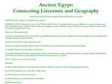
Ancient Egypt: Connecting Literature and Geography
Students brainstorm prior knowledge of Ancient Egypt, locate Egypt on map of Africa and on world map, watch King Tut film, discuss term biography, and map geographical information mentioned in stories and documentaries about Ancient Egypt.
Curated OER
World Map and Globe - Lesson 15 Mountains of the World
Students locate major world mountain ranges. In this geography lesson, students identify major mountain ranges on 6 on of the 7 continents on a large world physical map.
Curated OER
Geography of Africa
Students examine the geography of Africa and understand its diverse ethnicity. In this African geography lesson, students create a mental map of Africa. Students label the maps and list the languages of Africa. Students compare the...
Curated OER
Tears of Joy Theatre Presents Anansi the Spider
Accompany the African folktale, Anansi the Spider, with a collection of five lessons, each equipped with supplemental activities. Lessons offer multidisciplinary reinforcement in English language arts, social studies, science, and arts...
Institute for Geophysics
Understanding Maps of Earth
Here is your go-to student resource on primary geography concepts, including facts about the surface of the earth and its hemispheres, latitude and longitude, globes, types of maps, and identifying continents and oceans.
Curated OER
The Global Grid System-World Map Activity
Students demonstrate how to use the global grid system. In this map skills lesson, students use a world map to locate various locations. Students identify locations based on the global grid system. Students complete a worksheet as an...
Curated OER
Africa's Climatic Regions
Learners are introduced to the different climates and vegetation of Africa, and compare them to similar climatic regions found in the United States.
Los Angeles Unified School District
World History Medieval and Early Modern Times
A slew of graphic organizers, worksheets, and student activities are packaged here for your world history pupils. From comparing and contrasting the Qur'an and Sunnah, studying cultural diffusion across eastern nations, or examining the...
Curated OER
Globe Skills Lesson 4 The Colonial Period
Students practice their map skills. In this Colonial geography lesson, students complete an activity that requires them to locate English colonial locations using latitude and longitude coordinates.
Curated OER
Where Is Rome?
Third graders discover Ancient Rome through maps and worksheets. In this world history lesson, 3rd graders locate Rome on a world map and identify the scope of the Roman Empire. Students label an entire map of Italy after printing one...
Curated OER
A Moroccan Fairy Tale vs. European Folk/Fairy Tale
Second graders explore world geography by reading two different fairy tales. In this cultural storytelling lesson, 2nd graders read Snow White and the Seven Dwarves and the Moroccan story The Girl Who Lived with the Gazelles. Students...
Curated OER
Traveling for Water
Students explore global water contamination and water shortage problems. For this geography/ecology lesson, students gain information about the lack of safe drinking water in many countries. Students read, use websites, and complete...
Curated OER
Where is the Water?
Learners explore freshwater ecosystems. In this geography lesson, students brainstorm all the lakes and rivers they know then mark them on a map. Learners will then mark all the major freshwater resources on each of the seven continents,...
Curated OER
Identifying Continents and Oceans
Students locate and identify the four major oceans and the seven continents on a world map. They use an unlabeled world map and compass rose to describe relative locations of the continents and oceans.
K12 Reader
Add an Appositive 2
Do your kids need additional practice with appositives? A straightforward activity prompts them to rewrite a series of sentences, adding appositives to each one.
August House
Anansi Goes To Lunch - First Grade
Greed is the theme of this collection of multidisciplinary activities. As a class, read The West African folktale, Anansi Goes to Lunch by Bobby Norfolk, and take part in a grand discussion about it's plot and theme. Reinforce the theme...
Curated OER
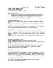
Swahili Alphabet Lesson
Third graders learn about other cultures. In this Swahili instructional activity, 3rd graders discuss if they know any other languages, read the book Jambo Means Hello, discuss why it is important to learn about other cultures, learn a...
Curated OER
Data Analysis and Measurement: Ahead, Above the Clouds
Students explore and discuss hurricanes, and examine how meteorologists, weather officers, and NASA researchers use measurement and data analysis to predict severe weather. They plot points on coordinate map, classify hurricanes...
Curated OER
You're In My Space!
Students explain how political, social, and economic boundaries can be changed through cooperation and conflict. Small groups are assigned a particular trouble area of the world. Each group studies a particular side of the conflict.
Curated OER
Seas, Gulfs and Bays
Students define gulf, bay, and sea. In this bodies of water mapping lesson, students locate seas, gulfs and bays and explain how they knew which body of water it was.
Curated OER
Database Scavenger Hunt
Students create a database to show information about events in history. In this database lesson, students create and analyze information on the slave trade. Students answer questions based on the information collected.
Other popular searches
- West Africa Geography
- South Africa Geography
- Physical Geography of Africa
- Sub Saharan Africa Geography
- Geography of Africa
- Africa Geography Lessons
- Northern Africa Geography
- Africa Geography Game
- Africa Geography Tourism
- Africa Geography Video
- North Africa Geography
- Africa Geography Ghana


