Student Handouts
Christopher Columbus Workbook
Youngsters gain ample reading comprehension practice while studying the history of Christopher Columbus with this great workbook! It includes word puzzles and comprehension checks of multiple assessment styles, including multiple choice,...
Curated OER
NATO Geography & Language
The class receives background information on NATO, an atlas, and a blank world map. They color the original 1949 countries in red, the 1952 additions in green, and the 1990 additions in blue. This exercise would be a good starting point...
Curated OER
Roman Empire: Physical Framework - Location, Borders, Dimensions
Students relate the classical world to the modern world. For this map skills lesson, students turn a blank map into a colorful complete map by following step-by-step directions. This lesson allows students to connect our current...
Curated OER
First World War Maps
Tenth graders examine the First World War. In this Global History lesson plan, 10th graders analyze various maps of this time. Students construct maps of each front of the war by answering various questions.
Curated OER
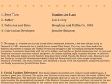
Number the Stars
Students read Number the Stars. In this social studies lesson, students read the story and use a map of western Europe and identify the countries involved in the war. Students locate the cities of Denmark that are discussed in the story.
Curated OER
Legislating neutrality
Eleventh graders explore the Merchants of death thesis. In this American History lesson plan, 11th graders explain the Neutrality Laws. Students assess the overall effectiveness of US neutrality policy.
Other popular searches
- European Cities Blank Maps
- Blank Europe Political Maps
- Blank Maps of Europerating=3
- Blank Maps of Europe Cold War
- Europe Blank City Map


