British Council
Weather 1
Match weather words with pictures in a weather vocabulary worksheet. Beginning readers look at pictures of various weather patterns and choose/write the word that describes the weather. They create a map and write about the weather...
Montana State University
What's the Weather?
How many jackets do you need to stay warm and climb Mount Everest? An informatie resource covers the topic of Mount Everest, the resource helps young scientists discover the difference between climate and weather. Activities include...
Curated OER
Creating a Thematic Map
Students create and analyze a weather-related data table and a thematic map based upon information provided.
Curated OER
Weather and Seasons
Use pictures and manipulatives to develop vocabulary with your beginning language learners. This plan can be used with foreign language learners (although you'll have to provide the vocabulary), English language learners, or a young...
Curated OER
Creating Station Models
Learners review weather conditions at various cities and create station models on a weather map.
Curated OER
"We're Back ... Eagles Soar!"
Students use information from Internet websites to create a map of where Bald Eagle habitats can be found after being familiarized with the map by the instructor.
Curated OER
Weather Predictions
Students record weather data and create a five day forecast. Students investigate the roles of meteorologists and identify symbols used on a weather map. After gathering weather data for a week, students will create a five day forecast...
Curated OER
Observing Weather
Students investigate the weather by reading children stories. For this weather observation lesson, students read Cloudy With a Chance of Meatballs and several other stories about weather before they create a KWL chart. Students utilize...
Curated OER
Mapping West Virginia
Fourth graders explore West Virginia. In this Unites States geography lesson, 4th graders discuss the type of land and the cities in West Virginia. Students create two overlays, with transparencies, that show the natural land and the...
Curated OER
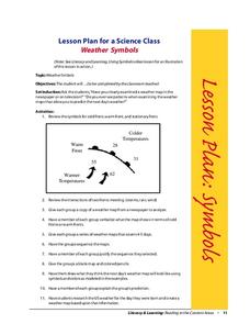
Weather Symbols
Students study weather symbols. In this weather symbols lesson, students review the symbols for cold, warm, and stationary fronts. Students use a weather map to study the weather symbols, complete a weather illustration and prediction...
Curated OER
Homes Around the World
Students investigate houses and homes from around the world and create a map collage. They compare how the homes are similar and different and why houses match the weather and geography.
Curated OER
Weather Forecasting Basics
Eighth graders analyze weather diagrams and weather maps. In this earth science instructional activity, 8th graders explain why it is important to know the weather. They complete a handout at the end of the instructional activity.
Curated OER
Sequencing / Story Events
Students read a story and use sentence strips to order story events. In this sequencing lesson, students learn new vocabulary words centered around the story Cloudy With a Chance of Meatballs, preview the story, make predictions about...
Curated OER
Waldseemuller's Map: World 1507
Seventh graders analyze various maps. In this Geography lesson, 7th graders create a large map as a whole class. Students write a letter to Mr. Waldseemuller.
Sunburst Visual Media
Clouds
Support science instruction with a combination of engaging activities and skills-based worksheets that focus on clouds. Learners take part in grand discussions, write an acrostic poem, complete graphic organizers, solve word puzzles, and...
Living Rainforest
Finding the Rainforests
From Brazil to Indonesia, young scientists investigate the geography and climate of the world's tropical rain forests with this collection of worksheets.
Curated OER
Data Analysis and Measurement: Ahead, Above the Clouds
Students explore and discuss hurricanes, and examine how meteorologists, weather officers, and NASA researchers use measurement and data analysis to predict severe weather. They plot points on coordinate map, classify hurricanes...
National Wildlife Federation
Get Your Techno On
Desert regions are hotter for multiple reasons; the lack of vegetation causes the sun's heat to go straight into the surface and the lack of moisture means none of the heat is being transferred into evaporation. This concept, and other...
Environmental Education in Wisconsin
Biome Travel Guide
In a perfect marriage of social studies and science, groups work together to research and create a travel guide presentation to share with the class. Not only do kids learn about the climate and geography of a biome, but also the...
Curated OER
Highs and Lows
Learners use email to chart weather patterns and then graph their findings. In this weather patterns lesson, students chart their weather for a week at the school. Learners then use email to find temperatures at a variety of locations....
Curated OER
The Sun Affects Earth
Third graders read, write, and listen to information about the sun and its effects on the Earth.as it relates to its axis, orbit, rotate, and revolution. In this solar system lesson, 3rd graders examine how the sun effects the Earth's...
Curated OER
Tracking the Storm
Young scholars discuss the different types of storms that can hit land. They locate specific coordinates on a plane grid. They discuss lonsgitude and latitude to plot the coordinates of a tropical storm. They practice finding...
Curated OER
Lesson Plan of a Thematic Project - Water
Sixth graders investigate the properties of water. In this life science instructional activity, 6th graders create a concept map of water. They share their work with the class.
Curated OER
J’adore Blackpool, Chuck*: YouTube Lures the French to the British Seaside Resort
Ninth graders explore the British seaside resort Blackpool. In this British Travel ESL lesson, 9th graders read an article and answer guided reading questions. Students create a short story about what a person did in Blackpool.


