DocsTeach
Analyzing a Map of the Louisiana Purchase
With the stroke of a pen, Thomas Jefferson roughly doubled the size of the United States. The Louisiana Purchase not only grew the new country, but also it gave rise to the legends surrounding westward expansion and accelerated the...
Curated OER
Globe Skills Lesson 4 The Colonial Period
Students practice their map skills. In this Colonial geography lesson, students complete an activity that requires them to locate English colonial locations using latitude and longitude coordinates.
Curated OER
Mapping My World
First graders make two maps. For this developing and reading maps lesson, 1st graders read Mapping Penny's World, discuss the parts of a map, create a map of their classroom, and create a list of directions of how to get to various...
Civil War Trust
Map the Civil War
Mapmaking was a very important element in successfully planning attacks on enemies during the Civil War. Guide pupils through the process of pacing to find the average length of their steps, measure the distance between one object to the...
Curated OER
An Early American Culture
Students identify the locations of the Hopewell culture. In this map skills lesson, students use a globe to mark several locations of the Hopewell culture.
Curated OER
Globe Skills Lesson 1 Some Early American Cultures
Young scholars apply their knowledge of geography. In this geography skills lesson, students read brief selections regarding early Americans. Young scholars respond to the questions included in the self-guided map skills lesson.
Curated OER
Plotting a Hurricane Using Latitude and Longitude
Learners define and use "absolute location," latitude, and longitude. They locate on a map or globe the Earth's poles, circles, tropics, and beginning points of measurements for latitude and longitude.
Student Handouts
Christopher Columbus Workbook
Youngsters gain ample reading comprehension practice while studying the history of Christopher Columbus with this great workbook! It includes word puzzles and comprehension checks of multiple assessment styles, including multiple choice,...
Smithsonian Institution
Borders and Community: Early 20th Century Chicago Neighborhoods and Ethnic Enclaves
Chicago is one city, four neighborhoods, and countless nationalities. The lesson explores the ethnic division of Chicago in the early twentieth century. Academics read primary sources, analyze maps, and tour an online exhibit to...
Curated OER
Those Who Have Come Before Me
Class members are transformed into explorers as they work in groups to locate hidden items and map their journey along the way. They then leave clues for other groups of students to follow, and ultimately discover how past explorations...
Curated OER
Drake's West Indian Voyage 1588-1589
Young scholars investigate several maps detailing Sir Francis Drake's voyages. In this geography lesson, students practice reading maps and locating the precise locations of where Sir Francis Drake visited. Young scholars create an...
Pace University
Urban Communities
Urban communities are the focus of a series of lessons created to meet specific needs using differentiated instruction. A pre-assessment designates scholars into three groups based on their ability level. Small groups take part in...
Curated OER
My First Biography: Christopher Columbus Storia Teaching Guide | Scholastic.com
Sail with Christopher Columbus on a biographical reading adventure. Young explorers learn about the life of Sir Columbus as they hone their comprehension skills through guiding questions, shared reading, and fluency practice. Included in...
Curated OER
Magellan
Students identify the route of Magellan's voyage. In this map skills lesson plan, students use a globe to identify various coordinates where Magellan traveled.
Curated OER
Cardinal Directions
Students explore cardinal directions. In this social studies instructional activity, students create maps of home and school using the cardinal directions.
Florida Center for Reading Research
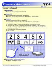
Phonemic Awareness: Phoneme Segmenting, Phoneme Counting Sort
Pre-readers use the provided cards to say and sort based on the number of phonemes in each word.
New York State Education Department
US History and Government Examination: June 2017
Ready for a test that uses primary sources as a tool to assess comprehension? Learners answer multiple choice, essay, and short answer questions to demonstrate their understanding of American history.
Curated OER
Early Explorers
Fifth graders investigate the routes taken by the early explorers. In this explorers lesson, 5th graders use interactive notebooks, discussion and maps to discover the routes taken. Students get into pairs and label maps, and create...
Annenberg Foundation
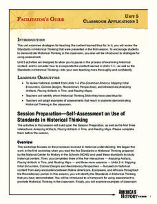
America's History in the Making: Classroom Applications One
Someone finds a time capsule 100 years from now, and it includes your family photo album. What would the photos tell that person about you and your place in history? Scholars investigate how artifacts tell stories. Using photos, maps,...
Florida Center for Reading Research
Phonological Awareness: Onset and Rime, Quick Pick
What does it begin with? In this engaging phonics game, small groups study onset and rime using picture cards. Groups take turns as one player draws three cards from an overturned pile, placing them face-up on the table. They silently...
Stanford University
King Philip's War
King Philip's War was the crescendo of a violent period between the Pequot and English colonists. Using documents from English settlers, including a contemporary report on the conflict, learners explore the little-known period. They then...
Curated OER
Stellar Navigation
Middle schoolers are introduced to the concept of stellar navigation. Inside a portable digital planetarium they identify various stars that were used as a navigational tool. They go through several activities in which they attempt to...
Curated OER
Maryland’s Chesapeake Bay Landscape Long Ago and Today
Combine a fantastic review of primary source analysis with a study of Captain John Smith's influence on the Chesapeake Bay region in the seventeenth century. Your young historians will use images, a primary source excerpt, and maps...
K12 Reader
Conflict Over North American Lands
Readers are introduced to some of the conflicts that arose over land and resources in the Americas in a two-part cross-curricular comprehension worksheet that asks kids to study the article and then to use information provided to respond...


