Arizona Cooperative Extension
Geocaching
Using GPS units, small groups participate in a scavenger hunt to find an object that you have hidden. They use coordinates for stopping points along a pre-planned path to get to the final cache. This is a terrific activity to include in...
Curated OER
Indiana Tornado Project
Young scholars become aware of the number of tornadoes that impact Indiana. They explore basic facts about tornadoes. Students use the GIS for research. They explore that natural phenomena in Indiana. Young scholars become familiar...
Curated OER
Me on the Map Lesson 1
Students use maps, globes, geographic information systems and other
sources of information to analyze the nature of places at a variety of scales. They identify on a map and determine the population
of the city, county, state, country...
Curated OER
Where Am I - Navigation and Satellites
Students explore geography by completing a navigation activity in class. In this satellite positioning lesson, students define terms such as orbit, satellite, GPS and triangulation. Students view diagrams of the Earth's orbit and...
Curated OER
Location, Location, Location: Civilization's Ultimate Advantage
Students discover how geographical advantages, locational and regional, ultimately led to western Eurasian societies' disproportionate accounting of world power and innovation. They utilize a workbook which can be downloaded within this...
Curated OER
Terrestrial Ecozones, Population Density and Species at Risk
Tenth graders navigate and use the online Atlas of Canada. They explain the cause and effect relationship between human settlement and the natural environment and wildlife species. They utilize a worksheet imbedded in this plan.
Curated OER
What do Maps Show?
Eighth graders practice the skill of reading maps. In this geography instructional activity, 8th graders participate in a classroom lecture on how to read a map.
Curated OER
Design a Latin American Restaurant
Learners investigate the culture of a Latin American country to design a new restaurant. In this Latin American lesson, students identify social classes, geographical locations, cultural practices, and monetary systems of a Latin...
Curated OER
Introducing Topographic Maps: Guiding Students from Concrete Models to Graphic Representations
Students interpret topographic maps and infer human activity as it is influenced by the landscape.
Curated OER
Cartogram of the Great Compromise
Students create cartograms of populations during 1790.
Curated OER
Understanding Latitude, Longitude, and Time Zones
Students take an imaginary world tour by locating cities with latitude and longitude. They plan an itinerary and calculate the time zones from which they would call home. Then they construct word problems involving travel across time zones.
Curated OER
Mapping With MapPoint
The class is engaged through a discussion of mapping. They determine what they believe makes a good map and what the essential elements of a map are. Students work independently to complete a worksheet on mapping. They follow clear...
Curated OER
Various Industries to Help Hawaii's Economy
Students identify various industries in Hawaii and where those products/services are exported to. They create a timeline which highlights important dates and events of those different industries. Finally, they identify on a map places...
Curated OER
Recycle, Reduce, Reuse and Save a Tree
Students examine how to save and protect trees. In this conservation lesson, students read books about the usefulness of trees, write ideas in their journals about how trees can be used, and make a book of ways to protect trees.
Curated OER
The Rise of the City States in Greece
Sixth graders examine Ancient Greece and its development of democracy. In this Greek History lesson, 6th graders explore the rise of city-states in Greece and its overall effect on the development of democracy. The class continues with...
Curated OER
No Magic Borders: Haleakala Style
Young scholars discuss borders and boundaries. They discuss pollution and the fact that boundaries cannot stop pollution and that pollution affects even protected wildlife and plants. They participate in an activity in which they must...
Curated OER
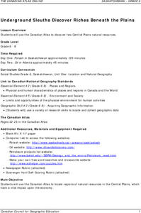
Underground Sleuths Discover Riches Beneath the Plains
Young scholars identify Alberta, Saskatchewan, and Manitoba on map, and use Canadian Atlas to locate regions of natural resources in Central Plains, which have vital impact upon the economy. Students then complete scavenger hunt worksheet.
Curated OER
Like Waves on the Shore: Settling Canada
Students examine and discuss past and current migration patterns in Canada. Using populatioon maps they complete a worksheet on migration waves.
Curated OER
Oregon Trail Landforms
Fourth graders explore landforms located along the Oregon Trail. They discuss the significance of the Oregon Trail, identify visual landforms, and explain the definition of each one. Students complete worksheets, color, and label maps.
Curated OER
The Mesoamerican Mystique
Students gain a better understanding of the cultural diversity in the northern region of Central America. They engage in a lesson which focuses on research, archaeology, historical videos, and travel highlights.
Curated OER
Cardinal Directions
Students explore cardinal directions. In this social studies lesson, students create maps of home and school using the cardinal directions.


