Curated OER
Matrix Analysis of Networks
Explore the connection between a finite graph, a directed graph, and a matrix. Graph lines and identify the relationship of matrices in real-world scenarios. Then use this information to work with a partner to plan and design a...
Curated OER
Calculating Impervious Cover in the City of Austin
Students use GIS to calculate park impervious cover in Austin, TX. They consider that there are different types of impervious cover from hard, packed dirt to cement paving. Students consider the limitations of data in several areas...
Curated OER
Hagerman GIS Questions
Students examine maps and pictures to identify specific geographic information. In addition, they explore data tables and GIS data to identify fossil beds and vegetation. Students explore the correlations between soil type, vegetation,...
Center for History Education
To What Extent Were Women's Contributions to World War II Industries Valued?
Women rose to the challenge when the nation's war effort called them—but were sent home when the GIs came back from World War II. Young historians consider whether the United States valued women's contributions during the war using a...
Arizona Cooperative Extension
Geocaching
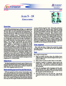
Using GPS units, small groups participate in a scavenger hunt to find an object that you have hidden. They use coordinates for stopping points along a pre-planned path to get to the final cache. This is a terrific activity to include in...
Prairie Public Broadcasting
Egyptian Pyramids Virtual Field Trip!
A virtual field trip takes enthusiastic travelers to the pyramids of Giza. Using Google, scholars explore the grounds of the ancient pyramids found in Egypt then complete three worksheets: a photo analysis page, a reflection sheet, and a...
Curated OER
Career Connections
Students use online self-assessment inventories to aid them in making career decisions. In this career decisions instructional activity, students visit the given website and identify their strengths and weaknesses. Students complete an...
Curated OER
Introducing Topographic Maps: Guiding Students from Concrete Models to Graphic Representations
Students interpret topographic maps and infer human activity as it is influenced by the landscape.
Curated OER
Treasure Hunters
Students design an on campus treasure hunt to find various architectural vocabulary words which they then create definitions for on the blog page on the Environmental Design website.
Curated OER
Cruisin' the Counties: Learning Counties and Major Roads in Arizona
Young scholars examine Arizona counties and use the themes of location and movement to develop an Arizona map.
Curated OER
Effect of Daylight Hours on Human Activity
Students determine the average hours of daily sunlight for each month of the year by constructing a bar graph. They develop a understanding of how the amount of daylight hours varies by month and how that affects both temperature and...
Curated OER
Underground Sleuths Discover Riches Beneath the Plains
Young scholars identify Alberta, Saskatchewan, and Manitoba on map, and use Canadian Atlas to locate regions of natural resources in Central Plains, which have vital impact upon the economy. Students then complete scavenger hunt worksheet.


