Curated OER
Weather Forecasting
Students discover how to read a current weather map. In this weather forecasting lesson, students view weather maps from three consecutive days and observe how quickly weather moves and changes. Students review key terms associated with...
Curated OER
What Do Maps Show?: Lesson 1 Introduction to Maps
Students brainstorm a list of the different types of maps they have seen or used. Using the activity sheet, they look through a social studies book to find all the maps and to determine what they are used for. Using a poster, they review...
Curated OER
Observing Weather
Students investigate the weather by reading children stories. For this weather observation lesson, students read Cloudy With a Chance of Meatballs and several other stories about weather before they create a KWL chart. Students utilize...
Curated OER
What Do Maps Show?
Students discover the uses for various types of maps. In this geography skills lesson, students discuss the type of maps that exist and what their individual features are. Students then practice using different types of maps.
Curated OER
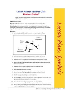
Weather Symbols
Students study weather symbols. In this weather symbols lesson, students review the symbols for cold, warm, and stationary fronts. Students use a weather map to study the weather symbols, complete a weather illustration and prediction...
Curated OER
Mapping West Virginia
Fourth graders explore West Virginia. In this Unites States geography lesson, 4th graders discuss the type of land and the cities in West Virginia. Students create two overlays, with transparencies, that show the natural land and the...
Curated OER
Hot n' Cold
Students keep a weather log. For this weather and temperature lesson, students discuss the information that can be obtained from a map and lead into a discussion about temperature. Students watch a video about temperature and...
Curated OER
Data Analysis and Measurement: Ahead, Above the Clouds
Students explore and discuss hurricanes, and examine how meteorologists, weather officers, and NASA researchers use measurement and data analysis to predict severe weather. They plot points on coordinate map, classify hurricanes...
Sunburst Visual Media
Clouds
Support science instruction with a combination of engaging activities and skills-based worksheets that focus on clouds. Learners take part in grand discussions, write an acrostic poem, complete graphic organizers, solve word puzzles, and...
Curated OER
Lesson Plan of a Thematic Project - Water
Sixth graders investigate the properties of water. In this life science instructional activity, 6th graders create a concept map of water. They share their work with the class.
Curated OER
Flash Flood!
Students study floods and flash floods. The About Floods page explains the difference between floods and flash floods, and why flash floods occur. The Flood Types page explores some of the different types of floods that occur. There is...
Curated OER
The Sun Affects Earth
Third graders read, write, and listen to information about the sun and its effects on the Earth.as it relates to its axis, orbit, rotate, and revolution. In this solar system lesson, 3rd graders examine how the sun effects the Earth's...
Curated OER
Scientific Graphs
Students organize data collected from their experiments using graphs. For this statistics and biology lesson, students organize their scientific data from an article into readable graphs. They define the usefulness of their graph and...


