Curated OER
Scaling it Down: Caves Have Maps, Too
Measurement and map skills are the focus of this lesson, where learners crawl through a "cave" made out of boxes, desks and chairs, observing the dimensions. Your young geographers measure various aspects of the cave and practice math...
T. Smith Publishing
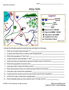
Map Skills
Help younger learners develop their map skills with this simple worksheet, which includes 12 questions utilizing a map legend that involves highway markers, population indicators, and other landmark signs.
Curated OER
U.S. Political Map
Students explore the symbols found in a map legend. In this map skills lesson, students locate the legend on a political map and explain what each of the symbols mean. Students locate and identify several symbols on the map.
Curated OER
Mapping the News
Young scholars explore cartography. In this map skills and map making lesson, Students work in groups to create wall size world maps including legends, compass roses, latitude and longitude, and physical features. Young scholars...
Curated OER
United States Map- State Capitals
Young scholars explore map skills. In this state capital lesson, students view a United States Political Map and identify and use post-it notes to label the state capitals.
Curated OER
Where Am I: How to Read a Map
Third graders develop an understanding of maps. They explore what a map is, who uses maps, and how to use maps. Students investigate the compas rose. They create a compose rose which illustrates the cardinal directions. Students practice...
Curated OER
Political Legends and Map Symbols
Students identify the legend and map symbols. In this map skills lesson, students use a world map to find various locations using a map key.
Institute for Geophysics
Understanding Maps of Earth
Here is your go-to student resource on primary geography concepts, including facts about the surface of the earth and its hemispheres, latitude and longitude, globes, types of maps, and identifying continents and oceans.
Curated OER
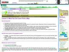
What You Can Learn From a Map
Students discover how to interpret maps. In this geography skills lesson, students explore geographic themes as they complete worksheet activities regarding road maps, shaded relief maps, and topographic maps.
Curated OER
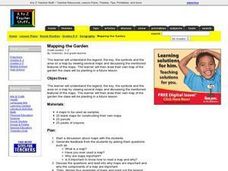
Mapping the Garden
Students discuss maps, the features on a map, and why maps are important. They make a map of a garden they will be planting, complete with symbols that represent the various plants they choose to plant.
Curated OER
Maps, Maps, and More Maps
First graders create a map and display an understanding of the cardinal directions. In this map skills lesson plan, 1st graders listen to stories where a map would come in handy, create their own map, and use the cardinal directions...
Curated OER
What You Can Learn From a Map
Young scholars investigate the use of road maps, shadeded relief maps, and topographic maps.
Curated OER
Drake's West Indian Voyage 1588-1589
Young scholars investigate several maps detailing Sir Francis Drake's voyages. In this geography instructional activity, students practice reading maps and locating the precise locations of where Sir Francis Drake visited. Young...
Curated OER
Waldseemuller's Map: World 1507
Seventh graders analyze various maps. For this Geography lesson, 7th graders create a large map as a whole class. Students write a letter to Mr. Waldseemuller.
Curated OER
Country Capitals
Students locate country capitals on a world map. In this map skills lesson, students review the definition of the word country and discuss what a capital is. Students locate and label capital cities on a world map using a map marker.
Curated OER
Rescue!
Students explore movement and position concepts. They follow directions using left , right, up, down, North, South, East and West. Students draw and follow a path on a grid to show a route followed. They label and follow legends on a map.
Curated OER
Cities of the World
Young scholars identify the symbol for cities on a political map. In this world map activity, students identify specific cities on the World Political Map. Young scholars should identify the country in which the city is located. Students...
Curated OER
Country Capitals
Students define the meaning of country capital. In this country capital lesson, students identify the symbol and find country capitals. Students locate and label capital cities on a map and insert the capital symbol.
Curated OER
White Bear Lake Fitness Challenge
Students participate in fitness challenge. After choosing a destination they would like to visit, students record their mileage to their destination after riding on bikes and walking on treadmills. Students receive an incentive...


