Curated OER
Africa, A Look Through the Eyes of A Child
Second graders read literature about Africa, examine physical characteristics of the continent, explore animals native to Africa, and discuss distance between Africa and locations in the United States.
Curated OER
Introduction to Africa
Students are introduced to Africa. The purpose of this lesson is to find out what students all ready know about the continent of Africa, and what students are interested in learning more about. They focus on the physical features of Africa.
Curated OER
Africa: Political Map
Students create a political map for Africa. In this country identification lesson, students locate Africa on a globe and discuss some of its major countries and bodies of water. Students complete a political map of Africa and test...
Curated OER
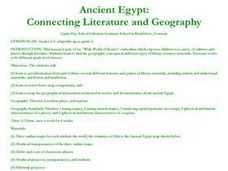
Ancient Egypt: Connecting Literature and Geography
Students brainstorm prior knowledge of Ancient Egypt, locate Egypt on map of Africa and on world map, watch King Tut film, discuss term biography, and map geographical information mentioned in stories and documentaries about Ancient Egypt.
Curated OER
World Map and Globe - Lesson 15 Mountains of the World
Students locate major world mountain ranges. In this geography lesson, students identify major mountain ranges on 6 on of the 7 continents on a large world physical map.
Curated OER
Where Is Rome?
Third graders discover Ancient Rome through maps and worksheets. In this world history lesson, 3rd graders locate Rome on a world map and identify the scope of the Roman Empire. Students label an entire map of Italy after printing one...
Curated OER
Africa's Climatic Regions
Learners are introduced to the different climates and vegetation of Africa, and compare them to similar climatic regions found in the United States.
Curated OER
Students Become Mapmakers
Students practice making a map of a continent and correctly plotting five cities on that map. They place latitude and longitude lines on a map, determine the need for various map projections and explain why map scales are necessary.


