Curated OER
Where Am I: How to Read a Map
Third graders develop an understanding of maps. They explore what a map is, who uses maps, and how to use maps. Students investigate the compas rose. They create a compose rose which illustrates the cardinal directions. Students practice...
Curated OER
Drake's West Indian Voyage 1588-1589
Young scholars investigate several maps detailing Sir Francis Drake's voyages. In this geography instructional activity, students practice reading maps and locating the precise locations of where Sir Francis Drake visited. Young...
Institute for Geophysics
Understanding Maps of Earth
Here is your go-to student resource on primary geography concepts, including facts about the surface of the earth and its hemispheres, latitude and longitude, globes, types of maps, and identifying continents and oceans.
Curated OER
United States Map- State Capitals
Young scholars explore map skills. In this state capital lesson, students view a United States Political Map and identify and use post-it notes to label the state capitals.
Curated OER
Topo Map Mania!
Seventh graders describe the major features of maps and compasses. They read a topographical map. They take a bearing using a compass. They practice using scales on a map.
Curated OER
Maps, Maps, and More Maps
First graders create a map and display an understanding of the cardinal directions. In this map skills lesson plan, 1st graders listen to stories where a map would come in handy, create their own map, and use the cardinal directions...
Curated OER
Location, Location, Location!
Twelfth graders locate cities, states and countries on maps. They use the cardinal directions to locate places on maps. They describe where they were born by giving clues without naming the exact state. They trade papers and try to guess...
Curated OER
Mapping the Garden
Students discuss maps, the features on a map, and why maps are important. They make a map of a garden they will be planting, complete with symbols that represent the various plants they choose to plant.
Curated OER
Globe Skills Lesson 1 Some Early American Cultures
Students apply their knowledge of geography. In this geography skills activity, students read brief selections regarding early Americans. Students respond to the questions included in the self-guided map skills activity.
Curated OER
Country Capitals
Students locate country capitals on a world map. In this map skills lesson, students review the definition of the word country and discuss what a capital is. Students locate and label capital cities on a world map using a map marker.
Curated OER
The Weather Page: Comparing Data
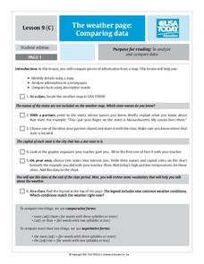
Young scholars analyze data from maps. In this comparing data lesson, students use comparative and superlative statements to draw comparisons among the weather in different American cities based on USA Today weather maps.
Curated OER
Nursery Rhymes
Students recall details of nursery rhyme read by teacher, identify main characters, and demonstrate knowledge of poem by creating concept map about story that includes title, clip art, and changes in font and color.
Curated OER
Rescue!
Students explore movement and position concepts. They follow directions using left , right, up, down, North, South, East and West. Students draw and follow a path on a grid to show a route followed. They label and follow legends on a map.
Curated OER
The Woman Who Outshone the Sun
Third graders read the story "The Woman Who Outshone the Sun" from the Scott Foresman reading series. They create puppets and a setting out of a shoebox and retell the story with props. They research the Oaxaca region and the Zapotecs.
Curated OER
It's Happening, Where? Find the Absolute and Relative Location of News Articles
Students read newspaper articles. For this social studies lesson, students locate the latitude and longitude of the location where the news article takes place. Students write a summary of the news article.
Curated OER
Growing Plants in Science and Literature, More Than an Empty Pot
Students read The Empty Pot as an introduction to plants. In this planting lesson, students understand a sequence of events in the book and relate it to the sequence of a plants life. Students grow plants and record information in flower...
Curated OER
White Bear Lake Fitness Challenge
Students participate in fitness challenge. After choosing a destination they would like to visit, students record their mileage to their destination after riding on bikes and walking on treadmills. Students receive an incentive...
Curated OER
Country Capitals
Students define the meaning of country capital. In this country capital lesson, students identify the symbol and find country capitals. Students locate and label capital cities on a map and insert the capital symbol.
Curated OER
Cause and Effect
Students identify cause and effect relationships in a short story. After reading a short story, they participate in a discussion of how one event in a story can lead to several others. Students are then paired for a matching task that...
Curated OER
Science: Rock On!
Fourth graders explore the traits of rocks and minerals in their local area. After creating a rock and mineral legend, they color maps based on their legends. Once students examine rock and mineral specimens, they draw pictures of them.
Curated OER
Oregon Rainshadows
Young scholars brainstorm list of possible highest locations in Oregon, identify and label places from list on map using color code, and discuss and identify causes of a rain shadow.


