Polar Trec
Playground Profiling—Topographic Profile Mapping
The Kuril islands stretch from Japan to Russia, and the ongoing dispute about their jurisdiction prevents many scientific research studies. Scholars learn to create a topographic profile of a specific area around their schools. Then they...
Core Knowledge Foundation
Maya, Aztec, and Inca Civilizations
A 10-lesson unit explores the Maya, Aztec, and Inca civilizations. Over the course of two weeks, scholars read nonfiction excerpts, discuss their findings, and complete activities. An assessment equipped with multiple choice and matching...
It's About Time
Volcanic Landforms
Did you know the word volcano comes from the name of the Roman god of fire, Vulcan? During this activity, scholars make a topographic map, interpret topographic maps, and infer how lava will flow based on their analysis.
Curated OER
Maps: Latitude and Longitude
Students visit interactive sites focusing on latitude and longitude. They participate in activities about the prime meridian, time zones, and equator. They view the coordinates of states and cities.
Curated OER
Map Grids
Young scholars study map grids and explore how they can be used to locate positions of objects or features on a map. They read a story and then participate in a grid activity using a large map of the setting of the story.
Curated OER
Go West With Columbus
Students play a board game where their tokens must move Columbus west. They choose cards which give commands to move in a coordinate direction. They practice moving west, north, east, south by playing the game.
K12 Reader
Absolute Location
Where in the world are we? As a reading comprehension exercise, kids read a short passage about navigation using latitude and longitude, and then respond to a series of questions based on the article.
Curated OER
Places on the Planet: Latitude and Longitude
Students locate different places on globes and maps by learning about latitude and longitude lines. For this latitude and longitude lesson plan, students identify specific locations based on the degrees of latitude and longitude.
Curated OER
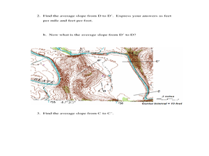
Slope and Topographic Maps
Learners investigate slopes as they study topographic maps. In this algebra lesson, students discuss and apply the concept of slopes to graphing and analyzing data.
Curated OER
Navigation, Working With Coordinates
Students view a polar view map and discuss ways of telling locations on the map. They view a copy of the map superimposed on a coordinate grid, then discuss ways of telling the locations. Students practice as a class and then...
CK-12 Foundation
CK-12 Middle School Math Concepts - Grade 6
Twelve chapters cover a multitude of math concepts found in the Common Core standards for sixth grade. Each title provides a brief explanation of what you will find inside the chapter—concepts from which you can click on and learn more...
Curated OER
Robot Cartography
Students identify points plotted on the coordinate plane. In this geometry lesson, students learn to read a map using concepts of a coordinate plane grid. They find the path given a map to tell them where to go.
Curated OER
Eager to Get to Ancient Egypt
Seventh graders explore the geography of Ancient Egypt, read a story and answer questions on a web site.
Curated OER
Map Coordinate Bingo
Students play a bingo-type game to locate cities by coordinates. They explain the use of orientation on a map and identify cities in the western hemisphere. They compare road maps, shutttle images, and a CIR image and obtain an...
Curated OER
Maps: U.S, Time Zones
Learners perform various activities to demonstrate knowledge of time zones. They connect with an interactive map to discover what time zone they are in. They create clocks out of paper plates and simulate different time zones.
PHET
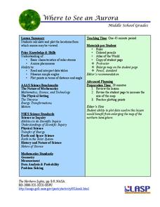
Where to See an Aurora
Where can you see an aurora in North America? After completing an astronomy activity, scholars can locate the exact coordinates. Pupils plot points of the inner and outer ring of the auroral oval and answer questions based on...
Curated OER
Latitude and Longitude
Fifth graders study latitude and longitude. They estimate the latitude and longitude of their hometown and find the latitude and longitude of other cities using a map. They use a website to find out the cities' actual latitude and...
Curated OER
Rescue!
Students explore movement and position concepts. They follow directions using left , right, up, down, North, South, East and West. Students draw and follow a path on a grid to show a route followed. They label and follow legends on a map.
Curated OER
Separate Vacations
Students plot the migration paths of birds using latitude and longitude data from a table.
Curated OER
Fly on the Ceiling
Fourth graders complete activities to increase their understanding of coordinates. They listen to Julie Glass' book, The Fly on the Ceiling, before playing fly tic-tac-toe and Swat the Flies, in which they use ordered pairs to state the...
Curated OER
Catch Me If You Can: Over and Under
Students read a story. In this vocabulary skills lesson, students read The Gingerbread Man, use flannel cut outs to re-enact the gingerbread man running over and under.
Curated OER
States of Fitness
Young scholars participate in physical activities coordinating to divisions on a map.


