Curated OER
Maps
Students investigate three types of maps. In this history lesson plan, students idenitfy different maps and explore how they relate to the area, while keeping climate and topography in mind. They discuss maps used to navigate...
Richmond Community Schools
Map Skills
Young geographers will need to use a variety of map skills to complete the tasks required on this worksheet. Examples of activities include using references to label a map of Mexico, identify Canadian territories and European...
Curated OER
Map Skills
Students create two types of maps. In this map skills instructional activity, students discuss map vocabulary and view maps of Florida. Students draw a free hand map of Florida and include major cities, bodies of water and...
Curated OER
Little Pig, Little Pig
First graders compare versions of the Three Little Pigs. In this comparison lesson, 1st graders read several version of the Three Little Pigs and compare the situations, characters, settings, solutions, emotions and costumes. ...
Owl Teacher
Introduction to World of Geography Test
Assess your learners on the five themes of geography and the most important key terms and concepts from an introductory geography unit. Here you'll find an assessment with 15 fill-in-the-blank and 14 multiple-choice questions, sections...
Curated OER
Be A Perfect Person in Just Three Days- Lesson 7
Students review a book. In this reading comprehension lesson plan, students take a vocabulary and comprehension test. Students complete a book review activity of the book Be A Perfect Person In Just Three Days, complete a...
Pace University
Urban Communities
Urban communities are the focus of a series of lessons created to meet specific needs using differentiated instruction. A pre-assessment designates scholars into three groups based on their ability level. Small groups take part in...
Big History Project
Human Migration Patterns II
While humans have always been on the move, the period between 1400 and 1800 saw vast migrations of people between the East and the West. These migrations—whether through slavery or a desire to colonize new lands—shaped the modern world....
Curated OER
Explore Surface Types on a Journey Around Earth
Students explore satellite data. In this technology cross-curriculum math and world geography lesson plan, students locate specific map areas using a microset of satellite data. Students use technology and math skills to determine...
It's About Time
Volcanic Landforms
Did you know the word volcano comes from the name of the Roman god of fire, Vulcan? During this activity, scholars make a topographic map, interpret topographic maps, and infer how lava will flow based on their analysis.
Curated OER
Fairy Tales
Once upon a time are four words most children are familiar with when reading a fairy tale. But do they know that fairy tales are a great way to learn the literary elements of reading and writing? Use a thorough fairy tale unit...
Curated OER
Two-Step Problems and Money Concepts
Elementary schoolers solve two-step equations and practice money concepts. They solve multi-step addition and subtraction contextual problems and apply money concepts to real life situations. Pupils use pictures and counters to help them...
Worksheet Web
Using Pictographs
If one ice cream cone represents three ice cream scoops, and Bob has four ice cream cones, then how many scoops does Bob have? Learners solve these kind of questions with their new understanding of pictographs.
Curated OER
Introducing Topographic Maps: Guiding Students from Concrete Models to Graphic Representations
Students interpret topographic maps and infer human activity as it is influenced by the landscape.
GCSE Modern World History
Mao's China
Here is a great textbook chapter on China's establishment as a communist state in 1949 and the effects of World War II on the nation. The first page prompts learners to complete a timeline activity as they read the material,...
Curated OER
Weather Forecasting
Students discover how to read a current weather map. In this weather forecasting lesson, students view weather maps from three consecutive days and observe how quickly weather moves and changes. Students review key terms associated...
Curated OER
Making a Map
Students are introduced to maps by examining the various types and practice using a key to find information. They each create their own map with a key and graph information. As a class, they read the story "Henny Penny" and share their...
Curated OER
United States Map - Lesson 11
Students explore lakes of the United States. For this geography lesson, students identify noteworthy lakes on a map of the United States.
Curated OER
Political Legends and Map Symbols
Students identify the legend and map symbols. In this map skills lesson, students use a world map to find various locations using a map key.
Mathematics Assessment Project
Taxi Cabs
A simple real-world problem involving taxi cab fares is used to practice the multplicaiton and division of integers. How many of two different-sized taxis are needed to transport 75 people to the airport? What is the least...
Curated OER
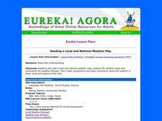
Reading a Local and National Weather Map
Students examine weather maps. They examine icons and map symbols. Students explore vocabulary words related to weather. Students analyze and evaluate information provided on the weather map.
It's About Time
Volcanic History of Your Community
Did you know there are 20 volcanoes erupting at any given time? Pupils look at various igneous rocks, read local geologic maps, and determine if their area has a history of volcanic activity. A reading passage and analysis questions...
Poetry4kids
How to Host an Open Mic Poetry Party
Four steps to Open Mic Night! The location, invitations, supplies, and party favors are all part of the process in planning and hosting a fun-filled gathering where scholars read aloud an original poem or one by their favorite author.
Curated OER
Three D Constellations
Students are introduced to both celestial coordinates and to the first rung on the distance determination ladder. They convert spherical coordinates to Cartesian coordinates to construct a three dimensional model of a constellation...


