Curated OER
Introducing Topographic Maps: Guiding Students from Concrete Models to Graphic Representations
Students interpret topographic maps and infer human activity as it is influenced by the landscape.
Curated OER
Topographic Maps
Pupils complete a worksheet about topographic mapping. In this map skills lesson, students examine the features and discuss the uses for topographic maps.
Polar Trec
Playground Profiling—Topographic Profile Mapping
The Kuril islands stretch from Japan to Russia, and the ongoing dispute about their jurisdiction prevents many scientific research studies. Scholars learn to create a topographic profile of a specific area around their schools. Then they...
Curated OER
Principles of Flight: Where are We?
Young scholars explore the concept of topographical maps. In this topographical map lesson, students discuss how airplanes know where to fly. Young scholars use topographical maps to simulate a field trip on the computer.
Curated OER
What You Can Learn From a Map
Students discover how to interpret maps. In this geography skills lesson plan, students explore geographic themes as they complete worksheet activities regarding road maps, shaded relief maps, and topographic maps.
Curated OER
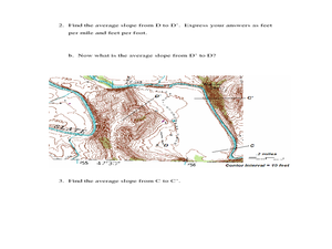
Slope and Topographic Maps
Students investigate slopes as they study topographic maps. In this algebra activity, students discuss and apply the concept of slopes to graphing and analyzing data.
Curated OER
Mapmaker, Make Me a Map!
Pupils are introduced to the state quarter program and examine the Colorado state quarter. They locate Colorado on a map and create a map with a key. They discuss the state motto and examine pictures of the state's geographical features.
Smithsonian Institution
Borders with the World: Mexican-American War and U.S. Southern Borderlands
The Mexican-American War created social borders—not just physical ones. Scholars learn about the effects of the Mexican-American War on the people living in the borderlands using text excerpts, maps, and partnered activities. Academics...
Curated OER
Topo Map Mania!
Seventh graders describe the major features of maps and compasses. They read a topographical map. They take a bearing using a compass. They practice using scales on a map.
Curated OER
Finding Longitude and Latitude on Pennsylvania Maps
Students draw the lines of longitude and latitude on a map. Students look at a topographical maps to see how topography relates to land use.
Curated OER
Welcome to My World!
Students use maps to locate information. They read the story, "It Looked Like Spilt Milk", view images of the continents and discuss the various continents. Afterward, they make their own Atlas to record information that they can later...
Curated OER
Waldseemuller's Map: World 1507
Seventh graders analyze various maps. In this Geography lesson, 7th graders create a large map as a whole class. Students write a letter to Mr. Waldseemuller.
Curated OER
Topography: Know the topography of your neighborhood
Students read and identify features on a topography map. In this topography lesson plan, students learn how to read a topography map, and then go out and take pictures of their own and discuss the topography pictures they took.
Curated OER
U.S. Geography: The Northeast
Students investigate U.S. Geography by creating a map in class. In this natural resource lesson, students create a map of the United States and research the Northeast based on their resources and recyclable materials. Students...
Curated OER
Working on the Railroad
Students plan a trip on the railroad. For this railroad creation and implementation lesson, students listen to the song "Working on the Railroad", make a map of where the track was laid and discuss the geographical...
Curated OER
State My Name
Students study the names of all fifty states, their capitols, location on a map, and an economic resource of each state. They complete a matching game activity.
Curated OER
Navigation Across the Seas
Students examine nautical navigation and discover the differences between nautical charts and other types of maps or charts. Students practice setting a course, taking a bearing, and dead reckoning. This gives students an example of...
Curated OER
U.S. Place Names Show Our Diversity
Middle schoolers study place names for different area in the US and determine why they were named in such a way. They examine maps to look at the religious names, "new" beginning names, and copy cat names. They complete a word search to...
Curated OER
Research Report on Earth Science Topics
Sixth graders are given a variety of Earth Science topics which be covered during the year. They select one of their choices to research and work in class and at home to meet the guidelines for their report.


