Curated OER
Understanding Latitude and Longitude
Teaching learners about latitude and longitude can get a little complicated. Present the concept by first representing it as a graph. Just like finding a location on a graph using the x and y-axis, learners will be able to locate items...
Curated OER
A Comparison of Cloud Coverage Over Africa
Students use a NASA satellite data to contrast amounts of cloud coverage over different climate regions in Africa. They explore how Earth's major air circulations affect global weather patterns, and relate to local weather patterns.
Curated OER
Blank Jeopardy
Games are a great way to motivate learners to internalize information.. Using this PowerPoint which is in a Jeopardy format, students can review map skills and facts about the Civil War, famous places, and our government. This is a handy...
PBS
Make a Balloon Globe
"We've got the whole world in our hands," is what your students will be singing after completing this fun geography activity. Using the included templates for the seven continents and a balloon, they create their very own globes.
Curated OER
Geography Terms
Introduce the terms and concepts related to basic map and geography skills. Terms include full definitions and cover latitude, longitude, the Equator, Tropic of Cancer, Tropic of Capricorn, Prime Meridian, and the International Date Line.
Curated OER
Bill Nye Video: Earth's Seasons
In this earth's seasons worksheet, students answer fill in the blank questions after seeing Bill Nye's video. Topics include the rotation of the earth around the sun, the tilt of the earth, the time zones and sunlight.
Curated OER
Climatic Changes
Investigate the greenhouse effect and global warming with this weather instructional activity: scholars describe the seasonal variations of temperature and day length at its greatest and its least. Then they describe the effects of El...
Curated OER
A Map as a Tool
Students study the concept of using a map as a tool with the usage of a balloon designed to mimic the features of the Earth with the major features marked and shown on the balloon.
Curated OER
Why Is It Hotter At the Equator?
Students investigate the different heating effects of sunlight. They conduct an experiment that demonstrates the way sunlight strikes the equator, the poles and other parts of the globe.
Curated OER
Understanding Oceans
Students investigate how ocean currents affect our world. In this ocean currents lesson, students perform an experiment to show how cold water is near the poles and warm water is near the equator. Students use water, food coloring,...
Curated OER
Student Exploration: Summer and Winter
In this recognizing the seasons online/interactive instructional activity, students explore the Earth's positions and determine the summer and winter season. Students answer 21 short answer questions
Curated OER
Adopt a City-Winter Weather
In weather worksheet, students use an on line site to collect weather data. They create 10 different weather scenarios using a temperature and humidity slider. They includethe temperature, relative humidity and weather conditions and...
Curated OER
"Yarning" About Latitude and Longitude
Students identify various locations using latitude and longitude. In this map skills lesson, students use yarn and labels to create a "human globe." Students identify the Prime Meridian, the Equator, and Northern and Southern Hemisphere.
Curated OER
Viewpoints
In this latitude and longitude worksheet, students complete 10 matching questions identifying key features or locations on a map. Students also use lines of latitude and longitude to identify the time in 4 different places.
Curated OER
Exploring the World's Geography
Students discuss the seven continents of Earth and the diverse geography. After discussion, they create their own paper-mache globes which properly display all seven continents, the equator, and the prime meridian. They conduct research...
Curated OER
Rain Forest Adventures
Students identify and describe where tropical rain forests are located and examine the geographical correlation between rainfall and rain forest. They brainstorm what they think they know about tropical rain forests - where they're...
Curated OER
Two Reasons for the Four Seasons
Students explore the reasons for the seasons. In this season instructional activity,students use flashlights to demonstrate the movement of the Earth and how it influences the seasons. Students label pictures and discuss what would...
Curated OER
Longitude
In this globe worksheet, students learn how longitude is measured on a globe. Students read the information before answering 5 questions. A globe will be required.
Curated OER
Introduction to the World Globe
Students examine a globe and the world map to see what constitutes the differences. In this world map introductory lesson, students discuss what they see when they view the globe. Students then, look at a world map and compare the...
Curated OER
World Map and Globe-Equator, North Pole, and South Pole
Students identify the Equator, North Pole, and South Pole on a map. In this geography instructional activity, students use a world map and circle the North and South Pole. Students locate the Equator on a globe and use a map marker to...
Curated OER
Latitude Longitude Skills
In this latitude and longitude worksheet, students determine the number of degrees between the equator and specific latitude points. Students to the same for the longitude points from the Prime Meridian. This worksheet has 3 problems to...
Curated OER
Weather and Locality
In this weather research worksheet, students research the weather a specific location. Students mark the location on the globe and then list how the weather affects people there.
Curated OER
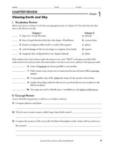
Viewing Earth and Sky
In this earth and sky learning exercise, students review terms associated with map reading. Students also review topographic maps and how contour lines represent elevation. This learning exercise has 5 matching, 5 true or false, 5 fill...
Curated OER
What is Climate?
In this weather worksheet, students read a brief excerpt that compares the various types of climates found on Earth. Then they explain where the low- and high-pressure systems follow each other throughout the year.


