Curated OER
Climatic Changes
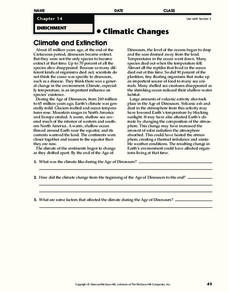
In this weather worksheet, students read an excerpt describing the climate and extinction. Then they explain what the climate was like during the Age of Dinosaurs. Students also determine some factors that affected the climate during...
Curated OER
Rainforest Data
In this geography worksheet, students use the climate data given to create a temperature line graph and rainfall bar graph for each of three locations given. Then they use an atlas to compare their graphs and draw conclusions about the...
Curated OER
Asia Crossword
In this geography worksheet, students complete a crossword puzzle on the continent of Asia. They answer 21 questions related to the type of government systems found, capital cities, deepest lake, and lowest population density.
Curated OER
All About Continental Drift
In this earth science worksheet, students identify and locate vocabulary terms related to continental drift and geography. There are 54 words located in the puzzle.
Curated OER
Learning About the Equator, The Seven Continents and the Four Oceans
Students use a globe or map to locate the equator, oceans and continents. Using the internet, they spend time surfing through predetermined websites on continents and oceans. They write facts on different parts of the globe on index...
Curated OER
Making a Globe
Young scholars participate in a creative project where they construct globes. They label specific places on the globe that helps them learn how to read an actual globe.
Curated OER
Maps: Latitude and Longitude
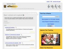
Students visit interactive sites focusing on latitude and longitude. They participate in activities about the prime meridian, time zones, and equator. They view the coordinates of states and cities.
Curated OER
Earth Matters
Students identify Earth's equator, prime meridian, lines of latitude, lines of longitude, parallels, and meridians.
Curated OER
Vocabulary for Dimensions of the Earth
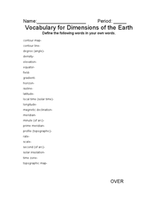
In this Earth dimensions worksheet, students define 24 terms associated with contour maps, latitude, longitude, and time zones.
Curated OER
Viewpoints
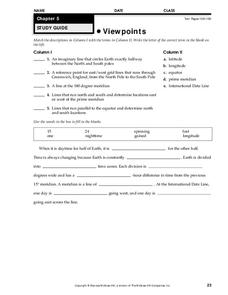
In this map worksheet, students review latitude, longitude, equator, and prime meridian. This worksheet has 5 matching and 8 fill in the blank questions.
Curated OER
South America Puzzle
In this geography worksheet, students complete a crossword puzzle related to the countries, capitals, bodies of water, and populations of South America. They use the 23 clues given to solve the puzzle.
Curated OER
Earth's Energy Balance Performance Standard
Students examine how Earth-Sun relationships affect Earth's energy balance and the pattern of world temperatures. Students study a Surface Temperature Regions map and write a paragraph describing the temperature pattern from the Equator...
Curated OER
Latitude and Longitude
Students identify latitude, longitude, prime meridian, international date line, and equator. They compute the latitude and longitude of different objects.
Curated OER
Where Is Cocoa Grown?
Students locate and identify cocoa-growing regions around the world. They discuss why it is grown there and how the climate and conditions needed are different from those in their hometowns. They play a true or false game about Ghana.
Curated OER
Exploring the Continents Through the Arts
Students examine the continents and explore geographic components in the fifteen lessons of this unit. The location of the continents, the equator, the four major oceans, and the music, food, literature, dance, and drama from each of the...
Curated OER
Earth/Globe (poles & equator)
First graders create his/her own paper mache earth and label the poles and equator. The land masses can be added and labeling of specific bodies of water. The paper mache earth can then be used to discuss the sun, moon, and the earth and...
Curated OER
Is Temperature Effected By How Close You Are to the Equator
Students collaborate with other schools to gather temperature data from a large number of locations. They determine how the average daily temperature of a location is affected by how close you are to the equator.
Other
Kites as Education: Wind Origins
This "kite science" site offers information on wind and the atmospheric conditions that cause it. From "Principles of Aeronautics."
Other
Brandeis University: Robert Louis Stevenson Biography
This Brandeis University webpage features a brief critical biography of the life and work of Robert Louis Stevenson, photograph of the author, and a selected bibliography.
Diffen
Diffen: Latitude vs. Longitude
Find out about the basics of latitude and longitude with this comparison chart. Then read the article and watch the video to dig a little deeper into the topic.
PBS
Pbs Nova Online: Lost at Sea the Search for Longitude
"The quest for a reliable method to find your way at sea was one of the thorniest problems of the 1700s." Find out about the search for longitude at this NOVA site. Includes interactive Shockwave game, learning activities and more.
Other
Ecuador Explorer: People and Culture
A detailed look at Ecuador's population, religion, language, and indigenous culture.
Alabama Learning Exchange
Alex: The Equator and the Poles
This lesson provides hands-on activities that will teach students about the poles and the equator. Students will be labeling a globe, recreating a globe within the classroom, and researching information on the Internet.
Wikimedia
Wikipedia: Latitude
This encyclopedia article from Wikipedia on latitude tells what it is, lists some latitudes of particular importance, and tendencies that latitudes can determine. Links are provided throughout for additional information.


