Other
Nasa: Iss Earth Kam
Students get a whole new perspective of the world through images obtained from the International Space Station. Students can even request images to be taken through ISS EarthKAM. Activities and educator guides are provided.
NASA
Nasa: Aerial Photography: The Adventures of Amelia the Pigeon
An animated adventure story, developed by NASA, that helps children understand earth science concepts by using satellite photography and other types of aerial photographs to identify physical features on the surface of the earth. Teaches...
Other
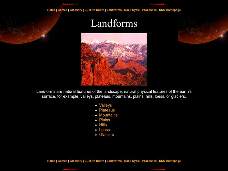
Landforms
The education department of Prince Edward Island has a great page with information pertaining to landforms. Starting with a definition, it then moves to the specific types like valleys, mountains, plateaus, etc.
Other
Science4 Us: Features
In the Earth's Features module, students explore mountains, volcanoes, caves, rivers and oceans and their place on Earth.
Science Education Resource Center at Carleton College
Serc: Geologic History Field Investigation Minnehaha Falls
An inquiry-based geology field investigation where students investigate sedimentary geology, stream processes, topography, rock layers, and land surface features as well as study past changes in the depositional environment in the area.
Science Education Resource Center at Carleton College
Serc: Uk Geological Society: Earth Science Education Network: Resources K 16
Scientifically based information on Kentucky's geology and mineral and water resource from the Kentucky Geological Surveys.
TED Talks
Ted: Ted Ed: The Most Groundbreaking Scientist You've Never Heard Of
Seventeenth-century Danish geologist Nicolas Steno earned his chops at a young age, studying cadavers and drawing anatomic connections between species. Addison Anderson recounts Steno's little-known legacy and lauds his insistence on...
Other
Jules Verne Voyager: Earth
A map resource that allows users to view many different features of the topography, textures, and geodetic data on selections in the drop down menus.
Other
Jules Verne Voyager Jr.: Earth
A map program allows users to explore the many features of Earth. Select base maps, features, and velocities.
Other
Jules Verne Voyager: Gem Global Strain Rate Map
GEM GSRM uses a texture underlay grid showing the 2nd invariant of lithospheric strain rate, with an image overlay of coastal outlines in white - which forces the texture underlay to have a black background in regions of zero strain...
NOAA
Noaa: Operational Significant Event Imagery
This site contains satellite images from around the world organized by significant events such as dust storms, floods, severe weather, etc. Not very user friendly, but the images are there for those willing to search.
Science Education Resource Center at Carleton College
Serc: Geologic Photo Field Trips for Introductory Physical Geology
Students participate in a series of virtual geology field trips by observing and describing rock outcrops, geologic structures, and landforms in field based photographs.
NASA
Nasa Earth Observatory: Changing Global Land Surface
Learn how scientists view the changes in the land surface made by humans over time. Read questions that scientists pose to answer some unknown questions about global land surface and learn several things scientists are doing to try to...
Other
Unavco: Earth Scope
This interactive map program illustrates global-scale geodynamic processes of Earth. View and add base maps, features and velocities which can be selected in the drop down menus.
The Wonder of Science
The Wonder of Science: Ms Ess2 1: Cycling of Earth's Materials
Work samples, phenomena, assessment templates, and videos that directly address standard MS-ESS2-1: cycling of earth's materials.
Math Science Nucleus
Math/science Nucleus: Observing Different Landforms
Lesson plan with subsequent pages to use with the lesson. Images with landform word match up and additional work on earth modeling.
PBS
Pbs Learning Media: Earth's Systems: The Water Planet
Observe different forms of water and how it covers about 75 percent of Earth's surface in this media gallery captured by NASA and the U.S. Geological Survey (USGS). Use the satellite and ground images in this resource to enhance student...
Geography 4 kids
Geography4 kids.com: Fields of Magnetic Forces
Find out how the Earth's magnetic field functions.
Ducksters
Ducksters: Science for Kids: Composition of the Earth
Kids learn about the science of the composition of the Earth. Different layers and what they do.
NASA
Nasa Star Child: Earth the Water Planet
Use this site to read about planet Earth. See a photo of the Earth from space, and learn quick facts about the earth's atmosphere, axis, and surface.
Other
Southern Kings Consolidated School: Loess
This site describes loess in pretty good detail, also adding visual with two pictures. Great source for understanding how loess occurs and where it is found.


