Thinkport Education
Mpt: Exploring Maryland's Roots: Visit a Woodland Indian Village
Explore a Woodlands Indian village in the area of what became Maryland. By using drawings from early explorers, this representative village helps you understand the culture of the Eastern Woodland Indians.
University of Texas at Austin
University of Texas: Map of Early Indian Tribes in Eastern u.s.
A map of the land inhabited by Indian tribes in the eastern part of the United States before European settlement. Map shows linguistic stocks as well as culture areas, major, and minor tribes.
Other
Woodland Indian Educational Programs: Coloring Pages
A collection of coloring pages depicting various Woodland native peoples in their daily lives growing and gathering food, building shelter, etc. Good illustrations of their clothing as well.
Other
Canku Ota: Regalia: Headwear: Part One
Describes the types of headwear worn by Native American tribes of the Northeast, Southeast, and the Plains.
Native American Art and Technology
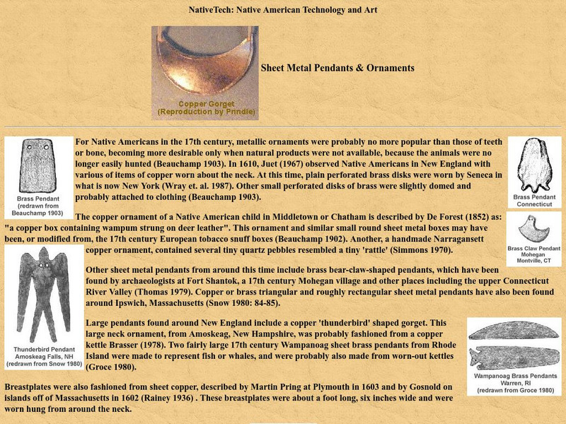
Native Tech: Eastern Woodland Metal Pendants and Ornaments
Describes and illustrates the transition from bone and other materials to metal gorgets and pendants made and worn by Native Americans.
Other
Many hoops.com: Clothing Coloring Page
Downloadable coloring pages that illustrate how the Wampanoag and the Pilgrims dressed in the 1600s.
ClassFlow
Class Flow: Native Americans Eastern Woodland Indians
[Free Registration/Login Required] This flipchart teaches about the Eastern Woodland Indians and facts about where and how they lived.
Other
The Woodland/ Algonquian Tribes Before 1500 (Map)
A Map of the geographic regions of the various Native American tribes in northeastern North America.


