Association of Religion Data Archives
Association of Religion Data Archives: National Profiles: Reunion
Learn about religion in East African island territory of France, Reunion, in this Association of Religion Data Archives country profile; includes general facts, history, and religious data.
PBS
Wnet: Thirteen: Africa: Explore the Regions: Savanna
Great site containing helpful data and information about the Eastern African Region of Savanna including Kenya and Tanzania. Learn about the economy, people, and culture of the Savanna Region.
Northwestern University
Northwestern University: Collection of East African Photographs: 1860 1960
View a sample of a vast collection of photographs taken in East Africa between 1860 and 1960 that is a great resource for documenting all aspects of African life.
Wisc-Online
Wisc Online: Horn of Africa
This resource addresses the economies and geographic locations of African countries.
PBS
Wnet: Thirteen: Africa: Explore the Regions: Ethiopian Highlands
Informational site containing facts about the fascinating region of Ethiopia. Learn about the intriguing history and culture of this region of Africa.
PBS
Wnet: Thirteen: Africa: Explore the Regions: Great Lakes
Explore the diverse and unique African Region of the Great Lakes. Within this region, you will learn about the countries, people, and economy. Uncover the beauty and diversity of this incredible region.
PBS
Wnet: Thirteen: Africa Explore the Regions: Swahili Coast
Peruse information about the captivating African Region of the Swahili Coast at this helpful site. Read about the people, economy, and countries of this fascinating region.
United Nations
United Nations: Cartographic Section: Horn of Africa [Pdf]
This relief map from the United Nations shows the countries on the Horn of Africa. Roads, rivers, and other geographic features are marked on the map.
United Nations
United Nations: Cartographic Section: Great Lakes Region (Map 1) [Pdf]
The United Nations offers this very clear map of part of the Great Lakes region in eastern Africa. The lakes, of course, are labeled, as are the rivers, major cities, and countries.
United Nations
United Nations: Cartographic Section: Great Lakes Region (Map 2) [Pdf]
This map of the Great Lakes region in Africa from the United Nations shows the large lakes, the countries the lakes touch, and rivers that flow into and out of the lakes.
PBS
Pbs: The Swahili People
This is a site from the PBS series "Wonders of the African World." This brief but detailed article gives information about the origins and history of the Swahili people.
Lizard Point Quizzes
Lizard Point Quizzes: Eastern Africa: Countries Quiz
Take this eleven question interactive map quiz to practice and test your knowledge of Eastern African geography.
Solomon R. Guggenheim Foundation
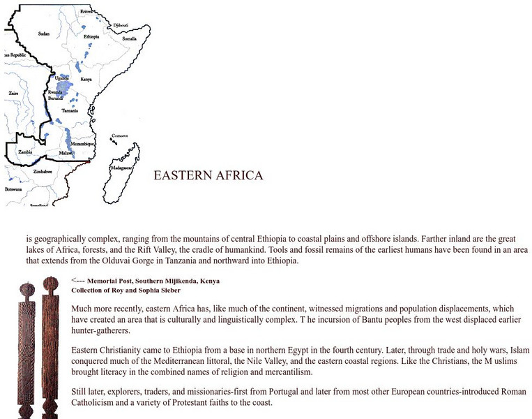
Guggenheim Museum: Africa: Eastern Africa
A simple explanation of the Eastern Africa region of Africa, with information on the cultural history and examples of artwork.
Other
Guggenheim Museum: Africa: Eastern Africa
A simple explanation of the Eastern Africa region of Africa, with information on the cultural history and examples of artwork.
Ducksters
Ducksters: Geography for Kids: Rwanda
Students learn about the geography, history, capital, flag, climate, terrain, people, economy, and population of Rwanda on this site.


![United Nations: Cartographic Section: Horn of Africa [Pdf] Graphic United Nations: Cartographic Section: Horn of Africa [Pdf] Graphic](https://d15y2dacu3jp90.cloudfront.net/images/attachment_defaults/resource/large/FPO-knovation.png)


