Curated OER
An Introduction to GPS
GPS is a technological tool that has become available for use by the general public. Navigate the components and science involved in this remote sensing system. Here is a comprehensive collection of slides that would be valuable to share...
Arizona Cooperative Extension
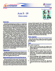
Geocaching
Using GPS units, small groups participate in a scavenger hunt to find an object that you have hidden. They use coordinates for stopping points along a pre-planned path to get to the final cache. This is a terrific activity to include in...
Curated OER
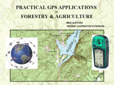
Practical GPS Applications in Forestry & Agriculture
An explanation of the Global Positioning System (GPS) and the Geographic Information System (GIS) is given in this presentation. Uses and applications are considered. How it works and sources of error are also touched upon. A large...
Curated OER
Where Am I?
Extensive background on marine navigation is provided for you as the teacher. Assign groups to research marine navigation techniques and construct astrolabes. Resource links are listed for extension ideas. If you are teaching an...
Curated OER
Lesson on GPS
Young scholars investigate global positioning systems. In this technology and mapping lesson, students view a PowerPoint presentation in which they identify the features of a GPS, state its uses, and follow steps to find a waypoint.
Curated OER
TE Lesson: GPS on the Move
Young scholars participate in a scavenger hunt and a drawing activity to examine the use of Global Positioning Systems including a handheld GPS receiver for personal navigation. They practice using the GPS receivers while collecting data...
Curated OER
Basic GPS
Students discuss benefits of global positioning systems (GPS) and practice using them on the school grounds. A personal navigator, such as, the Garmin eTrex is necessary for this lesson.
Curated OER
I Know Where You Are!
Students study what a GPS is and use it to challenge themselves and find positions on a map. In this investigative lesson students find various points on a map using a GPS system and answer questions on a worksheet.
Curated OER
TE Lesson: Navigating at the Speed of Satellites
Students study the basic concepts of the Global Positioning System and how it increases the accuracy of navigation. They examine trilateration and how the speed of light is used to calculate distances.
Curated OER
GPS Art
Students design their own logo or picture and use a handheld GPS receiver to map it out. They write out a word or graphic on a field or playground, walk the path, and log GPS data. The results display their "art" on their GPS receiver...
Curated OER
Find It!
Students analyze the basic concept of Global Positioning Systems using triangulation and measurement on a small scale in the classroom. They describe a satellite and how it helps in locating a person on Earth. They explain how...
Curated OER
Mapping My Community
Ninth graders are introduced to GPS technology. They complete fieldwork as they visit a specific area of their community to identify and map types of land use in the surveyed area. They use the collected data to create a digital map.
Science Buddies
Science Buddies: Tracking Geomagnetic Storms in the Ionosphere
The Sun is the ultimate source of the energy that powers weather systems on Earth. Geomagnetic storms are sun-powered storms in the upper atmosphere, arising from energized particles that are periodically ejected by the Sun. Among other...
TryEngineering
Try Engineering: Find It With Gps!
Using a GPS handheld device and online resources, young scholars work in teams to explore the technology behind GPS, current GPS applications, and brainstorm new applications for future global use to solve society's issues.
University of Colorado
University of Colorado: Global Positioning System Overview
A good overview of the Global Positioning System. Describes what it is, how it works, and goes into detail about its different applications.
NOAA
Noaa: National Ocean Service Education: Global Positioning Tutorial
Illustrated tutorial explains the history and science of geodesy. Animations help students visualize how scientists measure and monitor the size and shape of the Earth and the location of points on its surface.
PBS
Pbs: Frontline: The Gulf War
PBS Online and the TV show "Frontline" present information on the Persian Gulf War, a timeline, various maps, personal testimonies, and other resources.
Other
Groundspeak Inc.: Geocaching the Official Global Gps Cache Hunt Site
Geocaching is a unique online treasure hunt game. Players 'hide' a cache anywhere on the globe and other players must follow the clues to locate the cache. Great for getting practice using GPS. There is plenty of guidance to playing, as...
Smithsonian Institution
Smithsonian Institution: Time and Navigation
Explore navigation methods by sea, air, and space, what latitude and longitude mean, how GPS works, about satellite navigation, and learn about professional navigators. Includes a timeline of developments in navigation from 1280 to the...
TeachEngineering
Teach Engineering: State Your Position
To navigate, you must know roughly where you stand relative to your designation, so you can head in the right direction. In locations where landmarks are not available to help navigate (in deserts, on seas), objects in the sky are the...
NASA
Nasa: Slr and Gps (And Plate Tectonics and Earthquakes) [Pdf]
This slideshow explains how satellites are used to measure the movement of tectonic plates.
Massachusetts Institute of Technology
Mit: Open Course Ware: Courses: Modern Navigation
College-level planetary science course highlighting modern navigation. Course introduces the concepts and applications of navigation techniques using celestial bodies and satellite positioning systems (GPS). Course features include...
Massachusetts Institute of Technology
Mit: Open Course Ware: Exploring Black Holes: General Relativity and Astrophysics
College-level physics course focusing on black holes. Course topics include general relativity, astrophysics, and elements of cosmology . Course features include selected video lectures, lecture notes, assignments, and exams.
Science Education Resource Center at Carleton College
Serc: Litter Retriever With a Gps Receiver
Have you ever wondered why litter is in some locations and not others? You will use a Global Positioning System (GPS) to mark the locations of trash and trash cans around a local park or school campus, import the data into Google Earth,...


