Curated OER
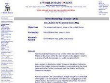
Introduction to the United States Map
Learners explore the United States using a map. In this map lesson, students discover how to use a United States map and a globe to locate places.
Curated OER
United States Map - Lesson 2 Introduction to Symbols
Students explore the United States using a map. For this map lesson, students discover how to use map symbols in order to read maps.
Curated OER
World Map and Globe-Equator, North Pole, and South Pole
Students identify the Equator, North Pole, and South Pole on a map. In this geography instructional activity, students use a world map and circle the North and South Pole. Students locate the Equator on a globe and use a map marker to...
Curated OER
Using the Four Main Directions in the Classroom
Students utilize a compass to determine where North is in the classroom. For this direction lesson, students label the four main directions. Students locate features in the classroom and describe the directions to get to them. Students...
Curated OER
The Globe and World Map
Students explore how to use maps for travel. In this map skills instructional activity, students read the text, With Love from Gran and discuss the places the character traveled. Students list the names of each city and country on chart...
Curated OER
Paper Mache Globes
Third graders create a paper mache model of the earth. At the conclusion of a discussion about the earth, they are given paper mache materials, they create their globe and appropriately draw and label landforms, bodies of water and the...
Curated OER
New: Around the World
First graders identify and demonstrate how symbols and models are used to represent features of the environment. They use a map and a globe to label where the students in the book came from, point out the continent, and show which ocean...
Curated OER
Learning About the Globe
Pupils examine the following terms to increase their geography skills: globe, equator, prime median, Western Hemisphere, Eastern Hemisphere, Northern Hemisphere, Southern Hemisphere, Pacific Ocean, Atlantic Ocean, and The United States.
Curated OER
Welcome to My World!
Second graders increase their usage of maps and understand how maps are important in their lives. Students define what an atlas is, and to enforce the students' definition of what an atlas is, they also make their own atlas.
Curated OER
Earth, Sun and Moon
Students investigate that the sun is at the center of the solar system through role play. One student is the sun and one student is the Earth. The students then show how the Earth orbits around the sun. Students view a flashlight and...
Curated OER
Making a Globe
Students participate in a creative project where they construct globes. They label specific places on the globe that helps them learn how to read an actual globe.
Curated OER
Introduction to the United States Map
Students identify the United States of America and it's states on a map. In this mapping activity, students examine a globe and find the United States as well as a few land marks (Florida and the Great Lakes). Students then look at a...
Curated OER
Old World and New World - Why Contact Took So Long
Students use a globe to determine why contact between the old world and the new world took a long time. In this map skills lesson, students analyze routes between regions to determine why it took so long for the old world and the new...
Curated OER
Using the Four Main Directions in the Classroom
Students use the four main directions to locate features in the classroom. For this direction lesson, students review the 4 main directions using a world map. Students use a magnetic compass to locate the north wall in their classroom...
Curated OER
Equator, North Pole, and South Pole
Students identify the Equator, North Pole, and South Pole on the globe. In this map skills lesson, students use a globe marker to locate specific locations on the globe. Students find where they live in relation to the Equator.
Curated OER
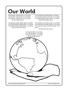
Our World
In this Earth Day coloring worksheet, students read a poem 'We've got the whole world around us in our hands.' Students then color the picture of the world in the hand.
Curated OER
Year 2004 Quiz
Students are able to use computers and answer questions about the years 2000-2004. They click on the globe at the end for the answers. Students can use this opportunity to delve into the topics in more detail and give more speaking...
Curated OER
Lost at Sea: The Search for Longitude
Students research and chart the shortest course to circumnavigate the globe.
Other
The Elizabethan Theatre Lecture by Hilda Spear
This lecture and slides traces the history of the Elizabeth theater through a variety of topics: London, inn-yards, great halls, outdoor theatres, performances, indoor threatres, theatre and drama, actors, acting, and audience. These...
Universal Teacher
Moore's Teacher Resources: Henry Iv, Part 1
This study guide is intended for university and AP students as well as the general reader studying Shakespeare's history play, Henry IV, Part I.
Geographyiq
Geography Iq
Detailed geographical information on any country is available at this site. Within the World Map section, you can get facts and figures about each country's geography, demographics, government, political system, flags, historical and...
Utah Education Network
Uen: Off to See the World!
Second graders play games that use the atlas and the globe.


